Monts (Monts)

- commune in Indre-et-Loire, France
- Country:

- Postal Code: 37260
- Coordinates: 47° 16' 29" N, 0° 38' 34" E


- GPS tracks (wikiloc): [Link]
- Area: 27.28 sq km
- Population: 7704
- Web site: http://www.monts.fr
- Wikipedia en: wiki(en)
- Wikipedia: wiki(fr)
- Wikidata storage: Wikidata: Q1170894
- Wikipedia Commons Category: [Link]
- Freebase ID: [/m/03nvfw7]
- GeoNames ID: Alt: [6454055]
- SIREN number: [213701592]
- BnF ID: [152577105]
- VIAF ID: Alt: [312671901]
- INSEE municipality code: 37159
Shares border with regions:


Artannes-sur-Indre
- commune in Indre-et-Loire, France
- Country:
- Postal Code: 37260
- Coordinates: 47° 16' 24" N, 0° 35' 57" E
- GPS tracks (wikiloc): [Link]
- Area: 20.97 sq km
- Population: 2615
- Web site: [Link]

Thilouze
- commune in Indre-et-Loire, France
- Country:
- Postal Code: 37260
- Coordinates: 47° 13' 23" N, 0° 34' 49" E
- GPS tracks (wikiloc): [Link]
- Area: 33.75 sq km
- Population: 1661
- Web site: [Link]

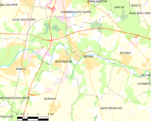
Veigné
- commune in Indre-et-Loire, France
- Country:
- Postal Code: 37250
- Coordinates: 47° 17' 15" N, 0° 44' 15" E
- GPS tracks (wikiloc): [Link]
- Area: 26.58 sq km
- Population: 6101
- Web site: [Link]


Joué-lès-Tours
- commune in Indre-et-Loire, France
- Country:
- Postal Code: 37300
- Coordinates: 47° 21' 2" N, 0° 39' 42" E
- GPS tracks (wikiloc): [Link]
- Area: 32.41 sq km
- Population: 37535
- Web site: [Link]


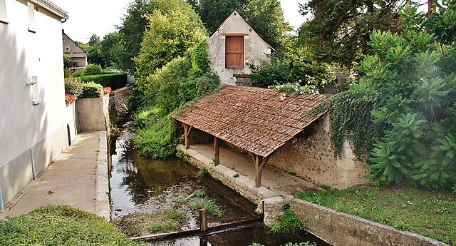
Montbazon
- commune in Indre-et-Loire, France
- Country:
- Postal Code: 37250
- Coordinates: 47° 17' 14" N, 0° 42' 49" E
- GPS tracks (wikiloc): [Link]
- Area: 6.5 sq km
- Population: 4154
- Web site: [Link]

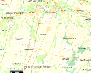
Sorigny
- commune in Indre-et-Loire, France
- Country:
- Postal Code: 37250
- Coordinates: 47° 14' 30" N, 0° 41' 43" E
- GPS tracks (wikiloc): [Link]
- Area: 43.43 sq km
- Population: 2511