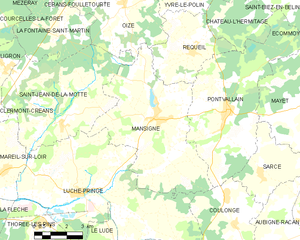
canton of Pontvallain (canton de Pontvallain)
- canton of France (until March 2015)
- Country:

- Capital: Pontvallain
- Coordinates: 47° 47' 12" N, 0° 7' 23" E


- GPS tracks (wikiloc): [Link]
- Wikidata storage: Wikidata: Q603766
- INSEE canton code: [7226]
Includes regions:


Château-l'Hermitage
- commune in Sarthe, France
- Country:
- Postal Code: 72510
- Coordinates: 47° 48' 13" N, 0° 10' 54" E
- GPS tracks (wikiloc): [Link]
- Area: 9.39 sq km
- Population: 272


Oizé
- commune in Sarthe, France
- Country:
- Postal Code: 72330
- Coordinates: 47° 48' 38" N, 0° 6' 12" E
- GPS tracks (wikiloc): [Link]
- Area: 16.91 sq km
- Population: 1325
- Web site: [Link]


Cérans-Foulletourte
- commune in Sarthe, France
- Country:
- Postal Code: 72330
- Coordinates: 47° 49' 38" N, 0° 4' 35" E
- GPS tracks (wikiloc): [Link]
- AboveSeaLevel: 64 м m
- Area: 32.52 sq km
- Population: 3384
- Web site: [Link]


Yvré-le-Pôlin
- commune in Sarthe, France
- Country:
- Postal Code: 72330
- Coordinates: 47° 49' 9" N, 0° 9' 10" E
- GPS tracks (wikiloc): [Link]
- Area: 21.84 sq km
- Population: 1761
- Web site: [Link]


Saint-Jean-de-la-Motte
- commune in Sarthe, France
- Country:
- Postal Code: 72510
- Coordinates: 47° 44' 32" N, 0° 3' 23" E
- GPS tracks (wikiloc): [Link]
- Area: 32.03 sq km
- Population: 935
- Web site: [Link]


La Fontaine-Saint-Martin
- commune in Sarthe, France
- Country:
- Postal Code: 72330
- Coordinates: 47° 47' 28" N, 0° 2' 58" E
- GPS tracks (wikiloc): [Link]
- Area: 13.72 sq km
- Population: 619

Mansigné
- commune in Sarthe, France
- Country:
- Postal Code: 72510
- Coordinates: 47° 44' 50" N, 0° 8' 6" E
- GPS tracks (wikiloc): [Link]
- Area: 36.31 sq km
- Population: 1594
- Web site: [Link]
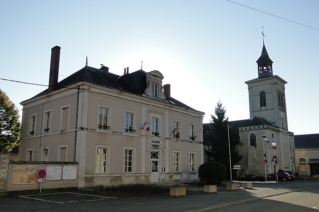

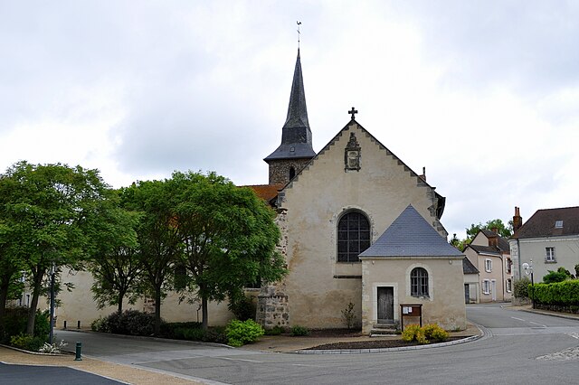
Pontvallain
- commune in Sarthe, France
- Country:
- Postal Code: 72510
- Coordinates: 47° 45' 1" N, 0° 11' 29" E
- GPS tracks (wikiloc): [Link]
- Area: 34.88 sq km
- Population: 1730

Requeil
- commune in Sarthe, France
- Country:
- Postal Code: 72510
- Coordinates: 47° 47' 4" N, 0° 9' 43" E
- GPS tracks (wikiloc): [Link]
- Area: 13.89 sq km
- Population: 1216
- Web site: [Link]