canton of Pré-en-Pail (canton de Pré-en-Pail)
- canton of France
- Country:

- Capital: Pré-en-Pail
- Coordinates: 48° 26' 22" N, 0° 8' 45" E


- GPS tracks (wikiloc): [Link]
- Wikidata storage: Wikidata: Q1726829
- INSEE canton code: [5324]
Includes regions:


Boulay-les-Ifs
- commune in Mayenne, France
- Country:
- Postal Code: 53370
- Coordinates: 48° 25' 13" N, 0° 7' 57" E
- GPS tracks (wikiloc): [Link]
- AboveSeaLevel: 210 м m
- Area: 9.05 sq km
- Population: 172


Champfrémont
- commune in Mayenne, France
- Country:
- Postal Code: 53370
- Coordinates: 48° 25' 37" N, 0° 5' 28" E
- GPS tracks (wikiloc): [Link]
- Area: 13.13 sq km
- Population: 302


Saint-Cyr-en-Pail
- commune in Mayenne, France
- Country:
- Postal Code: 53140
- Coordinates: 48° 26' 27" N, 0° 14' 39" E
- GPS tracks (wikiloc): [Link]
- Area: 20.65 sq km
- Population: 486

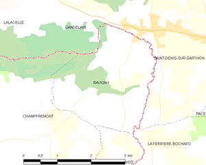
Ravigny
- commune in Mayenne, France
- Country:
- Postal Code: 61420
- Coordinates: 48° 26' 50" N, 0° 3' 43" E
- GPS tracks (wikiloc): [Link]
- Area: 6.54 sq km
- Population: 234


Pré-en-Pail
- former commune in Mayenne, France
- Country:
- Postal Code: 53140
- Coordinates: 48° 27' 36" N, 0° 11' 53" E
- GPS tracks (wikiloc): [Link]
- Area: 44.73 sq km
- Population: 1901
- Web site: [Link]


Saint-Samson
- former commune in Mayenne, France
- Country:
- Postal Code: 53140
- Coordinates: 48° 28' 54" N, 0° 11' 24" E
- GPS tracks (wikiloc): [Link]
- Area: 13.49 sq km
- Population: 440


Saint-Pierre-des-Nids
- commune in Mayenne, France
- Country:
- Postal Code: 53370
- Coordinates: 48° 23' 56" N, 0° 5' 58" E
- GPS tracks (wikiloc): [Link]
- Area: 37.34 sq km
- Population: 1991
- Web site: [Link]