canton of Saint-Beauzély (canton de Saint-Beauzély)
- canton of France (until March 2015)
- Country:

- Capital: Saint-Beauzély
- Coordinates: 44° 9' 57" N, 2° 57' 31" E


- GPS tracks (wikiloc): [Link]
- Area: 206.8 sq km
- Wikidata storage: Wikidata: Q385292
- INSEE canton code: [1231]
Includes regions:

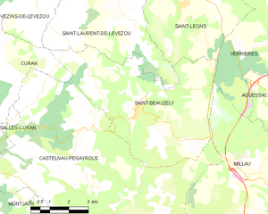
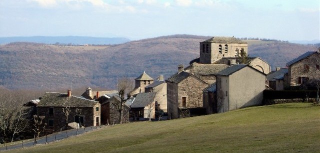
Saint-Beauzély
- commune in Aveyron, France
- Country:
- Postal Code: 12620
- Coordinates: 44° 9' 55" N, 2° 57' 29" E
- GPS tracks (wikiloc): [Link]
- Area: 30.69 sq km
- Population: 573
- Web site: [Link]


Montjaux
- commune in Aveyron, France
- Country:
- Postal Code: 12490
- Coordinates: 44° 6' 9" N, 2° 54' 20" E
- GPS tracks (wikiloc): [Link]
- Area: 31.48 sq km
- Population: 381


Viala-du-Tarn
- commune in Aveyron, France
- Country:
- Postal Code: 12490
- Coordinates: 44° 4' 19" N, 2° 52' 39" E
- GPS tracks (wikiloc): [Link]
- Area: 38.56 sq km
- Population: 453
- Web site: [Link]

Castelnau-Pégayrols
- commune in Aveyron, France
- Country:
- Postal Code: 12620
- Coordinates: 44° 7' 47" N, 2° 56' 1" E
- GPS tracks (wikiloc): [Link]
- Area: 53.01 sq km
- Population: 340
- Web site: [Link]


Verrières
- commune in Aveyron, France
- Country:
- Postal Code: 12520
- Coordinates: 44° 12' 5" N, 3° 3' 29" E
- GPS tracks (wikiloc): [Link]
- AboveSeaLevel: 480 м m
- Area: 53.01 sq km
- Population: 450
- Web site: [Link]