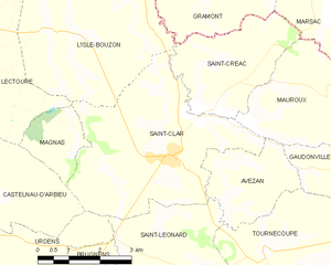
canton of Saint-Clar (canton de Saint-Clar)
- canton of France
- Country:

- Capital: Saint-Clar
- Coordinates: 43° 52' 39" N, 0° 48' 9" E


- GPS tracks (wikiloc): [Link]
- Wikidata storage: Wikidata: Q1727095
- INSEE canton code: [3225]
Includes regions:
Pessoulens
- commune in Gers, France
- Country:
- Postal Code: 32380
- Coordinates: 43° 51' 9" N, 0° 52' 36" E
- GPS tracks (wikiloc): [Link]
- Area: 12.63 sq km
- Population: 149


Tournecoupe
- commune in Gers, France
- Country:
- Postal Code: 32380
- Coordinates: 43° 51' 48" N, 0° 48' 40" E
- GPS tracks (wikiloc): [Link]
- Area: 18.95 sq km
- Population: 270
- Web site: [Link]


L'Isle-Bouzon
- commune in Gers, France
- Country:
- Postal Code: 32380
- Coordinates: 43° 55' 39" N, 0° 43' 41" E
- GPS tracks (wikiloc): [Link]
- Area: 15.95 sq km
- Population: 242

Saint-Clar
- commune in Gers, France
- Country:
- Postal Code: 32380
- Coordinates: 43° 53' 31" N, 0° 46' 12" E
- GPS tracks (wikiloc): [Link]
- Area: 17.91 sq km
- Population: 995
- Web site: [Link]
Mauroux
- commune in Gers, France
- Country:
- Postal Code: 32380
- Coordinates: 43° 54' 43" N, 0° 48' 37" E
- GPS tracks (wikiloc): [Link]
- AboveSeaLevel: 130 м m
- Area: 9.96 sq km
- Population: 132

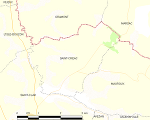
Saint-Créac
- commune in Gers, France
- Country:
- Postal Code: 32380
- Coordinates: 43° 55' 18" N, 0° 48' 6" E
- GPS tracks (wikiloc): [Link]
- AboveSeaLevel: 262 м m
- Area: 8.37 sq km
- Population: 91
Magnas
- commune in Gers, France
- Country:
- Postal Code: 32380
- Coordinates: 43° 53' 40" N, 0° 43' 49" E
- GPS tracks (wikiloc): [Link]
- Area: 3.19 sq km
- Population: 67


Gaudonville
- commune in Gers, France
- Country:
- Postal Code: 32380
- Coordinates: 43° 53' 4" N, 0° 50' 46" E
- GPS tracks (wikiloc): [Link]
- Area: 7.39 sq km
- Population: 111
Saint-Léonard
- commune in Gers, France
- Country:
- Postal Code: 32380
- Coordinates: 43° 51' 33" N, 0° 46' 8" E
- GPS tracks (wikiloc): [Link]
- Area: 13.11 sq km
- Population: 182
Cadeilhan
- commune in Gers, France
- Country:
- Postal Code: 32380
- Coordinates: 43° 49' 44" N, 0° 46' 17" E
- GPS tracks (wikiloc): [Link]
- Area: 8.43 sq km
- Population: 128
Estramiac
- commune in Gers, France
- Country:
- Postal Code: 32380
- Coordinates: 43° 50' 11" N, 0° 50' 55" E
- GPS tracks (wikiloc): [Link]
- Area: 9.69 sq km
- Population: 137
Castéron
- commune in Gers, France
- Country:
- Postal Code: 32380
- Coordinates: 43° 53' 31" N, 0° 51' 40" E
- GPS tracks (wikiloc): [Link]
- Area: 11.08 sq km
- Population: 53


Avezan
- commune in Gers, France
- Country:
- Postal Code: 32380
- Coordinates: 43° 52' 33" N, 0° 47' 45" E
- GPS tracks (wikiloc): [Link]
- Area: 5.66 sq km
- Population: 93


Bivès
- commune in Gers, France
- Country:
- Postal Code: 32380
- Coordinates: 43° 49' 59" N, 0° 48' 17" E
- GPS tracks (wikiloc): [Link]
- Area: 9.93 sq km
- Population: 126