
Gers (Gers)


- French department
- Country:

- Capital: Auch
- Coordinates: 43° 39' 0" N, 0° 35' 0" E


- GPS tracks (wikiloc): [Link]
- Area: 6257 sq km
- Population: 190932
- Web site: http://www.gers.pref.gouv.fr/
- Wikipedia en: wiki(en)
- Wikipedia: wiki(fr)
- Wikidata storage: Wikidata: Q12517
- Wikipedia Commons Gallery: [Link]
- Wikipedia Commons Category: [Link]
- Freebase ID: [/m/0mh58]
- GeoNames ID: Alt: [3016194]
- SIREN number: [223200015]
- BnF ID: [11941760q]
- VIAF ID: Alt: [170183917]
- OSM relation ID: [7422]
- GND ID: Alt: [4086707-9]
- archINFORM location ID: [99]
- Library of Congress authority ID: Alt: [n81007173]
- Encyclopædia Britannica Online ID: [place/Gers]
- NUTS code: [FR624]
- INSEE department code: [32]
- ISO 3166-2 code: FR-32
Includes regions:


Monblanc
- commune in Gers, France
- Country:
- Postal Code: 32130
- Coordinates: 43° 27' 50" N, 0° 59' 25" E
- GPS tracks (wikiloc): [Link]
- Area: 12.93 sq km
- Population: 352


Auch
- commune in Gers, France
- Country:
- Postal Code: 32000
- Licence Plate Code: 32
- Coordinates: 43° 38' 43" N, 0° 35' 19" E
- GPS tracks (wikiloc): [Link]
- Area: 72.48 sq km
- Population: 21943
- Web site: [Link]

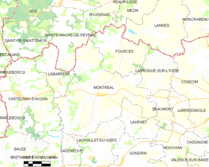
Montréal
- commune in Gers, France
- Country:
- Postal Code: 32250
- Coordinates: 43° 57' 0" N, 0° 12' 8" E
- GPS tracks (wikiloc): [Link]
- Area: 63.05 sq km
- Population: 1173
- Web site: [Link]


Barcelonne-du-Gers
- commune in Gers, France
- Country:
- Postal Code: 32720
- Coordinates: 43° 42' 12" N, 0° 14' 9" E
- GPS tracks (wikiloc): [Link]
- Area: 20.29 sq km
- Population: 1363
- Web site: [Link]

arrondissement of Auch
- arrondissement of France
- Country:
- Capital: Auch
- Coordinates: 43° 35' 0" N, 0° 40' 0" E
- GPS tracks (wikiloc): [Link]
- Area: 2134 sq km
- Population: 81216


arrondissement of Condom
- arrondissement of France
- Country:
- Capital: Condom
- Coordinates: 43° 55' 0" N, 0° 20' 0" E
- GPS tracks (wikiloc): [Link]
- Area: 2437 sq km
- Population: 67358


arrondissement of Mirande
- arrondissement of France
- Country:
- Capital: Mirande
- Coordinates: 43° 35' 0" N, 0° 10' 0" E
- GPS tracks (wikiloc): [Link]
- Area: 1686 sq km
- Population: 42358
Shares border with regions:


Haute-Garonne
- French department
- Country:
- Capital: Toulouse
- Coordinates: 43° 25' 0" N, 1° 30' 0" E
- GPS tracks (wikiloc): [Link]
- Area: 6309 sq km
- Population: 1335103
- Web site: [Link]


Landes
- French department
- Country:
- Capital: Mont-de-Marsan
- Coordinates: 43° 52' 41" N, 0° 52' 4" E
- GPS tracks (wikiloc): [Link]
- Area: 9243 sq km
- Population: 403234
- Web site: [Link]


Lot-et-Garonne
- French department
- Country:
- Capital: Agen
- Coordinates: 44° 20' 0" N, 0° 30' 0" E
- GPS tracks (wikiloc): [Link]
- Area: 5361 sq km
- Population: 333417
- Web site: [Link]


Hautes-Pyrénées
- French department
- Country:
- Capital: Tarbes
- Coordinates: 43° 12' 0" N, 0° 8' 0" E
- GPS tracks (wikiloc): [Link]
- Area: 4464 sq km
- Population: 228582
- Web site: [Link]


Pyrénées-Atlantiques
- departement in Aquitaine, France
- Country:
- Capital: Pau
- Coordinates: 43° 15' 0" N, 0° 50' 0" E
- GPS tracks (wikiloc): [Link]
- Area: 7645 sq km
- Population: 670032
- Web site: [Link]


Tarn-et-Garonne
- French department
- Country:
- Capital: Montauban
- Coordinates: 44° 0' 0" N, 1° 20' 0" E
- GPS tracks (wikiloc): [Link]
- Area: 3718 sq km
- Population: 255274
- Web site: [Link]