canton of Saint-Jean-de-Daye (canton de Saint-Jean-de-Daye)
- canton of France
- Country:

- Capital: Saint-Jean-de-Daye
- Coordinates: 49° 12' 29" N, 1° 9' 57" E


- GPS tracks (wikiloc): [Link]
- Wikidata storage: Wikidata: Q1683730
- Library of Congress authority ID: Alt: [n2012011090]
- INSEE canton code: [5034]
Includes regions:

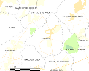
Tribehou
- commune in Manche, France
- Country:
- Postal Code: 50620
- Coordinates: 49° 12' 50" N, 1° 14' 38" E
- GPS tracks (wikiloc): [Link]
- Area: 9.97 sq km
- Population: 533
- Web site: [Link]