canton of Savigny-sur-Braye (canton de Savigny-sur-Braye)
- canton of France (until March 2015)
- Country:

- Capital: Savigny-sur-Braye
- Coordinates: 47° 49' 53" N, 0° 49' 55" E


- GPS tracks (wikiloc): [Link]
- Wikidata storage: Wikidata: Q1547716
- INSEE canton code: [4121]
Includes regions:
Fortan
- commune in Loir-et-Cher, France
- Country:
- Postal Code: 41360
- Coordinates: 47° 50' 44" N, 0° 54' 57" E
- GPS tracks (wikiloc): [Link]
- Area: 5.98 sq km
- Population: 283
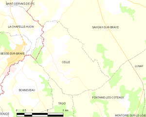
Cellé
- commune in Loir-et-Cher, France
- Country:
- Postal Code: 41360
- Coordinates: 47° 50' 1" N, 0° 46' 58" E
- GPS tracks (wikiloc): [Link]
- Area: 12.67 sq km
- Population: 234

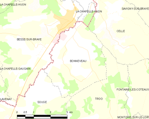
Bonneveau
- commune in Loir-et-Cher, France
- Country:
- Postal Code: 41800
- Coordinates: 47° 48' 45" N, 0° 44' 59" E
- GPS tracks (wikiloc): [Link]
- Area: 10.95 sq km
- Population: 479

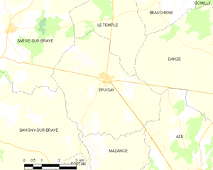
Épuisay
- commune in Loir-et-Cher, France
- Country:
- Postal Code: 41360
- Coordinates: 47° 54' 1" N, 0° 55' 53" E
- GPS tracks (wikiloc): [Link]
- Area: 23.52 sq km
- Population: 819

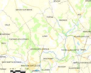
Lunay
- commune in Loir-et-Cher, France
- Country:
- Postal Code: 41360
- Coordinates: 47° 48' 33" N, 0° 54' 55" E
- GPS tracks (wikiloc): [Link]
- Area: 38.63 sq km
- Population: 1276
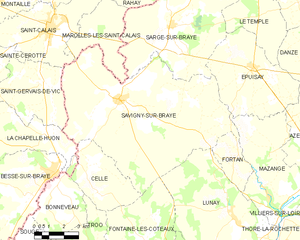
Savigny-sur-Braye
- commune in Loir-et-Cher, France
- Country:
- Postal Code: 41360
- Coordinates: 47° 52' 46" N, 0° 48' 33" E
- GPS tracks (wikiloc): [Link]
- Area: 67.18 sq km
- Population: 2072
- Web site: [Link]


Sougé
- commune in Loir-et-Cher, France
- Country:
- Postal Code: 41800
- Coordinates: 47° 46' 13" N, 0° 43' 40" E
- GPS tracks (wikiloc): [Link]
- AboveSeaLevel: 62 м m
- Area: 16.88 sq km
- Population: 472
- Web site: [Link]
Fontaine-les-Coteaux
- commune in Loir-et-Cher, France
- Country:
- Postal Code: 41800
- Coordinates: 47° 47' 57" N, 0° 49' 43" E
- GPS tracks (wikiloc): [Link]
- Area: 22.11 sq km
- Population: 349