canton of Songeons (canton de Songeons)
- canton of France (until March 2015)
- Country:

- Capital: Songeons
- Coordinates: 49° 32' 13" N, 1° 50' 44" E


- GPS tracks (wikiloc): [Link]
- Wikidata storage: Wikidata: Q626779
- INSEE canton code: [6035]
Includes regions:


Hanvoile
- commune in Oise, France
- Country:
- Postal Code: 60650
- Coordinates: 49° 30' 42" N, 1° 52' 47" E
- GPS tracks (wikiloc): [Link]
- Area: 5.88 sq km
- Population: 618
- Web site: [Link]

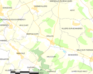
Crillon
- commune in Oise, France
- Country:
- Postal Code: 60112
- Coordinates: 49° 31' 13" N, 1° 55' 47" E
- GPS tracks (wikiloc): [Link]
- Area: 8.66 sq km
- Population: 474


Hannaches
- commune in Oise, France
- Country:
- Postal Code: 60650
- Coordinates: 49° 29' 53" N, 1° 48' 26" E
- GPS tracks (wikiloc): [Link]
- Area: 9.52 sq km
- Population: 148


Haucourt
- commune in Oise, France
- Country:
- Postal Code: 60112
- Coordinates: 49° 30' 46" N, 1° 56' 17" E
- GPS tracks (wikiloc): [Link]
- Area: 3.88 sq km
- Population: 136
- Web site: [Link]


Glatigny
- commune in Oise, France
- Country:
- Postal Code: 60650
- Coordinates: 49° 29' 51" N, 1° 53' 40" E
- GPS tracks (wikiloc): [Link]
- Area: 3.63 sq km
- Population: 224

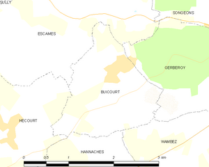
Buicourt
- commune in Oise, France
- Country:
- Postal Code: 60380
- Coordinates: 49° 32' 24" N, 1° 49' 9" E
- GPS tracks (wikiloc): [Link]
- Area: 3.51 sq km
- Population: 143
Bazancourt
- commune in Oise, France
- Country:
- Postal Code: 60380
- Coordinates: 49° 33' 15" N, 1° 44' 7" E
- GPS tracks (wikiloc): [Link]
- Area: 3.15 sq km
- Population: 130


Lachapelle-sous-Gerberoy
- commune in Oise, France
- Country:
- Postal Code: 60380
- Coordinates: 49° 32' 6" N, 1° 52' 8" E
- GPS tracks (wikiloc): [Link]
- Area: 4.93 sq km
- Population: 147


Wambez
- commune in Oise, France
- Country:
- Postal Code: 60380
- Coordinates: 49° 31' 35" N, 1° 51' 4" E
- GPS tracks (wikiloc): [Link]
- Area: 4.54 sq km
- Population: 162

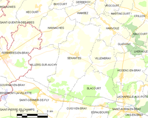
Senantes
- commune in Oise, France
- Country:
- Postal Code: 60650
- Coordinates: 49° 29' 9" N, 1° 50' 6" E
- GPS tracks (wikiloc): [Link]
- Area: 19.94 sq km
- Population: 642


Sully
- commune in Oise, France
- Country:
- Postal Code: 60380
- Coordinates: 49° 33' 33" N, 1° 46' 52" E
- GPS tracks (wikiloc): [Link]
- Area: 4.83 sq km
- Population: 167
Hécourt
- commune in Oise, France
- Country:
- Postal Code: 60380
- Coordinates: 49° 31' 13" N, 1° 45' 36" E
- GPS tracks (wikiloc): [Link]
- Area: 7.47 sq km
- Population: 157


Martincourt
- commune in Oise, France
- Country:
- Postal Code: 60112
- Coordinates: 49° 31' 23" N, 1° 53' 51" E
- GPS tracks (wikiloc): [Link]
- Area: 5.08 sq km
- Population: 130

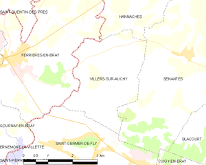
Villers-sur-Auchy
- commune in Oise, France
- Country:
- Postal Code: 60650
- Coordinates: 49° 29' 13" N, 1° 47' 40" E
- GPS tracks (wikiloc): [Link]
- Area: 8.59 sq km
- Population: 389
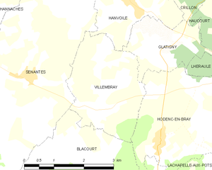
Villembray
- commune in Oise, France
- Country:
- Postal Code: 60650
- Coordinates: 49° 28' 35" N, 1° 52' 8" E
- GPS tracks (wikiloc): [Link]
- Area: 6.53 sq km
- Population: 255
- Web site: [Link]
Ernemont-Boutavent
- commune in Oise, France
- Country:
- Postal Code: 60380
- Coordinates: 49° 35' 21" N, 1° 48' 29" E
- GPS tracks (wikiloc): [Link]
- Area: 8.95 sq km
- Population: 200
Escames
- commune in Oise, France
- Country:
- Postal Code: 60380
- Coordinates: 49° 33' 12" N, 1° 48' 2" E
- GPS tracks (wikiloc): [Link]
- Area: 11.68 sq km
- Population: 216


Lhéraule
- commune in Oise, France
- Country:
- Postal Code: 60650
- Coordinates: 49° 29' 14" N, 1° 55' 51" E
- GPS tracks (wikiloc): [Link]
- Area: 2.76 sq km
- Population: 190


Grémévillers
- commune in Oise, France
- Country:
- Postal Code: 60380
- Coordinates: 49° 33' 51" N, 1° 53' 46" E
- GPS tracks (wikiloc): [Link]
- Area: 6.85 sq km
- Population: 450
- Web site: [Link]


Saint-Quentin-des-Prés
- commune in Oise, France
- Country:
- Postal Code: 60380
- Coordinates: 49° 31' 14" N, 1° 45' 14" E
- GPS tracks (wikiloc): [Link]
- Area: 10.8 sq km
- Population: 292
Saint-Deniscourt
- commune in Oise, France
- Country:
- Postal Code: 60380
- Coordinates: 49° 36' 20" N, 1° 52' 13" E
- GPS tracks (wikiloc): [Link]
- Area: 4.68 sq km
- Population: 88


Vrocourt
- commune in Oise, France
- Country:
- Postal Code: 60112
- Coordinates: 49° 31' 44" N, 1° 53' 11" E
- GPS tracks (wikiloc): [Link]
- Area: 4.4 sq km
- Population: 35

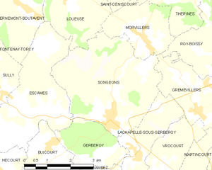
Songeons
- commune in Oise, France
- Country:
- Postal Code: 60380
- Coordinates: 49° 32' 57" N, 1° 51' 11" E
- GPS tracks (wikiloc): [Link]
- Area: 13.53 sq km
- Population: 1070
- Web site: [Link]


Loueuse
- commune in Oise, France
- Country:
- Postal Code: 60380
- Coordinates: 49° 35' 56" N, 1° 49' 31" E
- GPS tracks (wikiloc): [Link]
- Area: 7.32 sq km
- Population: 147


Fontenay-Torcy
- commune in Oise, France
- Country:
- Postal Code: 60380
- Coordinates: 49° 34' 5" N, 1° 46' 11" E
- GPS tracks (wikiloc): [Link]
- Area: 5.96 sq km
- Population: 125

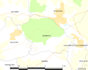
Gerberoy
- commune in Oise, France
- Country:
- Postal Code: 60380
- Coordinates: 49° 32' 3" N, 1° 50' 59" E
- GPS tracks (wikiloc): [Link]
- Area: 4.51 sq km
- Population: 92
- Web site: [Link]
Thérines
- commune in Oise, France
- Country:
- Postal Code: 60380
- Coordinates: 49° 36' 10" N, 1° 53' 36" E
- GPS tracks (wikiloc): [Link]
- Area: 10.8 sq km
- Population: 209
- Web site: [Link]
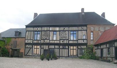
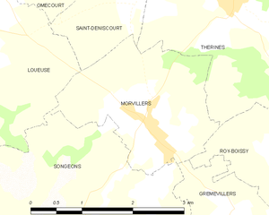
Morvillers
- commune in Oise, France
- Country:
- Postal Code: 60380
- Coordinates: 49° 34' 52" N, 1° 52' 14" E
- GPS tracks (wikiloc): [Link]
- Area: 5.12 sq km
- Population: 463