canton of Vendôme-2 (canton de Vendôme-2)
- canton of France (until March 2015)
- Country:

- Capital: Vendôme
- Coordinates: 47° 46' 50" N, 1° 3' 22" E


- GPS tracks (wikiloc): [Link]
- Wikidata storage: Wikidata: Q666533
- INSEE canton code: [4128]
Includes regions:

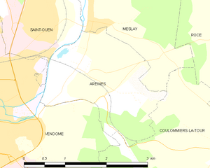
Areines
- commune in Loir-et-Cher, France
- Country:
- Postal Code: 41100
- Coordinates: 47° 48' 4" N, 1° 5' 40" E
- GPS tracks (wikiloc): [Link]
- Area: 4.84 sq km
- Population: 607


Villiersfaux
- commune in Loir-et-Cher, France
- Country:
- Postal Code: 41100
- Coordinates: 47° 44' 58" N, 0° 59' 17" E
- GPS tracks (wikiloc): [Link]
- Area: 7.22 sq km
- Population: 263
Saint-Ouen
- commune in Loir-et-Cher, France
- Country:
- Postal Code: 41100
- Coordinates: 47° 48' 39" N, 1° 5' 3" E
- GPS tracks (wikiloc): [Link]
- Area: 11.3 sq km
- Population: 3286

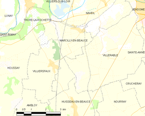
Marcilly-en-Beauce
- commune in Loir-et-Cher, France
- Country:
- Postal Code: 41100
- Coordinates: 47° 45' 49" N, 1° 0' 7" E
- GPS tracks (wikiloc): [Link]
- Area: 6.39 sq km
- Population: 351


Meslay
- commune in Loir-et-Cher, France
- Country:
- Postal Code: 41100
- Coordinates: 47° 48' 42" N, 1° 5' 57" E
- GPS tracks (wikiloc): [Link]
- Area: 7.18 sq km
- Population: 310
Villerable
- commune in Loir-et-Cher, France
- Country:
- Postal Code: 41100
- Coordinates: 47° 45' 30" N, 1° 1' 50" E
- GPS tracks (wikiloc): [Link]
- Area: 16.81 sq km
- Population: 526
- Web site: [Link]
Sainte-Anne
- commune in Loir-et-Cher, France
- Country:
- Postal Code: 41100
- Coordinates: 47° 45' 26" N, 1° 4' 54" E
- GPS tracks (wikiloc): [Link]
- Area: 5.13 sq km
- Population: 424