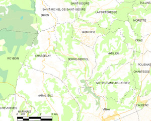
canton of Vinay (canton de Vinay)
- canton of France
Canton de Vinay, located in the Isère department in the Auvergne-Rhône-Alpes region of France, offers stunning landscapes and a variety of hiking opportunities suitable for different skill levels. The region is characterized by rolling hills, lush forests, and picturesque views of the surrounding Alps, making it a delightful destination for both casual walkers and experienced hikers.
Hiking Trails
-
Mont Moucherotte: This popular trail offers a moderate hike with rewarding panoramic views of the Vercors Massif and the surrounding area. It's approximately a 4-5 hour round trip, making it suitable for those looking for a half-day adventure.
-
Lac de Paladru: This easy trail around the lake is perfect for families. The flat terrain and beautiful lakeside scenery make it ideal for a relaxing hike, with options for picnics and swimming during warmer months.
-
Vignoble de Vinay: Explore the vineyards on the lower slopes of the hills. These trails often combine hiking with wine tasting, offering a unique way to appreciate the local culture and gastronomy.
-
Sentier des Ecureuils: A family-friendly trail with informative signs along the way. It is designed for educational purposes and offers insights into the local flora and fauna.
Tips for Hiking in Canton de Vinay
- Prepare for Varying Conditions: Weather can change rapidly in the mountains, so it's essential to check forecasts and dress in layers.
- Stay Hydrated: Carry enough water, especially on longer trails.
- Wear Appropriate Footwear: Sturdy hiking boots are recommended, as you may encounter rocky or uneven terrain.
- Respect Nature: Stick to marked trails, pack out what you pack in, and respect wildlife.
- Local Guides: If you're unfamiliar with the area or prefer guided experiences, consider hiring a local hiking guide who can offer insights into the region's history and ecology.
Local Attractions
After hiking, explore the charming village of Vinay itself, where you can enjoy local cuisine. Don't miss the chance to visit local wineries for a taste of the regional wines.
Whether you're after scenic views, exhilarating climbs, or leisurely strolls, Canton de Vinay has something for everyone. Happy hiking!
- Country:

- Capital: Vinay
- Coordinates: 45° 12' 57" N, 5° 24' 46" E


- GPS tracks (wikiloc): [Link]
- Wikidata storage: Wikidata: Q1727934
- INSEE canton code: [3842]
Includes regions:


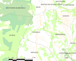
Chasselay
- commune in Isère, France
Chasselay, a small commune in the Isère department in the Auvergne-Rhône-Alpes region of France, offers several opportunities for outdoor enthusiasts, especially those who enjoy hiking. The area is known for its natural beauty, with scenic landscapes that include rolling hills, forests, and panoramic views of the surrounding mountains....
- Country:

- Postal Code: 38470
- Coordinates: 45° 15' 21" N, 5° 20' 19" E


- GPS tracks (wikiloc): [Link]
- Area: 9.45 sq km
- Population: 416


Cognin-les-Gorges
- commune in Isère, France
Cognin-les-Gorges, located in the French Alps, is a charming destination for hiking enthusiasts. The area is known for its stunning natural landscapes, including picturesque gorges, rugged mountains, and diverse flora and fauna. Here are some highlights for hiking in Cognin-les-Gorges:...
- Country:

- Postal Code: 38470
- Coordinates: 45° 10' 15" N, 5° 24' 42" E


- GPS tracks (wikiloc): [Link]
- Area: 12.52 sq km
- Population: 639
- Web site: [Link]


L'Albenc
- commune in Isère, France
L'Albenc is a charming village located in the Auvergne-Rhône-Alpes region of southeastern France. The area surrounding L'Albenc offers a range of hiking opportunities suited for various skill levels, with stunning views of the surrounding mountains and valleys....
- Country:

- Postal Code: 38470
- Coordinates: 45° 13' 30" N, 5° 26' 26" E


- GPS tracks (wikiloc): [Link]
- Area: 9.86 sq km
- Population: 1170
- Web site: [Link]


Varacieux
- commune in Isère, France
Varacieux is a charming village located in the Auvergne-Rhône-Alpes region of France. While it's a small community, it is surrounded by natural beauty and offers a variety of hiking opportunities that cater to different skill levels....
- Country:

- Postal Code: 38470
- Coordinates: 45° 13' 55" N, 5° 20' 15" E


- GPS tracks (wikiloc): [Link]
- Area: 18.48 sq km
- Population: 879
- Web site: [Link]


Saint-Gervais
- commune in Isère, France
Saint-Gervais is a beautiful commune located in the Isère department of the Auvergne-Rhône-Alpes region in southeastern France. It offers stunning landscapes, diverse trails, and a range of activities for outdoor enthusiasts, making it a fantastic destination for hikers....
- Country:

- Postal Code: 38470
- Coordinates: 45° 12' 6" N, 5° 28' 55" E


- GPS tracks (wikiloc): [Link]
- Area: 13.15 sq km
- Population: 567
- Web site: [Link]


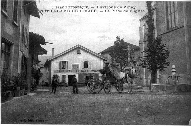
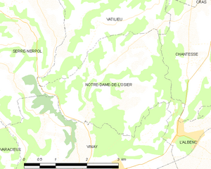
Notre-Dame-de-l'Osier
- commune in Isère, France
 Hiking in Notre-Dame-de-l'Osier
Notre-Dame-de-l'Osier, located in the Isère department of France, is a charming village surrounded by stunning natural landscapes, making it an excellent destination for hiking enthusiasts. Here are some highlights:...
- Country:

- Postal Code: 38470
- Coordinates: 45° 14' 18" N, 5° 24' 19" E


- GPS tracks (wikiloc): [Link]
- Area: 8.38 sq km
- Population: 478
- Web site: [Link]


Vinay
- commune in Isère, France
Vinay, located in the Isère department of the Auvergne-Rhône-Alpes region in France, is a charming village surrounded by beautiful natural landscapes, making it a great spot for hiking enthusiasts. Here are a few key points to consider when hiking in and around Vinay:...
- Country:

- Postal Code: 38470
- Coordinates: 45° 12' 36" N, 5° 24' 13" E


- GPS tracks (wikiloc): [Link]
- Area: 16.01 sq km
- Population: 4200
- Web site: [Link]


Chantesse
- commune in Isère, France
Chantesse, located in the picturesque region of France, offers a variety of hiking opportunities for both beginners and seasoned trekkers. It's nestled in the Vercors massif, which is known for its stunning landscapes, limestone cliffs, and diverse flora and fauna....
- Country:

- Postal Code: 38470
- Coordinates: 45° 14' 34" N, 5° 26' 40" E


- GPS tracks (wikiloc): [Link]
- Area: 5.83 sq km
- Population: 320
- Web site: [Link]


Rovon
- commune in Isère, France
Rovon is not a widely recognized hiking destination, but if you're referring to a specific location, I can provide general advice and tips for hiking in various terrains and regions. If Rovon is a local area or trail, it may have features typical of outdoor hiking locales....
- Country:

- Postal Code: 38470
- Coordinates: 45° 12' 9" N, 5° 27' 41" E


- GPS tracks (wikiloc): [Link]
- Area: 11.82 sq km
- Population: 609
- Web site: [Link]


Malleval-en-Vercors
- commune in Isère, France
Malleval-en-Vercors is a picturesque village located in the Isère department of the Auvergne-Rhône-Alpes region in France. Situated in the Vercors massif, it offers stunning natural landscapes, diverse hiking trails, and a rich variety of flora and fauna....
- Country:

- Postal Code: 38470
- Coordinates: 45° 8' 50" N, 5° 26' 15" E


- GPS tracks (wikiloc): [Link]
- Area: 14.1 sq km
- Population: 53
- Web site: [Link]


Serre-Nerpol
- commune in Isère, France
Serre-Nerpol, located in the French Alps, offers a range of hiking opportunities for enthusiasts of all skill levels. Here are some key highlights and tips for hiking in this beautiful region:...
- Country:

- Postal Code: 38470
- Coordinates: 45° 15' 29" N, 5° 22' 30" E


- GPS tracks (wikiloc): [Link]
- AboveSeaLevel: 400 м m
- Area: 13.16 sq km
- Population: 293
- Web site: [Link]