Cognin-les-Gorges (Cognin-les-Gorges)
- commune in Isère, France
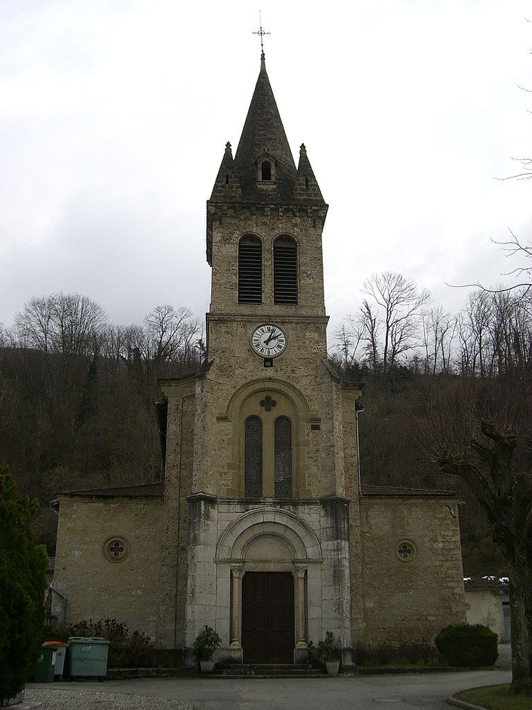
Cognin-les-Gorges, located in the French Alps, is a charming destination for hiking enthusiasts. The area is known for its stunning natural landscapes, including picturesque gorges, rugged mountains, and diverse flora and fauna. Here are some highlights for hiking in Cognin-les-Gorges:
Trails
-
Gorges de la Tardive: This is one of the most popular hiking routes in the area, offering breathtaking views of the gorges themselves. The trail may feature rocky terrain and water crossings, so make sure you're prepared with appropriate footwear.
-
Les Crêtes de Cognin: A higher elevation trail that provides panoramic views of the surrounding mountains and valleys. This route is suitable for more experienced hikers, as it can include steep ascents.
-
Thollon-les-Mémises: While not in Cognin-les-Gorges specifically, this nearby area is easily accessible and features varied trails with views over Lake Geneva and the surrounding Alps.
Wildlife and Flora
While hiking in Cognin-les-Gorges, you have a good chance of spotting various wildlife, including chamois, marmots, and a variety of bird species. The region is also home to diverse plant life, including alpine flowers.
Best Time to Hike
The best months for hiking in this region are typically late spring through early autumn (May to October) when the weather is milder and trails are more accessible. However, altitude and snow conditions can affect trail availability, so always check local conditions before setting out.
Tips for Hiking
- Preparation: Bring sufficient water, snacks, and a map. Cell reception may be limited, so having a physical map can be invaluable.
- Dress Appropriately: Weather can change quickly in the mountains, so layers are essential. Bring rain gear and wear sturdy hiking boots.
- Respect Nature: Follow Leave No Trace principles to help preserve the beauty of the area.
Local Amenities
Cognin-les-Gorges may have limited amenities, so it's advisable to plan accordingly. Check for local accommodations, restaurants, and shops before heading out for your hike.
Hiking in Cognin-les-Gorges can be a rewarding experience with its breathtaking views and rich natural environment, making it a wonderful destination for outdoor lovers!
- Country:

- Postal Code: 38470
- Coordinates: 45° 10' 15" N, 5° 24' 42" E


- GPS tracks (wikiloc): [Link]
- Area: 12.52 sq km
- Population: 639
- Web site: http://www.cognin-les-gorges.sud-gresivaudan.org
- Wikipedia en: wiki(en)
- Wikipedia: wiki(fr)
- Wikidata storage: Wikidata: Q1003151
- Wikipedia Commons Category: [Link]
- Freebase ID: [/m/03nvh6k]
- GeoNames ID: Alt: [6433173]
- SIREN number: [213801178]
- BnF ID: [15257943p]
- INSEE municipality code: 38117
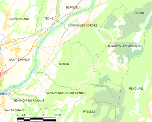
Shares border with regions:


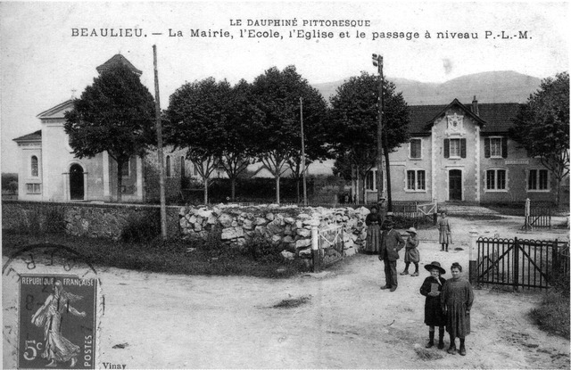
Beaulieu
- commune in Isère, France
Beaulieu in Isère is a charming destination for hiking enthusiasts, nestled in the foothills of the French Alps. The area is known for its beautiful landscapes, rolling hills, and proximity to the Chartreuse Mountains. Here are some highlights to consider if you're planning to hike in Beaulieu:...
- Country:

- Postal Code: 38470
- Coordinates: 45° 11' 33" N, 5° 23' 32" E


- GPS tracks (wikiloc): [Link]
- Area: 8.79 sq km
- Population: 623


Izeron
- commune in Isère, France
Izeron is a charming village located in the Isère department of southeastern France, not far from the Vercors National Park. The surrounding area is characterized by its beautiful landscapes, diverse flora and fauna, and a variety of hiking trails that cater to different skill levels....
- Country:

- Postal Code: 38160
- Coordinates: 45° 8' 48" N, 5° 22' 33" E


- GPS tracks (wikiloc): [Link]
- Area: 17.19 sq km
- Population: 701
- Web site: [Link]


Vinay
- commune in Isère, France
Vinay, located in the Isère department of the Auvergne-Rhône-Alpes region in France, is a charming village surrounded by beautiful natural landscapes, making it a great spot for hiking enthusiasts. Here are a few key points to consider when hiking in and around Vinay:...
- Country:

- Postal Code: 38470
- Coordinates: 45° 12' 36" N, 5° 24' 13" E


- GPS tracks (wikiloc): [Link]
- Area: 16.01 sq km
- Population: 4200
- Web site: [Link]


Rovon
- commune in Isère, France
Rovon is not a widely recognized hiking destination, but if you're referring to a specific location, I can provide general advice and tips for hiking in various terrains and regions. If Rovon is a local area or trail, it may have features typical of outdoor hiking locales....
- Country:

- Postal Code: 38470
- Coordinates: 45° 12' 9" N, 5° 27' 41" E


- GPS tracks (wikiloc): [Link]
- Area: 11.82 sq km
- Population: 609
- Web site: [Link]


Malleval-en-Vercors
- commune in Isère, France
Malleval-en-Vercors is a picturesque village located in the Isère department of the Auvergne-Rhône-Alpes region in France. Situated in the Vercors massif, it offers stunning natural landscapes, diverse hiking trails, and a rich variety of flora and fauna....
- Country:

- Postal Code: 38470
- Coordinates: 45° 8' 50" N, 5° 26' 15" E


- GPS tracks (wikiloc): [Link]
- Area: 14.1 sq km
- Population: 53
- Web site: [Link]

