canton of Écommoy (canton d'Écommoy)

- canton of France
- Country:

- Capital: Écommoy
- Coordinates: 47° 52' 0" N, 0° 15' 51" E


- GPS tracks (wikiloc): [Link]
- Population: 27952
- Wikipedia en: wiki(en)
- Wikipedia: wiki(fr)
- Wikidata storage: Wikidata: Q1728017
- INSEE canton code: [7204]
Includes regions:

Mulsanne
- commune in Sarthe, France
- Country:
- Postal Code: 72230
- Coordinates: 47° 54' 42" N, 0° 14' 56" E
- GPS tracks (wikiloc): [Link]
- Area: 15.25 sq km
- Population: 5088
- Web site: [Link]


Saint-Biez-en-Belin
- commune in Sarthe, France
- Country:
- Postal Code: 72220
- Coordinates: 47° 49' 18" N, 0° 14' 19" E
- GPS tracks (wikiloc): [Link]
- Area: 9.27 sq km
- Population: 730
- Web site: [Link]

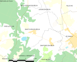
Saint-Ouen-en-Belin
- commune in Sarthe, France
- Country:
- Postal Code: 72220
- Coordinates: 47° 50' 1" N, 0° 12' 38" E
- GPS tracks (wikiloc): [Link]
- Area: 15.14 sq km
- Population: 1297

Saint-Mars-d'Outillé
- commune in Sarthe, France
- Country:
- Postal Code: 72220
- Coordinates: 47° 52' 15" N, 0° 19' 56" E
- GPS tracks (wikiloc): [Link]
- Area: 38.04 sq km
- Population: 2389
- Web site: [Link]


Brette-les-Pins
- commune in Sarthe, France
- Country:
- Postal Code: 72250
- Coordinates: 47° 54' 40" N, 0° 20' 13" E
- GPS tracks (wikiloc): [Link]
- Area: 14.51 sq km
- Population: 2148
- Web site: [Link]


Saint-Gervais-en-Belin
- commune in Sarthe, France
- Country:
- Postal Code: 72220
- Coordinates: 47° 52' 38" N, 0° 13' 7" E
- GPS tracks (wikiloc): [Link]
- Area: 9.53 sq km
- Population: 2111
- Web site: [Link]


Écommoy
- commune in Sarthe, France
- Country:
- Postal Code: 72220
- Coordinates: 47° 49' 42" N, 0° 16' 23" E
- GPS tracks (wikiloc): [Link]
- Area: 28.5 sq km
- Population: 4642
- Web site: [Link]


Teloché
- commune in Sarthe, France
- Country:
- Postal Code: 72220
- Coordinates: 47° 53' 16" N, 0° 16' 15" E
- GPS tracks (wikiloc): [Link]
- Area: 22.79 sq km
- Population: 3010
- Web site: [Link]


Laigné-en-Belin
- commune in Sarthe, France
- Country:
- Postal Code: 72220
- Coordinates: 47° 52' 41" N, 0° 13' 47" E
- GPS tracks (wikiloc): [Link]
- Area: 12.72 sq km
- Population: 2399
- Web site: [Link]


Marigné-Laillé
- commune in Sarthe, France
- Country:
- Postal Code: 72220
- Coordinates: 47° 49' 8" N, 0° 20' 23" E
- GPS tracks (wikiloc): [Link]
- Area: 32.73 sq km
- Population: 1652
- Web site: [Link]


Moncé-en-Belin
- commune in Sarthe, France
- Country:
- Postal Code: 72230
- Coordinates: 47° 53' 41" N, 0° 11' 53" E
- GPS tracks (wikiloc): [Link]
- Area: 17.49 sq km
- Population: 3620
- Web site: [Link]