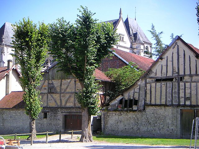
canton of Bar-sur-Seine (canton de Bar-sur-Seine)
- canton of France
- Country:

- Capital: Bar-sur-Seine
- Coordinates: 48° 6' 53" N, 4° 22' 36" E


- GPS tracks (wikiloc): [Link]
- Area: 668.27 sq km
- Population: 16899
- Wikipedia en: wiki(en)
- Wikipedia: wiki(fr)
- Wikidata storage: Wikidata: Q972703
- INSEE canton code: [1004]
Includes regions:

Villemorien
- commune in Aube, France
- Country:

- Postal Code: 10110
- Coordinates: 48° 5' 8" N, 4° 17' 47" E


- GPS tracks (wikiloc): [Link]
- Area: 13.8 sq km
- Population: 210


Fralignes
- commune in Aube, France
- Country:

- Postal Code: 10110
- Coordinates: 48° 9' 50" N, 4° 22' 27" E


- GPS tracks (wikiloc): [Link]
- Area: 5.14 sq km
- Population: 91
Villiers-sous-Praslin
- commune in Aube, France
- Country:

- Postal Code: 10210
- Coordinates: 48° 3' 44" N, 4° 14' 51" E


- GPS tracks (wikiloc): [Link]
- Area: 8.42 sq km
- Population: 70


Virey-sous-Bar
- commune in Aube, France
- Country:

- Postal Code: 10260
- Coordinates: 48° 8' 26" N, 4° 18' 18" E


- GPS tracks (wikiloc): [Link]
- Area: 10.85 sq km
- Population: 628
Poligny
- commune in Aube, France
- Country:

- Postal Code: 10110
- Coordinates: 48° 10' 28" N, 4° 20' 25" E


- GPS tracks (wikiloc): [Link]
- Area: 1.59 sq km
- Population: 65


Marolles-lès-Bailly
- commune in Aube, France
- Country:

- Postal Code: 10110
- Coordinates: 48° 11' 5" N, 4° 20' 43" E


- GPS tracks (wikiloc): [Link]
- Area: 4.4 sq km
- Population: 103


Fouchères
- commune in Aube, France
- Country:

- Postal Code: 10260
- Coordinates: 48° 8' 56" N, 4° 15' 53" E


- GPS tracks (wikiloc): [Link]
- Area: 8.58 sq km
- Population: 535


Bourguignons
- commune in Aube, France
- Country:

- Postal Code: 10110
- Coordinates: 48° 7' 51" N, 4° 21' 33" E


- GPS tracks (wikiloc): [Link]
- Area: 16.42 sq km
- Population: 291


Merrey-sur-Arce
- commune in Aube, France
- Country:

- Postal Code: 10110
- Coordinates: 48° 5' 45" N, 4° 23' 32" E


- GPS tracks (wikiloc): [Link]
- Area: 8.39 sq km
- Population: 320


Buxeuil
- commune in Aube, France
- Country:

- Postal Code: 10110
- Coordinates: 48° 3' 16" N, 4° 23' 47" E


- GPS tracks (wikiloc): [Link]
- Area: 4.43 sq km
- Population: 137


Chauffour-lès-Bailly
- commune in Aube, France
- Country:

- Postal Code: 10110
- Coordinates: 48° 11' 47" N, 4° 19' 44" E


- GPS tracks (wikiloc): [Link]
- Area: 19.01 sq km
- Population: 119


Jully-sur-Sarce
- commune in Aube, France
- Country:

- Postal Code: 10260
- Coordinates: 48° 6' 33" N, 4° 18' 18" E


- GPS tracks (wikiloc): [Link]
- Area: 30.44 sq km
- Population: 259


Villy-en-Trodes
- commune in Aube, France
- Country:

- Postal Code: 10140
- Coordinates: 48° 11' 54" N, 4° 22' 53" E


- GPS tracks (wikiloc): [Link]
- Area: 17.91 sq km
- Population: 243


Ville-sur-Arce
- commune in Aube, France
- Country:

- Postal Code: 10110
- Coordinates: 48° 6' 25" N, 4° 26' 43" E


- GPS tracks (wikiloc): [Link]
- Area: 16.16 sq km
- Population: 219


Bar-sur-Seine
- commune in Aube, France
- Country:

- Postal Code: 10110
- Coordinates: 48° 6' 51" N, 4° 22' 33" E


- GPS tracks (wikiloc): [Link]
- AboveSeaLevel: 156 м m
- Area: 27.53 sq km
- Population: 3054
- Web site: [Link]


Vaudes
- commune in Aube, France
- Country:

- Postal Code: 10260
- Coordinates: 48° 10' 42" N, 4° 11' 15" E


- GPS tracks (wikiloc): [Link]
- Area: 7.57 sq km
- Population: 718
Villemoyenne
- commune in Aube, France
- Country:

- Postal Code: 10260
- Coordinates: 48° 10' 41" N, 4° 13' 42" E


- GPS tracks (wikiloc): [Link]
- Area: 12.21 sq km
- Population: 779


Courtenot
- commune in Aube, France
- Country:

- Postal Code: 10260
- Coordinates: 48° 8' 57" N, 4° 18' 13" E


- GPS tracks (wikiloc): [Link]
- Area: 8.37 sq km
- Population: 230


Chappes
- commune in Aube, France
- Country:

- Postal Code: 10260
- Coordinates: 48° 9' 58" N, 4° 14' 46" E


- GPS tracks (wikiloc): [Link]
- Area: 9.75 sq km
- Population: 307


Rumilly-lès-Vaudes
- commune in Aube, France
- Country:

- Postal Code: 10260
- Coordinates: 48° 8' 35" N, 4° 12' 59" E


- GPS tracks (wikiloc): [Link]
- Area: 42.38 sq km
- Population: 522


Saint-Parres-lès-Vaudes
- commune in Aube, France
- Country:

- Postal Code: 10260
- Coordinates: 48° 10' 17" N, 4° 12' 56" E


- GPS tracks (wikiloc): [Link]
- Area: 3.08 sq km
- Population: 1012


Briel-sur-Barse
- commune in Aube, France
- Country:

- Postal Code: 10140
- Coordinates: 48° 12' 35" N, 4° 21' 21" E


- GPS tracks (wikiloc): [Link]
- Area: 12.45 sq km
- Population: 214
