canton of Brienne-le-Château (canton de Brienne-le-Château)
- canton of France
- Country:

- Capital: Brienne-le-Château
- Coordinates: 48° 23' 39" N, 4° 31' 33" E


- GPS tracks (wikiloc): [Link]
- Area: 665.7 sq km
- Population: 14526
- Wikipedia en: wiki(en)
- Wikipedia: wiki(fr)
- Wikidata storage: Wikidata: Q1269115
- INSEE canton code: [1005]
Includes regions:
Courcelles-sur-Voire
- commune in Aube, France
- Country:

- Postal Code: 10500
- Coordinates: 48° 28' 21" N, 4° 32' 20" E


- GPS tracks (wikiloc): [Link]
- Area: 4.9 sq km
- Population: 25
Molins-sur-Aube
- commune in Aube, France
- Country:

- Postal Code: 10500
- Coordinates: 48° 26' 6" N, 4° 22' 47" E


- GPS tracks (wikiloc): [Link]
- Area: 6.26 sq km
- Population: 106
Lassicourt
- commune in Aube, France
- Country:

- Postal Code: 10500
- Coordinates: 48° 26' 34" N, 4° 29' 21" E


- GPS tracks (wikiloc): [Link]
- AboveSeaLevel: 113 м m
- Area: 7.73 sq km
- Population: 65


Radonvilliers
- commune in Aube, France
- Country:

- Postal Code: 10500
- Coordinates: 48° 21' 33" N, 4° 30' 15" E


- GPS tracks (wikiloc): [Link]
- Area: 23.29 sq km
- Population: 392


Mathaux
- commune in Aube, France
- Country:

- Postal Code: 10500
- Coordinates: 48° 22' 15" N, 4° 28' 42" E


- GPS tracks (wikiloc): [Link]
- Area: 12.44 sq km
- Population: 201


Lesmont
- commune in Aube, France
- Country:

- Postal Code: 10500
- Coordinates: 48° 25' 39" N, 4° 24' 52" E


- GPS tracks (wikiloc): [Link]
- Area: 9.92 sq km
- Population: 315


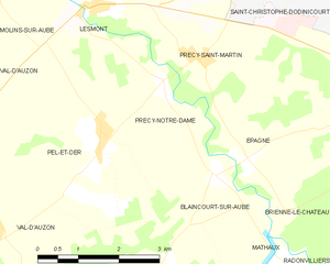
Précy-Notre-Dame
- commune in Aube, France
- Country:

- Postal Code: 10500
- Coordinates: 48° 24' 40" N, 4° 26' 14" E


- GPS tracks (wikiloc): [Link]
- Area: 4.53 sq km
- Population: 84


Rosnay-l'Hôpital
- commune in Aube, France
- Country:

- Postal Code: 10500
- Coordinates: 48° 27' 34" N, 4° 30' 13" E


- GPS tracks (wikiloc): [Link]
- AboveSeaLevel: 118 м m
- Area: 12.47 sq km
- Population: 212
Saint-Léger-sous-Brienne
- commune in Aube, France
- Country:

- Postal Code: 10500
- Coordinates: 48° 24' 14" N, 4° 30' 11" E


- GPS tracks (wikiloc): [Link]
- Area: 13.52 sq km
- Population: 391
Perthes-lès-Brienne
- commune in Aube, France
- Country:

- Postal Code: 10500
- Coordinates: 48° 25' 49" N, 4° 32' 23" E


- GPS tracks (wikiloc): [Link]
- Area: 3.63 sq km
- Population: 82


Précy-Saint-Martin
- commune in Aube, France
- Country:

- Postal Code: 10500
- Coordinates: 48° 24' 59" N, 4° 27' 1" E


- GPS tracks (wikiloc): [Link]
- Area: 6.57 sq km
- Population: 190
Épagne
- commune in Aube, France
- Country:

- Postal Code: 10500
- Coordinates: 48° 23' 38" N, 4° 27' 54" E


- GPS tracks (wikiloc): [Link]
- Area: 3.94 sq km
- Population: 127


Maizières-lès-Brienne
- commune in Aube, France
- Country:

- Postal Code: 10500
- Coordinates: 48° 26' 13" N, 4° 35' 15" E


- GPS tracks (wikiloc): [Link]
- Area: 9.5 sq km
- Population: 171


Vallentigny
- commune in Aube, France
- Country:

- Postal Code: 10500
- Coordinates: 48° 26' 48" N, 4° 34' 50" E


- GPS tracks (wikiloc): [Link]
- Area: 15.74 sq km
- Population: 184


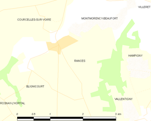
Rances
- commune in Aube, France
- Country:

- Postal Code: 10500
- Coordinates: 48° 28' 0" N, 4° 32' 45" E


- GPS tracks (wikiloc): [Link]
- AboveSeaLevel: 123 м m
- Area: 3.81 sq km
- Population: 43


Brienne-le-Château
- commune in Aube, France
- Country:

- Postal Code: 10500
- Coordinates: 48° 23' 30" N, 4° 31' 32" E


- GPS tracks (wikiloc): [Link]
- AboveSeaLevel: 126 м m
- Area: 21.56 sq km
- Population: 2907
- Web site: [Link]


Dienville
- commune in Aube, France
- Country:

- Postal Code: 10500
- Coordinates: 48° 21' 2" N, 4° 32' 1" E


- GPS tracks (wikiloc): [Link]
- Area: 20.34 sq km
- Population: 893


Saint-Christophe-Dodinicourt
- commune in Aube, France
- Country:

- Postal Code: 10500
- Coordinates: 48° 26' 20" N, 4° 28' 12" E


- GPS tracks (wikiloc): [Link]
- Area: 4.87 sq km
- Population: 34


Yèvres-le-Petit
- commune in Aube, France
- Country:

- Postal Code: 10500
- Coordinates: 48° 28' 43" N, 4° 29' 26" E


- GPS tracks (wikiloc): [Link]
- Area: 8.35 sq km
- Population: 61


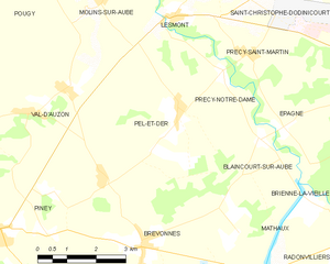
Pel-et-Der
- commune in Aube, France
- Country:

- Postal Code: 10500
- Coordinates: 48° 24' 3" N, 4° 24' 57" E


- GPS tracks (wikiloc): [Link]
- Area: 13.18 sq km
- Population: 139
Bétignicourt
- commune in Aube, France
- Country:

- Postal Code: 10500
- Coordinates: 48° 26' 48" N, 4° 27' 20" E


- GPS tracks (wikiloc): [Link]
- Area: 3.18 sq km
- Population: 32


Blaincourt-sur-Aube
- commune in Aube, France
- Country:

- Postal Code: 10500
- Coordinates: 48° 23' 23" N, 4° 27' 15" E


- GPS tracks (wikiloc): [Link]
- Area: 5.79 sq km
- Population: 105


Brienne-la-Vieille
- commune in Aube, France
- Country:

- Postal Code: 10500
- Coordinates: 48° 22' 29" N, 4° 31' 43" E


- GPS tracks (wikiloc): [Link]
- Area: 16.21 sq km
- Population: 446


Hampigny
- commune in Aube, France
- Country:

- Postal Code: 10500
- Coordinates: 48° 27' 21" N, 4° 35' 24" E


- GPS tracks (wikiloc): [Link]
- Area: 9.49 sq km
- Population: 247
Blignicourt
- commune in Aube, France
- Country:

- Postal Code: 10500
- Coordinates: 48° 27' 43" N, 4° 31' 55" E


- GPS tracks (wikiloc): [Link]
- Area: 4.27 sq km
- Population: 41
