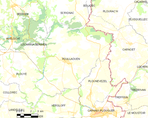
canton of Carhaix-Plouguer (canton de Carhaix-Plouguer)

- canton of France
- Country:

- Capital: Carhaix-Plouguer
- Coordinates: 48° 15' 18" N, 3° 37' 25" E


- GPS tracks (wikiloc): [Link]
- Population: 27055
- Wikipedia en: wiki(en)
- Wikipedia: wiki(fr)
- Wikidata storage: Wikidata: Q1610889
- Library of Congress authority ID: Alt: [n83215511]
- INSEE canton code: [2907]
Includes regions:

Spézet
- commune in Finistère, France
- Country:
- Postal Code: 29540
- Coordinates: 48° 11' 33" N, 3° 43' 0" E
- GPS tracks (wikiloc): [Link]
- Area: 60.67 sq km
- Population: 1821
- Web site: [Link]


Carhaix-Plouguer
- commune in Finistère, France
- Country:
- Postal Code: 29270
- Coordinates: 48° 16' 33" N, 3° 34' 28" E
- GPS tracks (wikiloc): [Link]
- AboveSeaLevel: 104 м m
- Area: 25.81 sq km
- Population: 7305
- Web site: [Link]


Plounévézel
- commune in Finistère, France
- Country:
- Postal Code: 29270
- Coordinates: 48° 17' 56" N, 3° 35' 23" E
- GPS tracks (wikiloc): [Link]
- Area: 24.42 sq km
- Population: 1255
- Web site: [Link]


Cléden-Poher
- commune in Finistère, France
- Country:
- Postal Code: 29270
- Coordinates: 48° 14' 7" N, 3° 40' 7" E
- GPS tracks (wikiloc): [Link]
- Area: 29.81 sq km
- Population: 1134
- Web site: [Link]

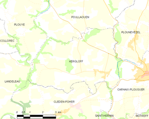
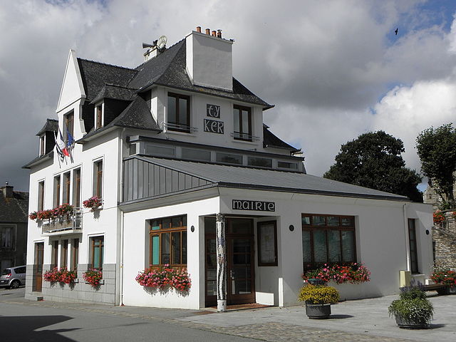
Kergloff
- commune in Finistère, France
- Country:
- Postal Code: 29270
- Coordinates: 48° 16' 28" N, 3° 37' 10" E
- GPS tracks (wikiloc): [Link]
- Area: 24.94 sq km
- Population: 920
- Web site: [Link]

Poullaouen
- commune in Finistère, France
- Country:
- Postal Code: 29246
- Coordinates: 48° 20' 24" N, 3° 38' 33" E
- GPS tracks (wikiloc): [Link]
- Area: 71.36 sq km
- Population: 1290
- Web site: [Link]


Saint-Hernin
- commune in Finistère, France
- Country:
- Postal Code: 29270
- Coordinates: 48° 13' 5" N, 3° 38' 5" E
- GPS tracks (wikiloc): [Link]
- AboveSeaLevel: 120 м m
- Area: 29.29 sq km
- Population: 760
- Web site: [Link]


Motreff
- commune in Finistère, France
- Country:
- Postal Code: 29270
- Coordinates: 48° 12' 6" N, 3° 33' 19" E
- GPS tracks (wikiloc): [Link]
- Area: 21.59 sq km
- Population: 706
- Web site: [Link]