Cléden-Poher (Cléden-Poher)

- commune in Finistère, France
- Country:

- Postal Code: 29270
- Coordinates: 48° 14' 7" N, 3° 40' 7" E


- GPS tracks (wikiloc): [Link]
- Area: 29.81 sq km
- Population: 1134
- Web site: http://www.cleden-poher.com
- Wikipedia en: wiki(en)
- Wikipedia: wiki(fr)
- Wikidata storage: Wikidata: Q381253
- Wikipedia Commons Gallery: [Link]
- Wikipedia Commons Category: [Link]
- Freebase ID: [/m/03gvx9n]
- GeoNames ID: Alt: [3024692]
- SIREN number: [212900294]
- BnF ID: [15254384w]
- VIAF ID: Alt: [155076439]
- Library of Congress authority ID: Alt: [no96060170]
- PACTOLS thesaurus ID: [pcrtvyK8LLEJdI]
- INSEE municipality code: 29029
Shares border with regions:

Spézet
- commune in Finistère, France
- Country:
- Postal Code: 29540
- Coordinates: 48° 11' 33" N, 3° 43' 0" E
- GPS tracks (wikiloc): [Link]
- Area: 60.67 sq km
- Population: 1821
- Web site: [Link]


Carhaix-Plouguer
- commune in Finistère, France
- Country:
- Postal Code: 29270
- Coordinates: 48° 16' 33" N, 3° 34' 28" E
- GPS tracks (wikiloc): [Link]
- AboveSeaLevel: 104 м m
- Area: 25.81 sq km
- Population: 7305
- Web site: [Link]

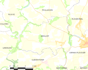
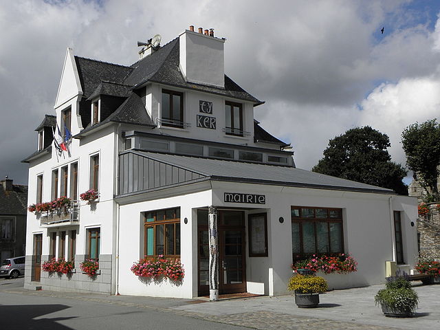
Kergloff
- commune in Finistère, France
- Country:
- Postal Code: 29270
- Coordinates: 48° 16' 28" N, 3° 37' 10" E
- GPS tracks (wikiloc): [Link]
- Area: 24.94 sq km
- Population: 920
- Web site: [Link]


Landeleau
- commune in Finistère, France
- Country:
- Postal Code: 29530
- Coordinates: 48° 13' 38" N, 3° 43' 46" E
- GPS tracks (wikiloc): [Link]
- Area: 30.41 sq km
- Population: 944
- Web site: [Link]


Saint-Hernin
- commune in Finistère, France
- Country:
- Postal Code: 29270
- Coordinates: 48° 13' 5" N, 3° 38' 5" E
- GPS tracks (wikiloc): [Link]
- AboveSeaLevel: 120 м m
- Area: 29.29 sq km
- Population: 760
- Web site: [Link]