canton of Cerizay (canton de Cerizay)

- canton of France
- Country:

- Capital: Cerizay
- Coordinates: 46° 48' 59" N, 0° 38' 50" E


- GPS tracks (wikiloc): [Link]
- Population: 26166
- Wikipedia en: wiki(en)
- Wikipedia: wiki(fr)
- Wikidata storage: Wikidata: Q1255994
- INSEE canton code: [7904]
Includes regions:


Cirières
- commune in Deux-Sèvres, France
- Country:
- Postal Code: 79140
- Coordinates: 46° 50' 13" N, 0° 37' 16" E
- GPS tracks (wikiloc): [Link]
- Area: 16.83 sq km
- Population: 973


Combrand
- commune in Deux-Sèvres, France
- Country:
- Postal Code: 79140
- Coordinates: 46° 51' 51" N, 0° 41' 22" E
- GPS tracks (wikiloc): [Link]
- Area: 24.62 sq km
- Population: 1175


Cerizay
- commune in Deux-Sèvres, France
- Country:
- Postal Code: 79140
- Coordinates: 46° 49' 17" N, 0° 39' 53" E
- GPS tracks (wikiloc): [Link]
- Area: 18.55 sq km
- Population: 4784
Courlay
- commune in Deux-Sèvres, France
- Country:
- Postal Code: 79440
- Coordinates: 46° 46' 46" N, 0° 34' 1" E
- GPS tracks (wikiloc): [Link]
- Area: 29.46 sq km
- Population: 2463
Saint-Jouin-de-Milly
- commune in Deux-Sèvres, France
- Country:
- Postal Code: 79380
- Coordinates: 46° 45' 16" N, 0° 37' 16" E
- GPS tracks (wikiloc): [Link]
- Area: 6.77 sq km
- Population: 190


Montravers
- commune in Deux-Sèvres, France
- Country:
- Postal Code: 79140
- Coordinates: 46° 49' 43" N, 0° 43' 5" E
- GPS tracks (wikiloc): [Link]
- Area: 10.12 sq km
- Population: 373


Le Pin
- commune in Deux-Sèvres, France
- Country:
- Postal Code: 79140
- Coordinates: 46° 51' 40" N, 0° 39' 15" E
- GPS tracks (wikiloc): [Link]
- AboveSeaLevel: 150 м m
- Area: 19.09 sq km
- Population: 1052
Bretignolles
- commune in Deux-Sèvres, France
- Country:
- Postal Code: 79140
- Coordinates: 46° 51' 47" N, 0° 36' 23" E
- GPS tracks (wikiloc): [Link]
- Area: 13.16 sq km
- Population: 624

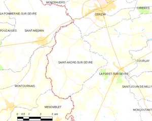
Saint-André-sur-Sèvre
- commune in Deux-Sèvres, France
- Country:
- Postal Code: 79380
- Coordinates: 46° 47' 1" N, 0° 40' 43" E
- GPS tracks (wikiloc): [Link]
- Area: 19.85 sq km
- Population: 643

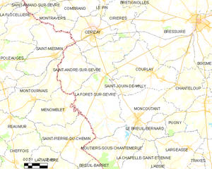
La Forêt-sur-Sèvre
- commune in Deux-Sèvres, France
- Country:
- Postal Code: 79380
- Coordinates: 46° 46' 12" N, 0° 38' 59" E
- GPS tracks (wikiloc): [Link]
- Area: 55.94 sq km
- Population: 2345