canton of Château-du-Loir (canton de Château-du-Loir)

- canton of France
- Country:

- Capital: Château-du-Loir
- Coordinates: 47° 42' 32" N, 0° 25' 34" E


- GPS tracks (wikiloc): [Link]
- Area: 537.24 sq km
- Population: 24210
- Wikipedia en: wiki(en)
- Wikipedia: wiki(fr)
- Wikidata storage: Wikidata: Q1724926
- INSEE canton code: [7203]
Includes regions:


Luceau
- commune in Sarthe, France
- Country:
- Postal Code: 72500
- Coordinates: 47° 42' 42" N, 0° 23' 49" E
- GPS tracks (wikiloc): [Link]
- Area: 18.77 sq km
- Population: 1239


Jupilles
- commune in Sarthe, France
- Country:
- Postal Code: 72500
- Coordinates: 47° 47' 25" N, 0° 24' 49" E
- GPS tracks (wikiloc): [Link]
- Area: 26.41 sq km
- Population: 569


Flée
- commune in Sarthe, France
- Country:
- Postal Code: 72500
- Coordinates: 47° 43' 58" N, 0° 27' 11" E
- GPS tracks (wikiloc): [Link]
- Area: 17.54 sq km
- Population: 545

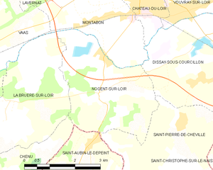
Nogent-sur-Loir
- commune in Sarthe, France
- Country:
- Postal Code: 72500
- Coordinates: 47° 40' 8" N, 0° 23' 48" E
- GPS tracks (wikiloc): [Link]
- Area: 10.81 sq km
- Population: 375


Dissay-sous-Courcillon
- commune in Sarthe, France
- Country:
- Postal Code: 72500
- Coordinates: 47° 39' 52" N, 0° 28' 21" E
- GPS tracks (wikiloc): [Link]
- Area: 34.92 sq km
- Population: 951


Beaumont-Pied-de-Bœuf
- commune in Sarthe, France
- Country:
- Postal Code: 72500
- Coordinates: 47° 45' 35" N, 0° 24' 4" E
- GPS tracks (wikiloc): [Link]
- Area: 24.68 sq km
- Population: 483


Saint-Pierre-de-Chevillé
- commune in Sarthe, France
- Country:
- Postal Code: 72500
- Coordinates: 47° 38' 45" N, 0° 26' 23" E
- GPS tracks (wikiloc): [Link]
- Area: 11.51 sq km
- Population: 366

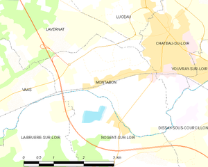
Montabon
- former commune in Sarthe, France
- Country:
- Postal Code: 72500
- Coordinates: 47° 40' 48" N, 0° 23' 12" E
- GPS tracks (wikiloc): [Link]
- Area: 7.48 sq km
- Population: 799


Thoiré-sur-Dinan
- commune in Sarthe, France
- Country:
- Postal Code: 72500
- Coordinates: 47° 45' 16" N, 0° 26' 56" E
- GPS tracks (wikiloc): [Link]
- Area: 17.72 sq km
- Population: 478


Château-du-Loir
- former commune in Sarthe, France
- Country:
- Postal Code: 72500
- Coordinates: 47° 41' 36" N, 0° 25' 5" E
- GPS tracks (wikiloc): [Link]
- Area: 11.46 sq km
- Population: 4750
- Web site: [Link]


Vouvray-sur-Loir
- former commune in Sarthe, France
- Country:
- Postal Code: 72500
- Coordinates: 47° 41' 42" N, 0° 27' 47" E
- GPS tracks (wikiloc): [Link]
- Area: 8.05 sq km
- Population: 789