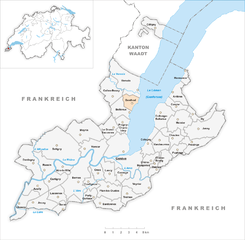
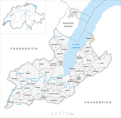
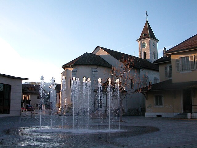
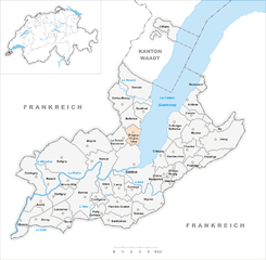
Canton of Geneva (Kanton Genf)


- canton of Switzerland
 Hiking in Canton of Geneva
Hiking in the Canton of Geneva offers a unique blend of urban accessibility and stunning natural landscapes. While Geneva itself is well-known for its cosmopolitan atmosphere, the surrounding areas provide numerous opportunities for outdoor enthusiasts.
Key Areas for Hiking:
-
Salève:
- Located just across the border in France, the Salève mountain offers panoramic views of Geneva and Lake Geneva. There are several trails of varying difficulty levels, making it accessible for both beginners and experienced hikers.
- The easiest path leads from the base to the summit, while more challenging routes can involve rocky sections and steeper climbs.
-
Cret de la Neige:
- This is one of the highest peaks in the Jura Mountains, offering stunning views of the Alps and the surrounding region. It is approximately a 2 to 3-hour hike from the nearest access points and is known for its beautiful landscapes, especially in spring and summer.
-
Les Bois de la Bâtie:
- A more accessible option, this area features a lovely trail that winds through forests and past charming ponds. It’s suitable for families and individuals looking for a leisurely day out in nature without venturing too far from the city.
-
Jura Mountains:
- The Jura mountain range offers a variety of trails, some of which begin just a short drive from Geneva. These trails vary in difficulty and can take you through beautiful forests, along ridges, and past stunning viewpoints.
-
The Rhône River Banks:
- For a gentler hiking experience, you can walk along the banks of the Rhône River. This trail is well-marked and provides lovely views of the city, parks, and waterfront, perfect for a relaxed hike.
Practical Tips:
- Transport: Public transport in and around Geneva is efficient, making it easy to reach hiking trailheads. Trains and buses can take you to key starting points.
- Weather: Always check the weather forecast before heading out, as mountain weather can change quickly.
- Trail Maps: Consider downloading maps or using a hiking app like Komoot or AllTrails to navigate.
- Gear: Wear good hiking shoes, dress in layers, and pack water, snacks, and a first aid kit.
Additional Considerations:
- The best hiking season is generally from late spring to early autumn, as winter snows can make trails challenging.
- Always leave no trace and respect local wildlife and ecosystems.
Whether you’re looking for a challenging mountain hike or a peaceful stroll through the woods, the Canton of Geneva has something to offer you. Happy hiking!
- Country:

- Capital: Geneva
- Licence Plate Code: GE
- Coordinates: 46° 13' 5" N, 6° 9' 58" E


- GPS tracks (wikiloc): [Link]
- AboveSeaLevel: 375 м m
- Area: 282.49 sq km
- Web site: http://www.ge.ch/
- Wikipedia en: wiki(en)
- Wikipedia: wiki(de)
- Wikidata storage: Wikidata: Q11917
- Wikipedia Commons Gallery: [Link]
- Wikipedia Commons Category: [Link]
- Freebase ID: [/m/01qtg0]
- GeoNames ID: Alt: [2660645]
- BnF ID: [119344325]
- VIAF ID: Alt: [128594881]
- OSM relation ID: [1702419]
- GND ID: Alt: [4020138-7]
- archINFORM location ID: [2786]
- Library of Congress authority ID: Alt: [n50059907]
- MusicBrainz area ID: [46c8ae38-5d1f-4bca-a78b-0189fde74bba]
- Quora topic ID: [Canton-of-Geneva]
- TGN ID: [7003746]
- SUDOC authorities ID: [026587041]
- HDS ID: [7398]
- ISNI: Alt: [0000 0001 1033 8214]
- NKCR AUT ID: [ge129456]
- NUTS code: [CH013]
- US National Archives Identifier: 10044857
- ISO 3166-2 code: CH-GE
- FIPS 10-4 (countries and regions): SZ07
Includes regions:

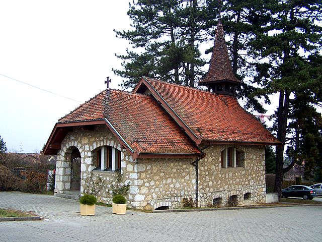
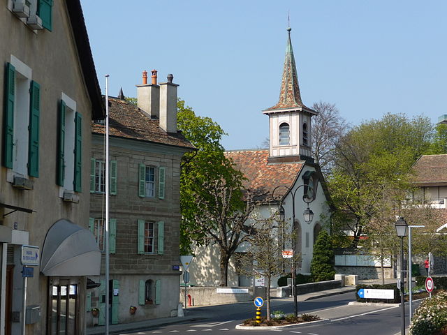
Genthod
- municipality in Switzerland
Hiking in Genthod
Genthod is a picturesque commune located near Geneva in Switzerland. While it may not be as widely recognized as some of the bigger hiking hotspots in Switzerland, it does offer some charming trails and beautiful views, especially given its proximity to the stunning shores of Lake Geneva....
- Country:
- Postal Code: 1294
- Local Dialing Code: 022
- Licence Plate Code: GE
- Coordinates: 46° 16' 0" N, 6° 9' 0" E
- GPS tracks (wikiloc): [Link]
- AboveSeaLevel: 405 м m
- Area: 2.87 sq km
- Population: 2779
- Web site: [Link]

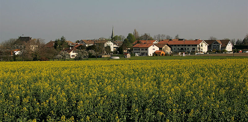
Vernier
- municipality in Switzerland
Hiking in Vernier
Vernier is a charming municipality located in the Canton of Geneva, Switzerland. While it may not be the first place that comes to mind when thinking of hiking, it provides access to some scenic trails and beautiful natural settings that can offer an enjoyable hiking experience. Here are a few points to consider when hiking in and around Vernier:...
- Country:
- Postal Code: 1214
- Local Dialing Code: 022
- Licence Plate Code: GE
- Coordinates: 46° 12' 39" N, 6° 5' 41" E
- GPS tracks (wikiloc): [Link]
- AboveSeaLevel: 390 м m
- Area: 7.68 sq km
- Population: 35132
- Web site: [Link]


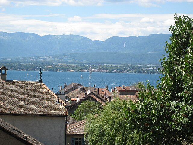
Versoix
- municipality in Switzerland
Hiking in Versoix
Versoix is a charming town located on the shores of Lake Geneva in Switzerland, offering scenic landscapes and outdoor activities, including hiking. While Versoix itself is not a major hiking destination, it serves as a great starting point for various hiking trails and excursions in the surrounding region. Here are some aspects to consider for hiking around Versoix:...
- Country:
- Postal Code: 1290
- Local Dialing Code: 022
- Licence Plate Code: GE
- Coordinates: 46° 17' 29" N, 6° 8' 44" E
- GPS tracks (wikiloc): [Link]
- AboveSeaLevel: 434 м m
- Area: 10.51 sq km
- Population: 13329
- Web site: [Link]


Lancy
- municipality in Switzerland
Hiking in Lancy
Lancy, located just outside of Geneva, Switzerland, is a fantastic area for hiking enthusiasts looking to explore the natural beauty of the region while benefiting from the proximity to urban amenities. While Lancy itself is a more urbanized area, you can access various hiking trails and green spaces nearby....
- Country:
- Postal Code: 1212
- Local Dialing Code: 022
- Licence Plate Code: GE
- Coordinates: 46° 11' 0" N, 6° 8' 0" E
- GPS tracks (wikiloc): [Link]
- AboveSeaLevel: 420 м m
- Area: 4.77 sq km
- Population: 31942
- Web site: [Link]

Bernex
- municipality in the canton of Geneva, Switzerland
Hiking in Bernex
Bernex is a charming municipality located in the canton of Geneva, Switzerland, nestled at the foot of the Voirons mountains. It offers stunning views of the surrounding landscape and a variety of hiking opportunities that cater to different skill levels....
- Country:
- Local Dialing Code: 022
- Licence Plate Code: GE
- Coordinates: 46° 10' 42" N, 6° 4' 6" E
- GPS tracks (wikiloc): [Link]
- AboveSeaLevel: 430 м m
- Area: 12.95 sq km
- Population: 10007
- Web site: [Link]


Plan-les-Ouates
- municipality in Switzerland
Hiking in Plan-les-Ouates
Plan-les-Ouates, located near Geneva in Switzerland, offers a variety of hiking opportunities that cater to both beginners and experienced hikers. While it's primarily known as a residential area, its proximity to the surrounding natural landscapes makes it a great base for exploration....
- Country:
- Postal Code: 1228
- Local Dialing Code: 022
- Licence Plate Code: GE
- Coordinates: 46° 9' 50" N, 6° 7' 9" E
- GPS tracks (wikiloc): [Link]
- AboveSeaLevel: 427 м m
- Area: 5.86 sq km
- Population: 10697
- Web site: [Link]


Confignon
- municipality in Switzerland
Hiking in Confignon
Confignon is a charming municipality located in the Canton of Geneva, Switzerland. Nestled at the foot of the Jura Mountains, it offers a variety of hiking opportunities that cater to different skill levels and preferences. Here are some aspects of hiking in Confignon:...
- Country:
- Postal Code: 1232
- Local Dialing Code: 022
- Licence Plate Code: GE
- Coordinates: 46° 11' 0" N, 6° 5' 0" E
- GPS tracks (wikiloc): [Link]
- AboveSeaLevel: 420 м m
- Area: 2.77 sq km
- Population: 4618
- Web site: [Link]


Aire-la-Ville
- municipality in the canton of Geneva, Switzerland
Hiking in Aire-la-Ville
Aire-la-Ville, a charming commune located near Geneva, Switzerland, offers some delightful hiking opportunities. While it may not be as widely known as larger hiking regions, its proximity to nature and scenic landscapes makes it an excellent spot for outdoor enthusiasts....
- Country:
- Postal Code: 1288
- Local Dialing Code: 022
- Licence Plate Code: GE
- Coordinates: 46° 11' 25" N, 6° 2' 32" E
- GPS tracks (wikiloc): [Link]
- AboveSeaLevel: 377 м m
- Area: 2.93 sq km
- Population: 1169
- Web site: [Link]


Perly-Certoux
- municipality in Switzerland
Hiking in Perly-Certoux
Perly-Certoux is a charming area located near Geneva, Switzerland, and is known for its picturesque landscapes that are ideal for hiking. While relatively small, the area offers a number of trails that allow hikers to enjoy the natural beauty of the region, including rolling hills, forests, and views of the surrounding Alps and the Jura Mountains....
- Country:
- Postal Code: 1258
- Local Dialing Code: 022
- Licence Plate Code: GE
- Coordinates: 46° 9' 26" N, 6° 5' 32" E
- GPS tracks (wikiloc): [Link]
- AboveSeaLevel: 437 м m
- Area: 2.53 sq km
- Population: 3074
- Web site: [Link]
Vandœuvres
- municipality in Switzerland
Hiking in Vandœuvres
Vandœuvres, a small residential area located near Geneva in Switzerland, is surrounded by beautiful natural landscapes ideal for hiking. Here’s what you can expect when hiking in the region:...
- Country:
- Postal Code: 1253
- Local Dialing Code: 022
- Licence Plate Code: GE
- Coordinates: 46° 13' 8" N, 6° 12' 13" E
- GPS tracks (wikiloc): [Link]
- AboveSeaLevel: 459 м m
- Area: 4.41 sq km
- Population: 2504
- Web site: [Link]


Cartigny
- municipality in the canton of Geneva, Switzerland
Hiking in Cartigny
Cartigny is a charming village situated just outside of Geneva, Switzerland. The area is perfect for hiking enthusiasts looking for a mix of scenic landscapes and moderate trails. Here are some key points about hiking in and around Cartigny:...
- Country:
- Local Dialing Code: 022
- Licence Plate Code: GE
- Coordinates: 46° 10' 26" N, 6° 1' 16" E
- GPS tracks (wikiloc): [Link]
- AboveSeaLevel: 431 м m
- Area: 4.38 sq km
- Population: 956
- Web site: [Link]


Soral
- municipality in the canton of Geneva, Switzerland
Hiking in Soral
Soral is a small town in the Canton of Geneva, Switzerland, located near the French border. While it may not be as well-known as other hiking destinations in the region, it offers scenic nature and picturesque landscapes that can appeal to hikers looking for less crowded trails....
- Country:
- Postal Code: 1286
- Local Dialing Code: 022
- Licence Plate Code: GE
- Coordinates: 46° 8' 36" N, 6° 2' 34" E
- GPS tracks (wikiloc): [Link]
- AboveSeaLevel: 459 м m
- Area: 2.95 sq km
- Population: 822
- Web site: [Link]

Jussy
- municipality in the canton of Geneva, Switzerland
Hiking in Jussy
Jussy, a charming village located in the Geneva region of Switzerland, offers beautiful hiking opportunities that showcase the natural beauty of the area. While Jussy itself may not be a hub of extensive hiking trails, its proximity to the larger network of trails in the surrounding region makes it a great starting point for outdoor enthusiasts....
- Country:
- Postal Code: 1254
- Local Dialing Code: 022
- Licence Plate Code: GE
- Coordinates: 46° 15' 0" N, 6° 17' 0" E
- GPS tracks (wikiloc): [Link]
- AboveSeaLevel: 470 м m
- Area: 11.35 sq km
- Population: 1294
- Web site: [Link]


Corsier
- municipality in the canton of Geneva, Switzerland
Hiking in Corsier
Corsier is a charming town located in the Canton of Geneva, Switzerland, and while it might not be the first place that comes to mind for hiking, it does provide access to some lovely trails in the surrounding areas. Here’s what you should know about hiking around Corsier:...
- Country:
- Postal Code: 1246
- Local Dialing Code: 022
- Licence Plate Code: GE
- Coordinates: 46° 15' 44" N, 6° 13' 42" E
- GPS tracks (wikiloc): [Link]
- AboveSeaLevel: 426 м m
- Area: 2.74 sq km
- Population: 2071
- Web site: [Link]


Collex-Bossy
- municipality in Switzerland
Hiking in Collex-Bossy
Collex-Bossy, located in the canton of Geneva in Switzerland, is a charming area that offers a unique blend of natural beauty and accessibility for hikers. The region is characterized by its rolling hills, forests, and proximity to the city, making it an excellent spot for both casual walkers and more serious hikers....
- Country:
- Local Dialing Code: 022
- Licence Plate Code: GE
- Coordinates: 46° 16' 0" N, 6° 7' 0" E
- GPS tracks (wikiloc): [Link]
- AboveSeaLevel: 430 м m
- Area: 6.89 sq km
- Population: 1687
- Web site: [Link]
Hermance
- municipality in Switzerland
Hiking in Hermance
Hermance is a charming village located on the shores of Lake Geneva in Switzerland, near the border with France. While it may not be as famous for hiking as some alpine regions, its picturesque surroundings and proximity to various trails in the larger Lake Geneva area offer delightful hiking opportunities....
- Country:
- Postal Code: 1248
- Local Dialing Code: 022
- Licence Plate Code: GE
- Coordinates: 46° 17' 37" N, 6° 14' 41" E
- GPS tracks (wikiloc): [Link]
- AboveSeaLevel: 408 м m
- Area: 1.44 sq km
- Population: 1036
- Web site: [Link]


Gy
- municipality in the canton of Geneva, Switzerland
Hiking in Gy
Gy, a small village located in the municipality of Bex in the Vaud region of Switzerland, offers an array of hiking opportunities that showcase the stunning landscapes of the Swiss Alps. Here are some aspects to consider when hiking in and around Gy:...
- Country:
- Postal Code: 1251
- Local Dialing Code: 022
- Licence Plate Code: GE
- Coordinates: 46° 15' 0" N, 6° 15' 0" E
- GPS tracks (wikiloc): [Link]
- AboveSeaLevel: 460 м m
- Area: 3.28 sq km
- Population: 481
- Web site: [Link]

Avusy
- municipality in Switzerland
Hiking in Avusy
Avusy is a picturesque commune located in the Geneva region of Switzerland, known for its beautiful landscapes and proximity to nature. Hiking in Avusy and the surrounding areas offers a variety of trails that cater to different skill levels and preferences....
- Country:
- Postal Code: 1285
- Local Dialing Code: 022
- Licence Plate Code: GE
- Coordinates: 46° 9' 0" N, 5° 59' 0" E
- GPS tracks (wikiloc): [Link]
- AboveSeaLevel: 410 м m
- Area: 5.19 sq km
- Population: 1434
- Web site: [Link]


Choulex
- municipality in Switzerland
Hiking in Choulex
Choulex is a charming municipality located in the Canton of Geneva, Switzerland, known for its scenic landscapes and proximity to the Jura mountains and Lake Geneva. While Choulex itself is a small village, it serves as a great starting point for various hiking opportunities in the surrounding areas....
- Country:
- Postal Code: 1244
- Local Dialing Code: 022
- Licence Plate Code: GE
- Coordinates: 46° 13' 34" N, 6° 13' 26" E
- GPS tracks (wikiloc): [Link]
- AboveSeaLevel: 456 м m
- Area: 3.91 sq km
- Population: 1149
- Web site: [Link]
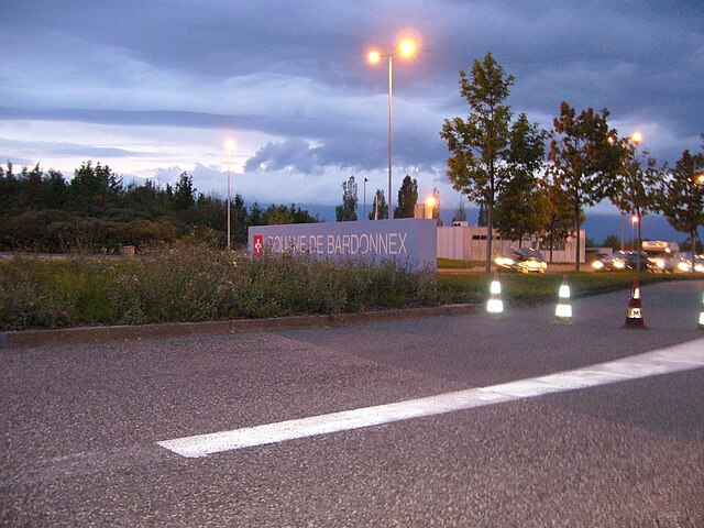
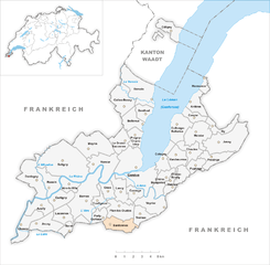
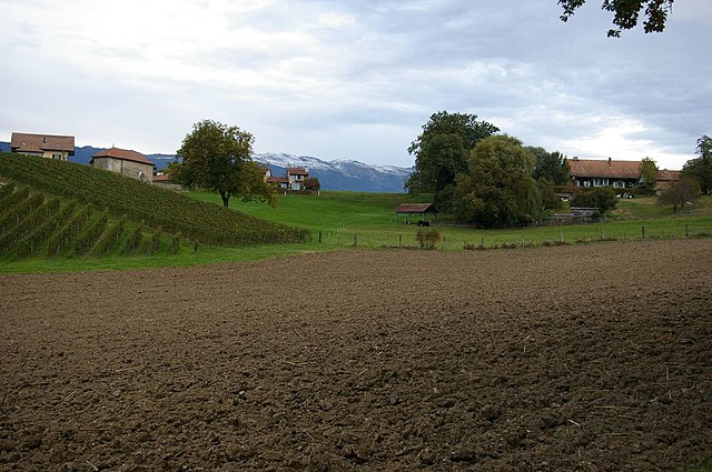
Bardonnex
- municipality in Switzerland
Hiking in Bardonnex
Bardonnex, located in the Haute-Savoie region of France near the Swiss border, offers a variety of outdoor experiences, including numerous hiking trails that cater to different skill levels. The beautiful landscapes, with views of the surrounding mountains and valleys, make it a fantastic destination for hikers....
- Country:
- Local Dialing Code: 022
- Licence Plate Code: GE
- Coordinates: 46° 8' 0" N, 6° 6' 0" E
- GPS tracks (wikiloc): [Link]
- AboveSeaLevel: 470 м m
- Area: 5.0 sq km
- Population: 2215
- Web site: [Link]


Thônex
- municipality in Switzerland
Hiking in Thônex
Thônex, located in the Canton of Geneva, Switzerland, offers beautiful trails and scenic views for hiking enthusiasts. While it’s primarily an urban area, it’s conveniently close to natural landscapes and the picturesque terrains of the surrounding regions. Here are some highlights about hiking in and around Thônex:...
- Country:
- Postal Code: 1226
- Local Dialing Code: 022
- Licence Plate Code: GE
- Coordinates: 46° 11' 46" N, 6° 12' 17" E
- GPS tracks (wikiloc): [Link]
- AboveSeaLevel: 427 м m
- Area: 3.84 sq km
- Population: 14091
- Web site: [Link]

Meyrin
- municipality in Switzerland
Hiking in Meyrin
Meyrin, a municipality located in the canton of Geneva, Switzerland, is not primarily known for its hiking opportunities, as it is more urbanized compared to other regions in the area. However, it is situated close to several beautiful natural settings where you can enjoy hiking experiences....
- Country:
- Postal Code: 1217
- Local Dialing Code: 022
- Licence Plate Code: GE
- Coordinates: 46° 13' 56" N, 6° 4' 45" E
- GPS tracks (wikiloc): [Link]
- AboveSeaLevel: 443 м m
- Area: 9.94 sq km
- Population: 24144
- Web site: [Link]


Onex
- municipality in Switzerland
Hiking in Onex
Onex, a suburb of Geneva in Switzerland, may not be the most prominent hiking destination, but it does serve as a gateway to some beautiful trails in the surrounding areas, including the nearby Geneva region and the larger Alpine landscape....
- Country:
- Postal Code: 1213
- Local Dialing Code: 022
- Licence Plate Code: GE
- Coordinates: 46° 11' 0" N, 6° 6' 0" E
- GPS tracks (wikiloc): [Link]
- AboveSeaLevel: 429 м m
- Area: 2.81 sq km
- Population: 18977
- Web site: [Link]


Chêne-Bourg
- municipality in Switzerland
Hiking in Chêne-Bourg
Chêne-Bourg, a suburb of Geneva in Switzerland, is ideally situated for outdoor enthusiasts, though it may not be as well-known for extensive hiking trails compared to more mountainous regions of the country. Nonetheless, there are several options for enjoying nature and hiking in and around Chêne-Bourg....
- Country:
- Local Dialing Code: 022
- Licence Plate Code: GE
- Coordinates: 46° 11' 51" N, 6° 11' 49" E
- GPS tracks (wikiloc): [Link]
- AboveSeaLevel: 423 м m
- Area: 1.28 sq km
- Population: 8708
- Web site: [Link]


Collonge-Bellerive
- municipality in Switzerland
Hiking in Collonge-Bellerive
Collonge-Bellerive is a picturesque municipality located on the southeastern shore of Lake Geneva in the canton of Geneva, Switzerland. While it’s a smaller area, it offers some beautiful hiking opportunities with stunning views of the lake and surrounding landscapes....
- Country:
- Postal Code: 1245
- Local Dialing Code: 022
- Licence Plate Code: GE
- Coordinates: 46° 15' 0" N, 6° 12' 0" E
- GPS tracks (wikiloc): [Link]
- AboveSeaLevel: 405 м m
- Area: 6.12 sq km
- Population: 8126
- Web site: [Link]


Avully
- municipality in Switzerland
Hiking in Avully
Avully, a picturesque village in the Grand Geneva region of Switzerland, offers a beautiful backdrop for hiking enthusiasts. Nestled near the border with France and close to the larger city of Geneva, Avully provides access to a variety of trails that cater to different skill levels....
- Country:
- Postal Code: 1237
- Local Dialing Code: 022
- Licence Plate Code: GE
- Coordinates: 46° 10' 3" N, 5° 59' 55" E
- GPS tracks (wikiloc): [Link]
- AboveSeaLevel: 423 м m
- Area: 4.61 sq km
- Population: 1763
- Web site: [Link]

Cologny
- municipality in Switzerland
Hiking in Cologny
Cologny, a picturesque town located near Geneva in Switzerland, offers a variety of beautiful hiking trails suitable for different skill levels. Here's an overview of what to expect when hiking in Cologny:...
- Country:
- Local Dialing Code: 022
- Licence Plate Code: GE
- Coordinates: 46° 13' 5" N, 6° 11' 6" E
- GPS tracks (wikiloc): [Link]
- AboveSeaLevel: 460 м m
- Area: 3.66 sq km
- Population: 5531
- Web site: [Link]


Carouge
- municipality in Switzerland
Hiking in Carouge
Carouge is a beautiful town located just outside of Geneva, Switzerland. While it’s more renowned for its vibrant culture, art scene, and charming architecture, there are a few aspects to consider if you’re looking to explore the outdoors and hiking opportunities nearby....
- Country:
- Postal Code: 1227
- Local Dialing Code: 022
- Licence Plate Code: GE
- Coordinates: 46° 10' 54" N, 6° 8' 25" E
- GPS tracks (wikiloc): [Link]
- AboveSeaLevel: 389 м m
- Area: 2.65 sq km
- Population: 22336
- Web site: [Link]


Céligny
- municipality in Switzerland
Hiking in Céligny
Céligny, located in the canton of Vaud in Switzerland, offers beautiful hiking opportunities with picturesque views of Lake Geneva and the surrounding landscapes. Here are some highlights and tips for hiking in and around Céligny:...
- Country:
- Postal Code: 1298
- Local Dialing Code: 022
- Licence Plate Code: GE
- Coordinates: 46° 21' 0" N, 6° 12' 0" E
- GPS tracks (wikiloc): [Link]
- AboveSeaLevel: 430 м m
- Area: 4.65 sq km
- Population: 787
- Web site: [Link]


Satigny
- municipality in Switzerland
Hiking in Satigny
Satigny is a charming area located in the Geneva region of Switzerland, known for its picturesque landscapes, vineyards, and proximity to nature. While it may not be as famous as some of the larger Swiss hiking destinations, there are still plenty of opportunities for hikers to explore the scenic countryside....
- Country:
- Postal Code: 1242
- Local Dialing Code: 022
- Licence Plate Code: GE
- Coordinates: 46° 12' 51" N, 6° 2' 13" E
- GPS tracks (wikiloc): [Link]
- AboveSeaLevel: 418 м m
- Area: 18.92 sq km
- Population: 4109
- Web site: [Link]


Dardagny
- municipality in Switzerland
Hiking in Dardagny
Dardagny is a charming commune located in the Geneva region of Switzerland, known for its picturesque landscapes and proximity to nature. Hiking in Dardagny offers beautiful trails that cater to various skill levels, making it an excellent destination for both novice and experienced hikers....
- Country:
- Postal Code: 1283
- Local Dialing Code: 022
- Coordinates: 46° 11' 43" N, 5° 59' 41" E
- GPS tracks (wikiloc): [Link]
- AboveSeaLevel: 451 м m
- Area: 8.60 sq km
- Population: 1861
- Web site: [Link]


Chêne-Bougeries
- municipality in Switzerland
Hiking in Chêne-Bougeries
Chêne-Bougeries is a picturesque municipality located in the Canton of Geneva, Switzerland. While it is primarily an urban area, it offers access to scenic trails and natural surroundings, making it a delightful spot for hikers looking for a mix of nature and urban convenience....
- Country:
- Local Dialing Code: 022
- Licence Plate Code: GE
- Coordinates: 46° 11' 37" N, 6° 10' 54" E
- GPS tracks (wikiloc): [Link]
- AboveSeaLevel: 420 м m
- Area: 4.13 sq km
- Population: 11862
- Web site: [Link]


Veyrier
- municipality in the canton of Geneva, Switzerland
Hiking in Veyrier
Veyrier, located in the vicinity of Geneva, Switzerland, offers a variety of hiking opportunities that cater to different skill levels. The area is known for its stunning landscapes, panoramic views of Lake Geneva, and the surrounding Alps, making it a popular destination for outdoor enthusiasts. Here are some key points about hiking in Veyrier:...
- Country:
- Postal Code: 1234, 1255
- Local Dialing Code: 022
- Licence Plate Code: GE
- Coordinates: 46° 10' 0" N, 6° 11' 0" E
- GPS tracks (wikiloc): [Link]
- AboveSeaLevel: 421 м m
- Area: 6.50 sq km
- Population: 11540
- Web site: [Link]


Grand-Saconnex
- municipality in Switzerland
Hiking in Grand-Saconnex
Le Grand-Saconnex is a beautiful commune located near Geneva, Switzerland, offering a range of outdoor activities, including hiking. While it is primarily an urban area, there are natural sites and trails in the surrounding region that provide great opportunities for hiking enthusiasts....
- Country:
- Postal Code: 1218
- Local Dialing Code: 022
- Licence Plate Code: GE
- Coordinates: 46° 14' 9" N, 6° 7' 9" E
- GPS tracks (wikiloc): [Link]
- AboveSeaLevel: 457 м m
- Area: 4.38 sq km
- Population: 12131
- Web site: [Link]

Chancy
- municipality in Switzerland
Hiking in Chancy
Chancy, located in the District of Vernier in the Geneva region of Switzerland, is a beautiful area known for its scenic views and outdoor activities, including hiking. While Chancy itself is a small village, it provides access to larger hiking trails and paths that wind through the surrounding countryside and hills....
- Country:
- Postal Code: 1284
- Local Dialing Code: 022
- Licence Plate Code: GE
- Coordinates: 46° 8' 51" N, 5° 58' 44" E
- GPS tracks (wikiloc): [Link]
- AboveSeaLevel: 360 м m
- Area: 5.36 sq km
- Population: 1691
- Web site: [Link]


Troinex
- municipality in Switzerland
Hiking in Troinex
Troinex is a charming village located near Geneva, Switzerland. While it may not be as widely known as some of the larger hiking destinations, it offers access to beautiful trails and a peaceful natural environment, perfect for day hikes. Here are some key points about hiking in and around Troinex:...
- Country:
- Postal Code: 1256
- Local Dialing Code: 022
- Licence Plate Code: GE
- Coordinates: 46° 9' 32" N, 6° 9' 4" E
- GPS tracks (wikiloc): [Link]
- AboveSeaLevel: 440 м m
- Area: 3.42 sq km
- Population: 2412
- Web site: [Link]

Pregny-Chambésy
- municipality in Switzerland
Hiking in Pregny-Chambésy
Pregny-Chambésy, located in the canton of Geneva, Switzerland, offers a unique blend of scenic beauty and tranquility, making it an appealing destination for hiking enthusiasts. Nestled close to the shores of Lake Geneva and bordered by the larger city of Geneva, the area features a variety of trails that allow hikers to explore both natural landscapes and charming local culture....
- Country:
- Postal Code: 1292
- Local Dialing Code: 022
- Licence Plate Code: GE
- Coordinates: 46° 14' 32" N, 6° 8' 36" E
- GPS tracks (wikiloc): [Link]
- AboveSeaLevel: 416 м m
- Area: 3.22 sq km
- Population: 3970
- Web site: [Link]

Russin
- municipality in Switzerland
Hiking in Russin
Hiking in Russia offers a diverse range of landscapes, from vast mountain ranges to serene forests and picturesque lakes. Here are some key areas and points of interest for hiking in Russia:...
- Country:
- Postal Code: 1281
- Local Dialing Code: 022
- Licence Plate Code: GE
- Coordinates: 46° 11' 38" N, 6° 0' 50" E
- GPS tracks (wikiloc): [Link]
- AboveSeaLevel: 420 м m
- Area: 4.91 sq km
- Population: 548
- Web site: [Link]


Puplinge
- municipality in Switzerland
Hiking in Puplinge
Puplinge is a charming little commune located in the Geneva administrative region of Switzerland, near the Swiss-French border. It offers some beautiful hiking opportunities, often characterized by scenic landscapes and serene natural surroundings....
- Country:
- Postal Code: 1241
- Local Dialing Code: 022
- Licence Plate Code: GE
- Coordinates: 46° 12' 39" N, 6° 13' 56" E
- GPS tracks (wikiloc): [Link]
- AboveSeaLevel: 432 м m
- Area: 2.66 sq km
- Population: 2430
- Web site: [Link]


Bellevue
- municipality in the canton of Geneva, Switzerland
Hiking in Bellevue
Bellevue, located in the canton of Vaud, is a picturesque town situated near Geneva and offers access to a variety of hiking opportunities in the stunning Swiss landscape. Here are some highlights of hiking in and around Bellevue, Switzerland:...
- Country:
- Local Dialing Code: 022
- Licence Plate Code: GE
- Coordinates: 46° 15' 26" N, 6° 8' 12" E
- GPS tracks (wikiloc): [Link]
- AboveSeaLevel: 419 м m
- Area: 4.35 sq km
- Population: 3322
- Web site: [Link]


Presinge
- municipality in Switzerland
Hiking in Presinge
Presinge, located near the shores of Lake Geneva in Switzerland, offers beautiful hiking opportunities amidst stunning landscapes. The region is characterized by rolling hills, lush forests, and picturesque views of the lake and the Alps....
- Country:
- Postal Code: 1243
- Local Dialing Code: 022
- Licence Plate Code: GE
- Coordinates: 46° 13' 5" N, 6° 15' 37" E
- GPS tracks (wikiloc): [Link]
- AboveSeaLevel: 476 м m
- Area: 4.72 sq km
- Population: 687
- Web site: [Link]

Anières
- municipality in Switzerland
Hiking in Anières
Anières is a picturesque commune located along the shores of Lake Geneva in Switzerland. It's part of the larger Geneva metropolitan area and offers a range of hiking opportunities that cater to different skill levels. Here are some key details about hiking in Anières and its surrounding areas:...
- Country:
- Local Dialing Code: 022
- Licence Plate Code: GE
- Coordinates: 46° 16' 0" N, 6° 13' 0" E
- GPS tracks (wikiloc): [Link]
- AboveSeaLevel: 400 м m
- Area: 3.86 sq km
- Population: 2456
- Web site: [Link]


Meinier
- municipality in Switzerland
Hiking in Meinier
Meinier is a picturesque village located near the shores of Lake Geneva in Switzerland, offering a variety of hiking opportunities that cater to different skill levels. Here are some key points to consider when planning a hike in this region:...
- Country:
- Postal Code: 1252
- Local Dialing Code: 022
- Licence Plate Code: GE
- Coordinates: 46° 14' 35" N, 6° 14' 6" E
- GPS tracks (wikiloc): [Link]
- AboveSeaLevel: 432 м m
- Area: 6.96 sq km
- Population: 2141
- Web site: [Link]


Laconnex
- municipality in the canton of Geneva, Switzerland
Hiking in Laconnex
Laconnex, located in the picturesque region of the Geneva countryside in Switzerland, offers hikers a charming blend of natural beauty, panoramic views, and well-marked trails. While the area may not be as famous as some larger Swiss hiking destinations, it has its unique appeal for those looking for serene outdoor experiences....
- Country:
- Postal Code: 1287
- Local Dialing Code: 022
- Licence Plate Code: GE
- Coordinates: 46° 9' 32" N, 6° 2' 3" E
- GPS tracks (wikiloc): [Link]
- AboveSeaLevel: 446 м m
- Area: 3.83 sq km
- Population: 682
- Web site: [Link]


Geneva
- city in Switzerland and capital of its canton
Hiking in Geneva
Hiking around Geneva offers a fantastic mix of natural beauty, stunning landscapes, and accessible trails. The region provides various hiking options that cater to all skill levels, from leisurely walks to challenging mountain treks. Here’s an overview of some popular hiking spots and tips for enjoying the outdoors in Geneva:...
- Country:
- Postal Code: 1209; 1208; 1207; 1206; 1205; 1204; 1203; 1202; 1201
- Local Dialing Code: 22
- Licence Plate Code: GE
- Coordinates: 46° 12' 0" N, 6° 9' 0" E
- GPS tracks (wikiloc): [Link]
- AboveSeaLevel: 373.6 м m
- Area: 15.92 sq km
- Population: 200548
- Web site: [Link]
Shares border with regions:


Haute-Savoie
- French department
Hiking in Haute-Savoie
Haute-Savoie, located in the southeastern part of France, is a stunning region of the French Alps known for its breathtaking landscapes, picturesque villages, and a plethora of outdoor activities. Hiking is one of the most popular pursuits in this area, offering trails that cater to all experience levels and showcasing everything from serene lakes to rugged mountain peaks....
- Country:

- Capital: Annecy
- Coordinates: 46° 0' 0" N, 6° 20' 0" E
- GPS tracks (wikiloc): [Link]
- AboveSeaLevel: 1160 м m
- Area: 4388 sq km
- Population: 793938
- Web site: [Link]


Canton of Vaud
- canton of Switzerland
Hiking in Canton of Vaud
The Canton of Vaud, located in the French-speaking part of Switzerland, is a fantastic destination for hiking enthusiasts. It offers a diverse range of landscapes, from picturesque lakeside trails along Lake Geneva to challenging mountain hikes in the Alps. Here are some highlights of hiking in this beautiful region:...
- Country:
- Capital: Lausanne
- Licence Plate Code: VD
- Coordinates: 46° 37' 0" N, 6° 33' 0" E
- GPS tracks (wikiloc): [Link]
- AboveSeaLevel: 495 м m
- Area: 3212 sq km
- Web site: [Link]


Auvergne-Rhône-Alpes
- administrative region of France
Hiking in Auvergne-Rhône-Alpes
Auvergne-Rhône-Alpes is a stunning region in southeastern France known for its diverse landscapes, which include mountains, lakes, and volcanic formations. It offers a wealth of hiking opportunities for all levels of experience. Here are some highlights and notable areas for hiking in this beautiful region:...
- Country:
- Capital: Lyon
- Local Dialing Code: 04
- Coordinates: 45° 44' 25" N, 4° 49' 10" E
- GPS tracks (wikiloc): [Link]
- Area: 69711 sq km
- Population: 7877698
- Web site: [Link]

Ain
- French département
Hiking in Ain
Certainly! Ain, a department located in the Auvergne-Rhône-Alpes region of France, offers a diverse range of hiking opportunities, from gentle trails suited for families to more challenging hikes for experienced trekkers. Here are some highlights about hiking in Ain:...
- Country:
- Capital: Bourg-en-Bresse
- Coordinates: 46° 5' 0" N, 5° 20' 0" E
- GPS tracks (wikiloc): [Link]
- Area: 5762 sq km
- Population: 631877
- Web site: [Link]