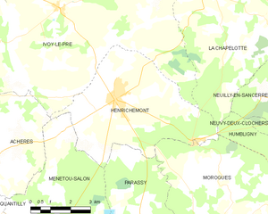
canton of Henrichemont (canton d'Henrichemont)
- canton in the French region of Centre-Val de Loire
- Country:

- Capital: Henrichemont
- Coordinates: 47° 18' 13" N, 2° 31' 30" E


- GPS tracks (wikiloc): [Link]
- Wikipedia en: wiki(en)
- Wikipedia: wiki(fr)
- Wikidata storage: Wikidata: Q1657694
- Freebase ID: [/m/05szqvl]
- INSEE canton code: [1815]
Includes regions:


Achères
- commune in Cher, France
- Country:
- Postal Code: 18250
- Coordinates: 47° 16' 42" N, 2° 26' 55" E
- GPS tracks (wikiloc): [Link]
- Area: 12.75 sq km
- Population: 378

Henrichemont
- commune in Cher, France
- Country:
- Postal Code: 18250
- Coordinates: 47° 18' 11" N, 2° 31' 28" E
- GPS tracks (wikiloc): [Link]
- Area: 25.27 sq km
- Population: 1795
La Chapelotte
- commune in Cher, France
- Country:
- Postal Code: 18250
- Coordinates: 47° 21' 9" N, 2° 35' 26" E
- GPS tracks (wikiloc): [Link]
- Area: 28.5 sq km
- Population: 159
Montigny
- commune in Cher, France
- Country:
- Postal Code: 18250
- Coordinates: 47° 14' 22" N, 2° 40' 52" E
- GPS tracks (wikiloc): [Link]
- AboveSeaLevel: 222 м m
- Area: 28.65 sq km
- Population: 381
Humbligny
- commune in Cher, France
- Country:
- Postal Code: 18250
- Coordinates: 47° 15' 14" N, 2° 39' 42" E
- GPS tracks (wikiloc): [Link]
- Area: 20.86 sq km
- Population: 193
Neuilly-en-Sancerre
- commune in Cher, France
- Country:
- Postal Code: 18250
- Coordinates: 47° 18' 10" N, 2° 41' 13" E
- GPS tracks (wikiloc): [Link]
- Area: 26.05 sq km
- Population: 249


Neuvy-Deux-Clochers
- commune in Cher, France
- Country:
- Postal Code: 18250
- Coordinates: 47° 16' 42" N, 2° 41' 57" E
- GPS tracks (wikiloc): [Link]
- Area: 16.5 sq km
- Population: 297
- Web site: [Link]