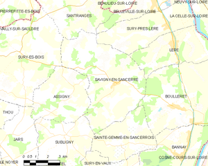
canton of Léré (canton de Léré)
- canton of France
- Country:

- Capital: Léré
- Coordinates: 47° 28' 15" N, 2° 52' 26" E


- GPS tracks (wikiloc): [Link]
- Wikipedia en: wiki(en)
- Wikipedia: wiki(fr)
- Wikidata storage: Wikidata: Q1657666
- Freebase ID: [/m/05s_2tv]
- INSEE canton code: [1816]
Includes regions:


Léré
- commune in Cher, France
- Country:
- Postal Code: 18240
- Coordinates: 47° 28' 12" N, 2° 52' 23" E
- GPS tracks (wikiloc): [Link]
- Area: 15.98 sq km
- Population: 1129
- Web site: [Link]


Belleville-sur-Loire
- commune in Cher, France
- Country:
- Postal Code: 18240
- Coordinates: 47° 30' 22" N, 2° 51' 2" E
- GPS tracks (wikiloc): [Link]
- Area: 11.01 sq km
- Population: 1054
- Web site: [Link]


Boulleret
- commune in Cher, France
- Country:
- Postal Code: 18240
- Coordinates: 47° 25' 27" N, 2° 52' 21" E
- GPS tracks (wikiloc): [Link]
- Area: 32.71 sq km
- Population: 1382


Santranges
- commune in Cher, France
- Country:
- Postal Code: 18240
- Coordinates: 47° 29' 55" N, 2° 46' 19" E
- GPS tracks (wikiloc): [Link]
- Area: 24.31 sq km
- Population: 414


Sainte-Gemme-en-Sancerrois
- commune in Cher, France
- Country:
- Postal Code: 18240
- Coordinates: 47° 23' 38" N, 2° 48' 59" E
- GPS tracks (wikiloc): [Link]
- AboveSeaLevel: 270 м m
- Area: 14.84 sq km
- Population: 430

Savigny-en-Sancerre
- commune in Cher, France
- Country:
- Postal Code: 18240
- Coordinates: 47° 26' 28" N, 2° 48' 33" E
- GPS tracks (wikiloc): [Link]
- Area: 33.31 sq km
- Population: 1002
- Web site: [Link]


Sury-près-Léré
- commune in Cher, France
- Country:
- Postal Code: 18240
- Coordinates: 47° 28' 59" N, 2° 52' 1" E
- GPS tracks (wikiloc): [Link]
- Area: 17.78 sq km
- Population: 685