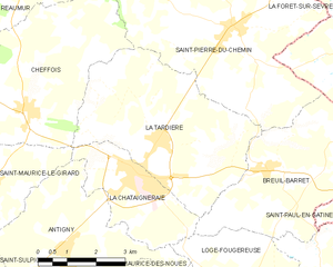
canton of La Châtaigneraie (canton de La Châtaigneraie)

- canton of France
- Country:

- Capital: La Châtaigneraie
- Coordinates: 46° 38' 11" N, 0° 45' 36" E


- GPS tracks (wikiloc): [Link]
- Area: 666.25 sq km
- Population: 31127
- Wikipedia en: wiki(en)
- Wikipedia: wiki(fr)
- Wikidata storage: Wikidata: Q1725594
- Library of Congress authority ID: Alt: [n89631401]
- INSEE canton code: [8504]
Includes regions:


Bazoges-en-Pareds
- commune in Vendée, France
- Country:
- Postal Code: 85390
- Coordinates: 46° 39' 25" N, 0° 55' 0" E
- GPS tracks (wikiloc): [Link]
- Area: 33.83 sq km
- Population: 1175
- Web site: [Link]


Cheffois
- commune in Vendée, France
- Country:
- Postal Code: 85390
- Coordinates: 46° 40' 7" N, 0° 47' 29" E
- GPS tracks (wikiloc): [Link]
- Area: 18.63 sq km
- Population: 987

La Chapelle-aux-Lys
- commune in Vendée, France
- Country:
- Postal Code: 85120
- Coordinates: 46° 37' 44" N, 0° 39' 28" E
- GPS tracks (wikiloc): [Link]
- Area: 10.56 sq km
- Population: 251


Breuil-Barret
- commune in Vendée, France
- Country:
- Postal Code: 85120
- Coordinates: 46° 39' 10" N, 0° 40' 56" E
- GPS tracks (wikiloc): [Link]
- Area: 14.74 sq km
- Population: 653
- Web site: [Link]


Saint-Maurice-des-Noues
- commune in Vendée, France
- Country:
- Postal Code: 85120
- Coordinates: 46° 36' 8" N, 0° 43' 21" E
- GPS tracks (wikiloc): [Link]
- Area: 21.42 sq km
- Population: 659


Mouilleron-en-Pareds
- former commune in Vendée, France
- Country:
- Postal Code: 85390
- Coordinates: 46° 40' 33" N, 0° 50' 58" E
- GPS tracks (wikiloc): [Link]
- Area: 19.97 sq km
- Population: 1370


Saint-Maurice-le-Girard
- commune in Vendée, France
- Country:
- Postal Code: 85390
- Coordinates: 46° 38' 36" N, 0° 48' 20" E
- GPS tracks (wikiloc): [Link]
- Area: 11.42 sq km
- Population: 594


Menomblet
- commune in Vendée, France
- Country:
- Postal Code: 85700
- Coordinates: 46° 43' 54" N, 0° 42' 43" E
- GPS tracks (wikiloc): [Link]
- Area: 20.95 sq km
- Population: 646
- Web site: [Link]
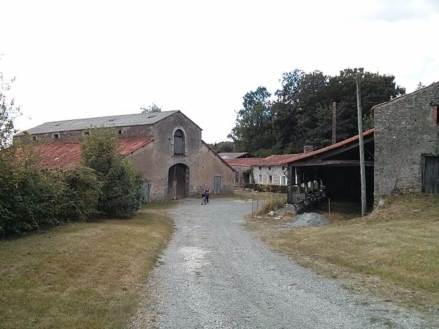
La Tardière
- commune in Vendée, France
- Country:
- Postal Code: 85120
- Coordinates: 46° 39' 38" N, 0° 44' 0" E
- GPS tracks (wikiloc): [Link]
- Area: 20.48 sq km
- Population: 1307


Thouarsais-Bouildroux
- commune in Vendée, France
- Country:
- Postal Code: 85410
- Coordinates: 46° 37' 9" N, 0° 52' 49" E
- GPS tracks (wikiloc): [Link]
- Area: 17.37 sq km
- Population: 757
- Web site: [Link]


Saint-Pierre-du-Chemin
- commune in Vendée, France
- Country:
- Postal Code: 85120
- Coordinates: 46° 41' 43" N, 0° 42' 3" E
- GPS tracks (wikiloc): [Link]
- Area: 29.65 sq km
- Population: 1343
- Web site: [Link]


Saint-Sulpice-en-Pareds
- commune in Vendée, France
- Country:
- Postal Code: 85410
- Coordinates: 46° 36' 6" N, 0° 50' 8" E
- GPS tracks (wikiloc): [Link]
- Area: 13.33 sq km
- Population: 422


Loge-Fougereuse
- commune in Vendée, France
- Country:
- Postal Code: 85120
- Coordinates: 46° 36' 47" N, 0° 41' 28" E
- GPS tracks (wikiloc): [Link]
- Area: 10.37 sq km
- Population: 379


Saint-Germain-l'Aiguiller
- former commune in Vendée, France
- Country:
- Postal Code: 85390
- Coordinates: 46° 41' 15" N, 0° 50' 30" E
- GPS tracks (wikiloc): [Link]
- Area: 8.43 sq km
- Population: 465


Saint-Hilaire-de-Voust
- commune in Vendée, France
- Country:
- Postal Code: 85120
- Coordinates: 46° 35' 28" N, 0° 39' 0" E
- GPS tracks (wikiloc): [Link]
- Area: 18.86 sq km
- Population: 633
- Web site: [Link]


Cezais
- commune in Vendée, France
- Country:
- Postal Code: 85410
- Coordinates: 46° 35' 22" N, 0° 49' 7" E
- GPS tracks (wikiloc): [Link]
- AboveSeaLevel: 67 м m
- Area: 12.22 sq km
- Population: 301


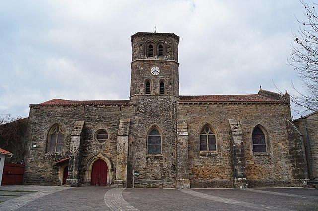
La Châtaigneraie
- commune in Vendée, France
- Country:
- Postal Code: 85120
- Coordinates: 46° 38' 58" N, 0° 44' 25" E
- GPS tracks (wikiloc): [Link]
- Area: 7.94 sq km
- Population: 2536
- Web site: [Link]


Antigny
- commune in Vendée, France
- Country:
- Postal Code: 85120
- Coordinates: 46° 37' 12" N, 0° 46' 10" E
- GPS tracks (wikiloc): [Link]
- Area: 22.17 sq km
- Population: 1057


Vouvant
- commune in Vendée, France
- Country:
- Postal Code: 85120
- Coordinates: 46° 34' 19" N, 0° 46' 9" E
- GPS tracks (wikiloc): [Link]
- Area: 20.2 sq km
- Population: 860
- Web site: [Link]


Marillet
- commune in Vendée, France
- Country:
- Postal Code: 85240
- Coordinates: 46° 34' 0" N, 0° 38' 9" E
- GPS tracks (wikiloc): [Link]
- Area: 4.25 sq km
- Population: 111