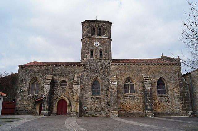
Saint-Pierre-du-Chemin (Saint-Pierre-du-Chemin)

- commune in Vendée, France
- Country:

- Postal Code: 85120
- Coordinates: 46° 41' 43" N, 0° 42' 3" E


- GPS tracks (wikiloc): [Link]
- Area: 29.65 sq km
- Population: 1343
- Web site: http://www.saintpierreduchemin.fr/
- Wikipedia en: wiki(en)
- Wikipedia: wiki(fr)
- Wikidata storage: Wikidata: Q1415047
- Wikipedia Commons Category: [Link]
- Freebase ID: [/m/0clsdp]
- GeoNames ID: Alt: [2977467]
- SIREN number: [218502649]
- BnF ID: [152783848]
- Library of Congress authority ID: Alt: [no2006134134]
- INSEE municipality code: 85264
Shares border with regions:


Cheffois
- commune in Vendée, France
- Country:
- Postal Code: 85390
- Coordinates: 46° 40' 7" N, 0° 47' 29" E
- GPS tracks (wikiloc): [Link]
- Area: 18.63 sq km
- Population: 987


Breuil-Barret
- commune in Vendée, France
- Country:
- Postal Code: 85120
- Coordinates: 46° 39' 10" N, 0° 40' 56" E
- GPS tracks (wikiloc): [Link]
- Area: 14.74 sq km
- Population: 653
- Web site: [Link]


Réaumur
- commune in Vendée, France
- Country:
- Postal Code: 85700
- Coordinates: 46° 43' 10" N, 0° 48' 6" E
- GPS tracks (wikiloc): [Link]
- Area: 22.09 sq km
- Population: 818
- Web site: [Link]


Menomblet
- commune in Vendée, France
- Country:
- Postal Code: 85700
- Coordinates: 46° 43' 54" N, 0° 42' 43" E
- GPS tracks (wikiloc): [Link]
- Area: 20.95 sq km
- Population: 646
- Web site: [Link]
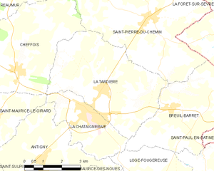
La Tardière
- commune in Vendée, France
- Country:
- Postal Code: 85120
- Coordinates: 46° 39' 38" N, 0° 44' 0" E
- GPS tracks (wikiloc): [Link]
- Area: 20.48 sq km
- Population: 1307

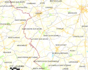
La Forêt-sur-Sèvre
- commune in Deux-Sèvres, France
- Country:
- Postal Code: 79380
- Coordinates: 46° 46' 12" N, 0° 38' 59" E
- GPS tracks (wikiloc): [Link]
- Area: 55.94 sq km
- Population: 2345
Moutiers-sous-Chantemerle
- commune in Deux-Sèvres, France
- Country:
- Postal Code: 79320
- Coordinates: 46° 41' 44" N, 0° 37' 6" E
- GPS tracks (wikiloc): [Link]
- Area: 25.64 sq km
- Population: 608