
La Flèche (La Flèche)

- commune in Sarthe, France
- Country:

- Postal Code: 72200
- Coordinates: 47° 41' 59" N, 0° 4' 34" E


- GPS tracks (wikiloc): [Link]
- Area: 74.21 sq km
- Population: 15185
- Web site: http://www.ville-lafleche.fr
- Wikipedia en: wiki(en)
- Wikipedia: wiki(fr)
- Wikidata storage: Wikidata: Q343
- Wikipedia Commons Category: [Link]
- Wikipedia Commons Maps Category: [Link]
- Freebase ID: [/m/07_j9q]
- GeoNames ID: Alt: [3009443]
- SIREN number: [217201540]
- BnF ID: [15273709d]
- VIAF ID: Alt: [268719567]
- GND ID: Alt: [4223664-2]
- archINFORM location ID: [5169]
- Library of Congress authority ID: Alt: [n82032279]
- MusicBrainz area ID: [f9bc63f5-0821-48eb-820d-cb1b83becfed]
- Quora topic ID: [La-Flèche]
- Encyclopædia Britannica Online ID: [place/La-Fleche]
- EMLO location ID: [bcecf69f-bda1-476d-9daa-074231aaefe7]
- Facebook Places ID: [104117049624676]
- National Library of Israel ID: [000991344]
- YouTube channel ID: [UCkD3Azso4sj3Ennt_OL5r6w]
- Brockhaus Enzyklopädie online ID: [la-fleche]
- BAV ID: [ADV11807452]
- INSEE municipality code: 72154
Shares border with regions:


Cré-sur-Loir
- former commune in Sarthe, France
- Country:
- Postal Code: 72200
- Coordinates: 47° 40' 37" N, 0° 9' 32" E
- GPS tracks (wikiloc): [Link]
- Area: 17.19 sq km
- Population: 801


Bazouges-sur-le-Loir
- former commune in Sarthe, France
- Country:
- Postal Code: 72200
- Coordinates: 47° 41' 25" N, 0° 10' 7" E
- GPS tracks (wikiloc): [Link]
- Area: 29.9 sq km
- Population: 1269
- Web site: [Link]

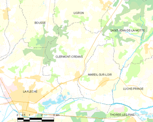
Clermont-Créans
- commune in Sarthe, France
- Country:
- Postal Code: 72200
- Coordinates: 47° 43' 5" N, 0° 0' 54" E
- GPS tracks (wikiloc): [Link]
- Area: 17.82 sq km
- Population: 1279
- Web site: [Link]

Thorée-les-Pins
- commune in Sarthe, France
- Country:
- Postal Code: 72800
- Coordinates: 47° 41' 12" N, 0° 2' 31" E
- GPS tracks (wikiloc): [Link]
- Area: 28.18 sq km
- Population: 719


Crosmières
- commune in Sarthe, France
- Country:
- Postal Code: 72200
- Coordinates: 47° 44' 45" N, 0° 9' 5" E
- GPS tracks (wikiloc): [Link]
- AboveSeaLevel: 61 м m
- Area: 20.45 sq km
- Population: 1045
- Web site: [Link]


Bousse, Sarthe
- commune in Sarthe, France
- Country:
- Postal Code: 72270
- Coordinates: 47° 46' 13" N, 0° 3' 32" E
- GPS tracks (wikiloc): [Link]
- Area: 12.02 sq km
- Population: 435


Mareil-sur-Loir
- commune in Sarthe, France
- Country:
- Postal Code: 72200
- Coordinates: 47° 42' 53" N, 0° 0' 39" E
- GPS tracks (wikiloc): [Link]
- Area: 11.83 sq km
- Population: 657


Villaines-sous-Malicorne
- commune in Sarthe, France
- Country:
- Postal Code: 72270
- Coordinates: 47° 45' 49" N, 0° 6' 2" E
- GPS tracks (wikiloc): [Link]
- Area: 19.16 sq km
- Population: 1031


Saint-Quentin-lès-Beaurepaire
- former commune in Maine-et-Loire, France
- Country:
- Postal Code: 49150
- Coordinates: 47° 37' 38" N, 0° 6' 28" E
- GPS tracks (wikiloc): [Link]
- AboveSeaLevel: 44 м m
- Area: 7.51 sq km
- Population: 289
- Web site: [Link]