canton of Aix-d'Angillon (canton des Aix-d'Angillon)
- canton of France (until March 2015)
- Country:

- Capital: Les Aix-d'Angillon
- Coordinates: 47° 11' 56" N, 2° 34' 21" E


- GPS tracks (wikiloc): [Link]
- Wikipedia en: wiki(en)
- Wikipedia: wiki(fr)
- Wikidata storage: Wikidata: Q1584776
- Freebase ID: [/m/05t0fz1]
- INSEE canton code: [1801]
Includes regions:


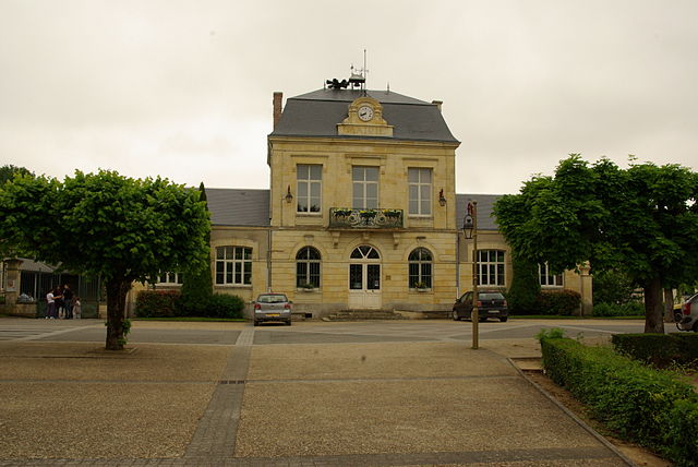
Les Aix-d'Angillon
- commune in Cher, France
- Country:
- Postal Code: 18220
- Coordinates: 47° 11' 54" N, 2° 34' 19" E
- GPS tracks (wikiloc): [Link]
- Area: 14.68 sq km
- Population: 1905
- Web site: [Link]
Aubinges
- commune in Cher, France
- Country:
- Postal Code: 18220
- Coordinates: 47° 13' 21" N, 2° 34' 56" E
- GPS tracks (wikiloc): [Link]
- Area: 10.97 sq km
- Population: 356


Sainte-Solange
- commune in Cher, France
- Country:
- Postal Code: 18220
- Coordinates: 47° 8' 11" N, 2° 33' 0" E
- GPS tracks (wikiloc): [Link]
- Area: 31.85 sq km
- Population: 1154
Soulangis
- commune in Cher, France
- Country:
- Postal Code: 18220
- Coordinates: 47° 11' 12" N, 2° 31' 3" E
- GPS tracks (wikiloc): [Link]
- Area: 13.76 sq km
- Population: 479
- Web site: [Link]


Morogues
- commune in Cher, France
- Country:
- Postal Code: 18220
- Coordinates: 47° 14' 28" N, 2° 35' 52" E
- GPS tracks (wikiloc): [Link]
- Area: 30.53 sq km
- Population: 432
- Web site: [Link]
Saint-Céols
- commune in Cher, France
- Country:
- Postal Code: 18220
- Coordinates: 47° 13' 19" N, 2° 37' 47" E
- GPS tracks (wikiloc): [Link]
- Area: 3.34 sq km
- Population: 15
Parassy
- commune in Cher, France
- Country:
- Postal Code: 18220
- Coordinates: 47° 13' 59" N, 2° 32' 51" E
- GPS tracks (wikiloc): [Link]
- Area: 26.02 sq km
- Population: 420


Saint-Michel-de-Volangis
- commune in Cher, France
- Country:
- Postal Code: 18390
- Coordinates: 47° 8' 52" N, 2° 29' 19" E
- GPS tracks (wikiloc): [Link]
- Area: 17.42 sq km
- Population: 477


Azy
- commune in Cher, France
- Country:
- Postal Code: 18220
- Coordinates: 47° 10' 59" N, 2° 42' 28" E
- GPS tracks (wikiloc): [Link]
- Area: 27.62 sq km
- Population: 458


Saint-Germain-du-Puy
- commune in Cher, France
- Country:
- Postal Code: 18390
- Coordinates: 47° 5' 57" N, 2° 28' 52" E
- GPS tracks (wikiloc): [Link]
- Area: 21.63 sq km
- Population: 5076

Brécy
- commune in Cher, France
- Country:
- Postal Code: 18220
- Coordinates: 47° 7' 27" N, 2° 37' 10" E
- GPS tracks (wikiloc): [Link]
- Area: 39.63 sq km
- Population: 952


Rians
- commune in Cher, France
- Country:
- Postal Code: 18220
- Coordinates: 47° 11' 7" N, 2° 36' 51" E
- GPS tracks (wikiloc): [Link]
- Area: 32.41 sq km
- Population: 985