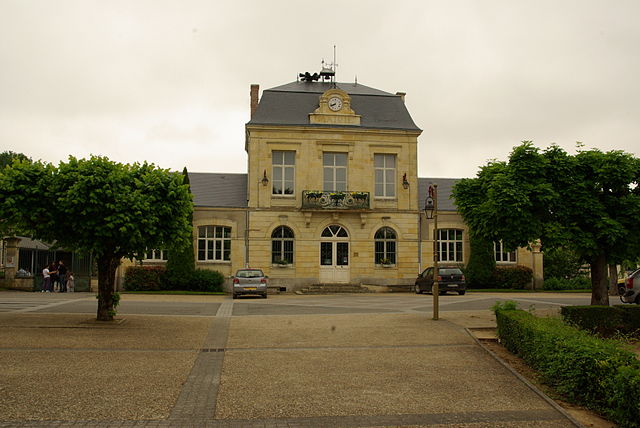
Rians (Rians)

- commune in Cher, France
- Country:

- Postal Code: 18220
- Coordinates: 47° 11' 7" N, 2° 36' 51" E


- GPS tracks (wikiloc): [Link]
- Area: 32.41 sq km
- Population: 985
- Wikipedia en: wiki(en)
- Wikipedia: wiki(fr)
- Wikidata storage: Wikidata: Q932403
- Wikipedia Commons Category: [Link]
- Freebase ID: [/m/03md2ny]
- GeoNames ID: Alt: [6428258]
- SIREN number: [211801949]
- BnF ID: [15249540t]
- INSEE municipality code: 18194
Shares border with regions:


Les Aix-d'Angillon
- commune in Cher, France
- Country:
- Postal Code: 18220
- Coordinates: 47° 11' 54" N, 2° 34' 19" E
- GPS tracks (wikiloc): [Link]
- Area: 14.68 sq km
- Population: 1905
- Web site: [Link]
Aubinges
- commune in Cher, France
- Country:
- Postal Code: 18220
- Coordinates: 47° 13' 21" N, 2° 34' 56" E
- GPS tracks (wikiloc): [Link]
- Area: 10.97 sq km
- Population: 356


Sainte-Solange
- commune in Cher, France
- Country:
- Postal Code: 18220
- Coordinates: 47° 8' 11" N, 2° 33' 0" E
- GPS tracks (wikiloc): [Link]
- Area: 31.85 sq km
- Population: 1154


Étréchy
- commune in Cher, France
- Country:
- Postal Code: 18800
- Coordinates: 47° 9' 44" N, 2° 43' 30" E
- GPS tracks (wikiloc): [Link]
- AboveSeaLevel: 205 м m
- Area: 31.88 sq km
- Population: 454
Montigny
- commune in Cher, France
- Country:
- Postal Code: 18250
- Coordinates: 47° 14' 22" N, 2° 40' 52" E
- GPS tracks (wikiloc): [Link]
- AboveSeaLevel: 222 м m
- Area: 28.65 sq km
- Population: 381
Saint-Céols
- commune in Cher, France
- Country:
- Postal Code: 18220
- Coordinates: 47° 13' 19" N, 2° 37' 47" E
- GPS tracks (wikiloc): [Link]
- Area: 3.34 sq km
- Population: 15


Azy
- commune in Cher, France
- Country:
- Postal Code: 18220
- Coordinates: 47° 10' 59" N, 2° 42' 28" E
- GPS tracks (wikiloc): [Link]
- Area: 27.62 sq km
- Population: 458

Brécy
- commune in Cher, France
- Country:
- Postal Code: 18220
- Coordinates: 47° 7' 27" N, 2° 37' 10" E
- GPS tracks (wikiloc): [Link]
- Area: 39.63 sq km
- Population: 952