canton of Lillers (canton de Lillers)
- canton of France
- Country:

- Capital: Lillers
- Coordinates: 50° 35' 50" N, 2° 32' 57" E


- GPS tracks (wikiloc): [Link]
- Population: 39415
- Wikipedia en: wiki(en)
- Wikipedia: wiki(fr)
- Wikidata storage: Wikidata: Q1725922
- Freebase ID: [/m/03c3nrv]
- INSEE canton code: [6231]
Includes regions:


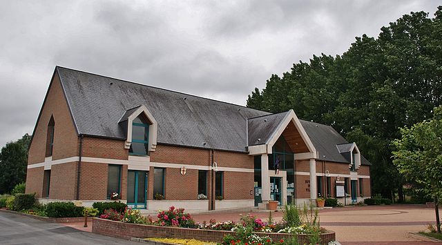
Lestrem
- commune in Pas-de-Calais, France
- Country:
- Postal Code: 62136
- Coordinates: 50° 37' 20" N, 2° 41' 6" E
- GPS tracks (wikiloc): [Link]
- Area: 21.15 sq km
- Population: 4441
- Web site: [Link]


Mont-Bernanchon
- commune in Pas-de-Calais, France
- Country:
- Postal Code: 62350
- Coordinates: 50° 34' 59" N, 2° 35' 22" E
- GPS tracks (wikiloc): [Link]
- Area: 11.4 sq km
- Population: 1363
- Web site: [Link]


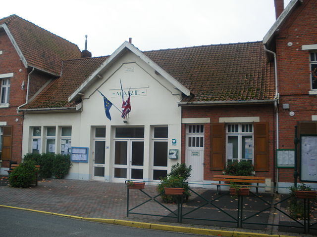
Saint-Venant
- commune in Pas-de-Calais, France
- Country:
- Postal Code: 62350
- Coordinates: 50° 37' 20" N, 2° 32' 40" E
- GPS tracks (wikiloc): [Link]
- Area: 14.24 sq km
- Population: 2978
- Web site: [Link]


Lillers
- commune in Pas-de-Calais, France
- Country:
- Postal Code: 62190
- Coordinates: 50° 33' 49" N, 2° 28' 55" E
- GPS tracks (wikiloc): [Link]
- Area: 26.9 sq km
- Population: 10196
- Web site: [Link]


Robecq
- commune in Pas-de-Calais, France
- Country:
- Postal Code: 62350
- Coordinates: 50° 35' 45" N, 2° 33' 48" E
- GPS tracks (wikiloc): [Link]
- Area: 10.56 sq km
- Population: 1359
- Web site: [Link]


Saint-Floris
- commune in Pas-de-Calais, France
- Country:
- Postal Code: 62350
- Coordinates: 50° 37' 38" N, 2° 34' 11" E
- GPS tracks (wikiloc): [Link]
- Area: 4.05 sq km
- Population: 560


Busnes
- commune in Pas-de-Calais, France
- Country:
- Postal Code: 62350
- Coordinates: 50° 35' 16" N, 2° 31' 6" E
- GPS tracks (wikiloc): [Link]
- Area: 9.55 sq km
- Population: 1289
- Web site: [Link]

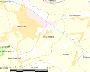
Guarbecque
- commune in Pas-de-Calais, France
- Country:
- Postal Code: 62330
- Coordinates: 50° 36' 39" N, 2° 29' 22" E
- GPS tracks (wikiloc): [Link]
- Area: 5.46 sq km
- Population: 1443
- Web site: [Link]

Gonnehem
- commune in Pas-de-Calais, France
- Country:
- Postal Code: 62920
- Coordinates: 50° 33' 42" N, 2° 34' 26" E
- GPS tracks (wikiloc): [Link]
- Area: 15.31 sq km
- Population: 2559

Calonne-sur-la-Lys
- commune in Pas-de-Calais, France
- Country:
- Postal Code: 62350
- Coordinates: 50° 37' 22" N, 2° 37' 0" E
- GPS tracks (wikiloc): [Link]
- Area: 11 sq km
- Population: 1585
- Web site: [Link]