canton of Montmélian (canton de Montmélian)
- canton of France
 Hiking in canton of Montmélian
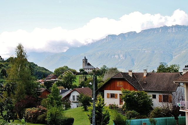
The Canton of Montmélian, located in the Savoie department of the Auvergne-Rhône-Alpes region in southeastern France, offers a variety of hiking opportunities for outdoor enthusiasts. The region is characterized by its beautiful landscapes, historical sites, and diverse terrain, making it an appealing destination for hikers of all levels.
Hiking Opportunities:
-
Scenic Trails: The canton features several trails that allow hikers to explore the stunning alpine scenery, including rolling hills, valleys, and mountain views. The trails vary in difficulty, catering to both beginners and experienced hikers.
-
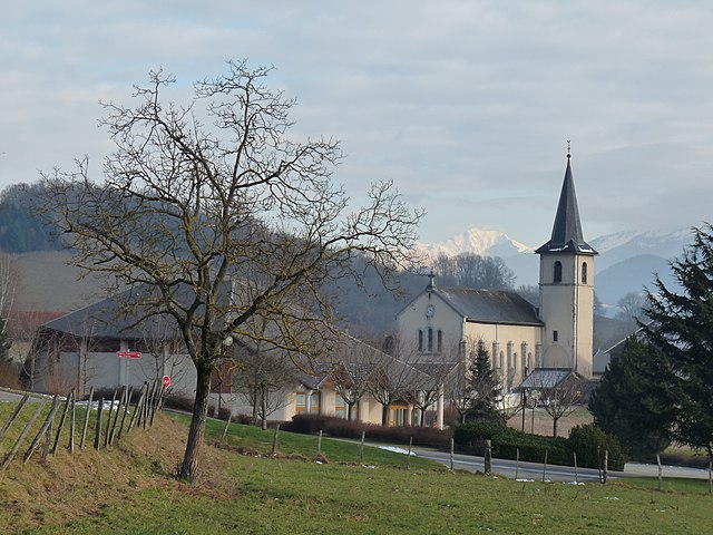
Historic Routes: Some hiking paths may take you past historical landmarks, such as ancient churches, ruins, and traditional Alpine villages, allowing you to experience the cultural heritage of the region as you hike.
-
Nature and Wildlife: While hiking, you may encounter diverse flora and fauna native to the Alpine ecosystem. Keep an eye out for local wildlife and enjoy the natural beauty of the high-altitude landscape.
-
Access to Nearby Mountains: The Canton of Montmélian is close to larger mountain ranges like the Chartreuse and Belledonne mountains, which offer additional hiking options and high-altitude experiences for those seeking more challenging trails.
Practical Tips:
-
Best Seasons: Spring and autumn are typically the best times for hiking, as the weather is often mild and the trails are less crowded. Summer can be warm, and winter may limit access to certain paths due to snow.
-
Trail Marking: Most trails are well-marked, but it’s always good to carry a map or a GPS device, especially in less familiar areas.
-
Equipment: Depending on the difficulty of the trail, ensure you have suitable hiking boots, sufficient water, snacks, and possibly trekking poles for steeper inclines.
-
Local Guidance: If you’re new to the area or looking for more information on trails, consider visiting local tourist information centers or hiring a guide.
Conclusion:
Hiking in the Canton of Montmélian can provide a wonderful escape into nature, allowing you to appreciate the breathtaking landscapes, rich culture, and warm hospitality of the region. Whether you’re looking for a leisurely walk or an adventurous hiking experience, Montmélian has something to offer for everyone. Remember to prepare accordingly and respect the natural environment while enjoying your outdoor adventures!
- Country:

- Capital: Montmélian
- Coordinates: 45° 29' 40" N, 6° 3' 3" E


- GPS tracks (wikiloc): [Link]
- Population: 24291
- Wikipedia en: wiki(en)
- Wikipedia: wiki(fr)
- Wikidata storage: Wikidata: Q1726351
- Freebase ID: [/m/02pmnfq]
- INSEE canton code: [7311]
Includes regions:


Montmélian
- commune in Savoie, France
Montmélian, located in the Savoie region of France, is an excellent destination for hiking enthusiasts. Nestled at the foot of the Alps, it offers a variety of trails that cater to all skill levels, from beginners to experienced hikers. Here are some highlights and tips for hiking in Montmélian:...
- Country:

- Postal Code: 73800
- Coordinates: 45° 30' 10" N, 6° 3' 13" E


- GPS tracks (wikiloc): [Link]
- Area: 5.69 sq km
- Population: 4112


Myans
- commune in Savoie, France
It seems you may be referring to Myanmar, formerly known as Burma. Hiking in Myanmar offers a range of experiences, from lush forests and mountainous terrain to cultural trails that lead through villages and ancient ruins. Here are some notable hiking destinations and considerations for hiking in Myanmar:...
- Country:

- Postal Code: 73800
- Coordinates: 45° 30' 53" N, 5° 59' 10" E


- GPS tracks (wikiloc): [Link]
- Area: 3.58 sq km
- Population: 1200
- Web site: [Link]
Villaroux
- commune in Savoie, France
Villaroux is a beautiful area for hiking, situated in the French Alps. It's known for its breathtaking landscapes, diverse flora and fauna, and a variety of trails that cater to different skill levels. Here are some details you might find useful if you're considering hiking in Villaroux:...
- Country:

- Postal Code: 73110
- Coordinates: 45° 27' 29" N, 6° 4' 30" E


- GPS tracks (wikiloc): [Link]
- Area: 3.09 sq km
- Population: 216
Villard-d'Héry
- commune in Savoie, France
Villard-d'Héry is a charming village located in the Savoie region of the French Alps. It's an excellent starting point for various hiking adventures, with picturesque landscapes, alpine meadows, and mountainous terrain. Here are some highlights and tips for hiking in the area:...
- Country:

- Postal Code: 73800
- Coordinates: 45° 30' 52" N, 6° 8' 16" E


- GPS tracks (wikiloc): [Link]
- Area: 4.9 sq km
- Population: 264


Les Mollettes
- commune in Savoie, France
Les Mollettes is a beautiful hiking destination located in the French Alps, specifically in the Savoie region. The area is known for its stunning natural landscapes, diverse wildlife, and a variety of hiking trails suitable for all levels of experience....
- Country:

- Postal Code: 73800
- Coordinates: 45° 27' 39" N, 6° 3' 15" E


- GPS tracks (wikiloc): [Link]
- Area: 5.47 sq km
- Population: 798
- Web site: [Link]


Arbin
- commune in Savoie, France
Arbin, located in the Savoie region of the French Alps, offers some beautiful hiking opportunities that cater to various skill levels. Nestled near the city of Albertville and not far from the iconic Mont Blanc, Arbin is surrounded by stunning mountain landscapes, vineyards, and rich natural heritage....
- Country:

- Postal Code: 73800
- Coordinates: 45° 30' 30" N, 6° 4' 1" E


- GPS tracks (wikiloc): [Link]
- Area: 1.71 sq km
- Population: 797


Chignin
- commune in Savoie, France
Chignin is a charming village located in the Savoie region of France, nestled in the foothills of the French Alps. This area is known for its stunning natural landscapes, picturesque vineyards, and opportunities for outdoor activities, including hiking....
- Country:

- Postal Code: 73800
- Coordinates: 45° 31' 27" N, 6° 0' 45" E


- GPS tracks (wikiloc): [Link]
- Area: 8.32 sq km
- Population: 871
- Web site: [Link]


Planaise
- commune in Savoie, France
Planaise, located in the French Alps, is a fantastic destination for hiking enthusiasts. The area is known for its stunning landscapes, ranging from alpine meadows to rugged mountain terrain. Here’s what you should know about hiking in Planaise:...
- Country:

- Postal Code: 73800
- Coordinates: 45° 30' 12" N, 6° 5' 26" E


- GPS tracks (wikiloc): [Link]
- Area: 4.16 sq km
- Population: 520
- Web site: [Link]


Francin
- commune in Savoie, France
Hiking in Francin, which is located in the Auvergne-Rhône-Alpes region of France, offers stunning natural beauty and a variety of trails suitable for different skill levels. The region is characterized by its picturesque landscapes, rolling hills, and diverse flora and fauna....
- Country:

- Postal Code: 73800
- Coordinates: 45° 30' 0" N, 6° 2' 4" E


- GPS tracks (wikiloc): [Link]
- Area: 6.93 sq km
- Population: 925
- Web site: [Link]


Sainte-Hélène-du-Lac
- commune in Savoie, France
 Hiking in Sainte-Hélène-du-Lac
Sainte-Hélène-du-Lac is a picturesque commune in the Savoie region of France, nestled in the French Alps. It's a great destination for hikers because of its stunning landscapes, diverse trails, and proximity to the Maurienne Valley and the Chartreuse Mountains....
- Country:

- Postal Code: 73800
- Coordinates: 45° 28' 56" N, 6° 3' 57" E


- GPS tracks (wikiloc): [Link]
- Area: 7.09 sq km
- Population: 767
- Web site: [Link]


Apremont
- commune in Savoie, France
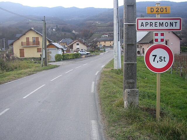
Apremont is a picturesque village located in the Savoie region of France, surrounded by the stunning Alpine landscape. It's a fantastic destination for hiking enthusiasts, offering a range of trails that cater to different skill levels and preferences....
- Country:

- Postal Code: 73190
- Coordinates: 45° 30' 40" N, 5° 57' 30" E


- GPS tracks (wikiloc): [Link]
- Area: 17.76 sq km
- Population: 1017
- Web site: [Link]


Saint-Pierre-de-Soucy
- commune in Savoie, France
 Hiking in Saint-Pierre-de-Soucy
Saint-Pierre-de-Soucy is a charming municipality in Quebec, Canada, known for its beautiful natural landscapes and outdoor recreational opportunities. Here are some highlights related to hiking in this area:...
- Country:

- Postal Code: 73800
- Coordinates: 45° 29' 39" N, 6° 6' 22" E


- GPS tracks (wikiloc): [Link]
- Area: 9.09 sq km
- Population: 434


Laissaud
- commune in Savoie, France
Laissaud is a beautiful area located in the French Alps, known for its stunning scenery and diverse hiking opportunities. The region offers a variety of trails suitable for different skill levels, from gentle walks to more challenging treks. Here's some information to help you plan your hiking experience in Laissaud:...
- Country:

- Postal Code: 73800
- Coordinates: 45° 26' 49" N, 6° 2' 13" E


- GPS tracks (wikiloc): [Link]
- Area: 6.57 sq km
- Population: 660
Les Marches
- commune in Savoie, France
Les Marches is a beautiful region located in the French Alps, known for its stunning landscapes and diverse hiking trails. It's a great destination for both beginners and experienced hikers alike, offering a variety of terrains and breathtaking views....
- Country:

- Postal Code: 73800
- Coordinates: 45° 29' 57" N, 6° 0' 3" E


- GPS tracks (wikiloc): [Link]
- Area: 15.35 sq km
- Population: 2559
- Web site: [Link]


La Chavanne
- commune in Savoie, France
La Chavanne is a picturesque area located in the French Alps, known for its stunning landscapes and hiking trails. While specific trails may vary by season and accessibility, here are some general points to consider when hiking in La Chavanne:...
- Country:

- Postal Code: 73800
- Coordinates: 45° 29' 42" N, 6° 4' 30" E


- GPS tracks (wikiloc): [Link]
- Area: 3.06 sq km
- Population: 637
- Web site: [Link]
