arrondissement of Chambéry (arrondissement de Chambéry)
- arrondissement of France
 Hiking in arrondissement of Chambéry
The Arrondissement of Chambéry, located in the Savoie department in the Auvergne-Rhône-Alpes region of southeastern France, is a fantastic area for hiking enthusiasts. Nestled in the French Alps, this region is characterized by stunning natural landscapes, including mountains, lakes, and lush valleys. Here are some highlights for hikers:
Popular Hiking Areas
-
Massif de la Chartreuse:
- This mountain range offers a range of hiking trails suitable for various skill levels. The views are breathtaking, with steep cliffs and dense forests. Notable hikes include the trail to the Col de la Charmette.
-
Belledonne Range:
- Located to the southeast of Chambéry, the Belledonne mountains provide more challenging hikes with alpine scenery. The hike to the refuge de la Pra is a favorite for those looking to experience high-altitude terrain.
-
Lake Bourget:
- The largest natural lake in France, offering easier hikes along its shores. The path around the lake provides lovely views and a more leisurely hiking experience, ideal for families.
-
Chambéry Town and Surroundings:
- Depending on your preference, you can also explore urban hikes in and around Chambéry itself. The Parc de Buisson Rond and the Mont Saint-Michel offer scenic views and are easily accessible.
Hiking Recommendations
-
Experience Level: Trails vary from easy lakeside walks to challenging mountain ascents. Beginners can enjoy more gentle paths around Lake Bourget or the valleys, while experienced hikers can tackle the peaks in the Belledonne or Chartreuse ranges.
-
Season: The best times to hike are typically from late spring to early autumn (May to September) when the weather is milder and the trails are more accessible. However, for those interested in winter sports, snowshoeing and skiing are popular in the winter months.
-
Preparation: Always check the weather forecast, bring sufficient water, snacks, a map (or GPS), and appropriate clothing for varying conditions. Many areas may lack cell service, so being prepared is crucial.
-
Local Regulations: Pay attention to local wildlife and environmental guidelines. The region is home to diverse flora and fauna, so be respectful of the natural habitat.
Hiking Resources
-
Tourist Offices: The Chambéry Tourist Office provides maps, brochures, and recommendations for local trails and guided hikes.
-
Guided Tours: For those less familiar with the area or looking for a unique experience, consider joining guided hiking tours that highlight local culture, wildlife, and history.
Overall, the Arrondissement of Chambéry offers a rich tapestry of hiking opportunities for all levels, making it a must-visit destination for outdoor enthusiasts. Enjoy your adventure!
- Country:

- Capital: Chambéry
- Coordinates: 45° 40' 0" N, 5° 55' 0" E


- GPS tracks (wikiloc): [Link]
- Area: 1586 sq km
- Population: 273095
- Wikipedia en: wiki(en)
- Wikipedia: wiki(fr)
- Wikidata storage: Wikidata: Q700869
- Freebase ID: [/m/095j13]
- GeoNames ID: Alt: [3027421]
- INSEE arrondissement code: [732]
- GNS Unique Feature ID: -1417925
Includes regions:


canton of Saint-Alban-Leysse
- canton of France
 Hiking in canton of Saint-Alban-Leysse
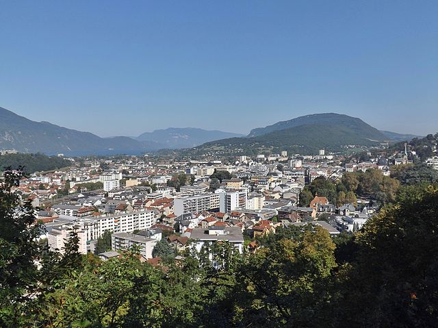
The Canton of Saint-Alban-Leysse, situated in the Savoie department of the Auvergne-Rhône-Alpes region in southeastern France, offers a picturesque setting for hiking enthusiasts. The region is framed by the beautiful mountains and lush landscapes of the French Alps, making it a destination that attracts both casual walkers and serious hikers....
- Country:

- Capital: Saint-Alban-Leysse
- Coordinates: 45° 35' 8" N, 5° 59' 21" E


- GPS tracks (wikiloc): [Link]
- Population: 22918
canton of Aix-les-Bains-Centre
- canton of France (until March 2015)
 Hiking in canton of Aix-les-Bains-Centre
Canton d'Aix-les-Bains-Centre, located in the Savoie department in the Auvergne-Rhône-Alpes region of France, is a beautiful area that offers a variety of hiking opportunities. Known for its stunning landscapes, mountainous terrain, and proximity to Lake Bourget, the largest natural lake in France, this region provides hikers with scenic trails that vary in difficulty....
- Country:

- Capital: Aix-les-Bains
- Coordinates: 45° 42' 0" N, 5° 55' 0" E


- GPS tracks (wikiloc): [Link]


canton of Chambéry-Sud-Ouest
- canton of France (until March 2015)
 Hiking in canton of Chambéry-Sud-Ouest
Canton de Chambéry-Sud-Ouest, located in the Savoie department of the Auvergne-Rhône-Alpes region in southeastern France, offers a variety of hiking opportunities that showcase the stunning natural beauty of the French Alps. Here are some highlights and tips for hiking in this area:...

canton of Aix-les-Bains-Sud
- canton of France
 Hiking in canton of Aix-les-Bains-Sud
Canton d'Aix-les-Bains-Sud, located in the Savoie region of France, offers a beautiful landscape for hiking enthusiasts. Nestled between the Savoie mountains and the stunning Lac du Bourget, the area is known for its diverse trails, ranging from easy walks to more challenging hikes....
- Country:

- Capital: Drumettaz-Clarafond
- Coordinates: 45° 39' 44" N, 5° 55' 7" E


- GPS tracks (wikiloc): [Link]

canton of Aix-les-Bains-Nord-Grésy
- canton of France
 Hiking in canton of Aix-les-Bains-Nord-Grésy
Canton d'Aix-les-Bains-Nord-Grésy, located in the Savoie department in the Auvergne-Rhône-Alpes region of France, is known for its beautiful landscapes and outdoor activities, making it an excellent destination for hiking enthusiasts. Here are some highlights to consider when hiking in this region:...
- Country:

- Capital: Grésy-sur-Aix
- Coordinates: 45° 43' 13" N, 5° 57' 7" E


- GPS tracks (wikiloc): [Link]

canton of Albens
- canton of France
Canton d'Albens, located in the Haute-Savoie region of France, offers a variety of hiking opportunities for outdoor enthusiasts. Nestled in the beautiful landscapes of the French Alps, this area is known for its stunning views, diverse terrain, and rich natural flora and fauna. Here are some details about hiking in this region:...

canton of Chambéry-Est
- canton of France
 Hiking in canton of Chambéry-Est
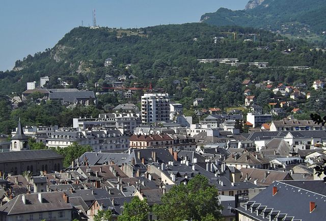
Canton de Chambéry-Est, located in the Savoie region of France, offers a rich variety of hiking opportunities. Nestled in the foothills of the Alps, this area is characterized by stunning landscapes, rolling hills, lush forests, and picturesque lakes, making it an excellent destination for hikers of all skill levels....


canton of Chambéry-Sud
- canton of France
 Hiking in canton of Chambéry-Sud
Hiking in the Canton of Chambéry-Sud, located in the Savoie region of France, offers an incredible blend of scenic beauty, challenging trails, and rich cultural experiences. Here are some highlights and tips for hiking in this area:...

canton of Chamoux-sur-Gelon
- canton of France
 Hiking in canton of Chamoux-sur-Gelon
Canton de Chamoux-sur-Gelon, located in the Savoie region of the French Alps, offers a variety of stunning hiking opportunities for outdoor enthusiasts. The area is characterized by its beautiful landscapes, including rolling hills, dense forests, and impressive mountain views....
- Country:

- Capital: Chamoux-sur-Gelon
- Coordinates: 45° 31' 57" N, 6° 11' 38" E


- GPS tracks (wikiloc): [Link]

canton of Cognin
- canton of France
Canton de Cognin, located in the Savoie department of the Auvergne-Rhône-Alpes region in southeastern France, offers a variety of hiking opportunities that cater to different skill levels and preferences. Here are some key highlights and tips for hiking in the area:...

canton of La Motte-Servolex
- canton of France
 Hiking in canton of La Motte-Servolex
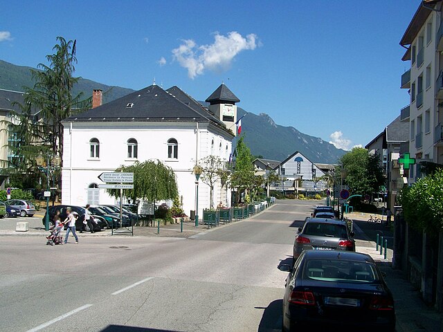
The Canton of La Motte-Servolex, located in the Savoie region of France, is a beautiful area for hiking enthusiasts. Nestled near the French Alps and close to the larger city of Chambéry, it offers a variety of hiking trails that cater to different skill levels—ranging from easy walks to more challenging treks....
- Country:

- Capital: La Motte-Servolex
- Coordinates: 45° 39' 30" N, 5° 51' 43" E


- GPS tracks (wikiloc): [Link]
- Population: 25400

canton of La Ravoire
- canton of France
 Hiking in canton of La Ravoire
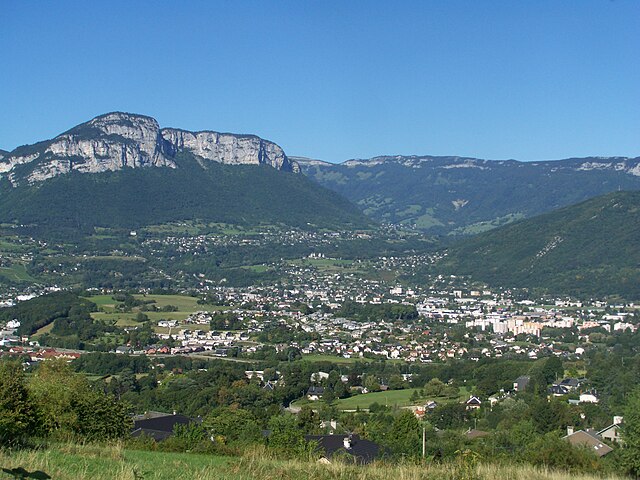
The Canton of La Ravoire is a beautiful region in the Savoie department of southeastern France, known for its stunning landscapes and access to the French Alps. While La Ravoire itself is primarily a suburban area near the city of Chambéry, it serves as a great base for exploring the surrounding natural beauty....
- Country:

- Capital: La Ravoire
- Coordinates: 45° 32' 51" N, 5° 58' 5" E


- GPS tracks (wikiloc): [Link]
- Population: 22388

canton of Échelles
- canton of France
Canton des Échelles, located in the Auvergne-Rhône-Alpes region of France, offers some fantastic hiking opportunities amid stunning landscapes, including mountains, forests, and rivers. Here are some highlights and tips for hiking in this area:...
- Country:

- Capital: Les Échelles
- Coordinates: 45° 27' 45" N, 5° 48' 2" E


- GPS tracks (wikiloc): [Link]


canton of Montmélian
- canton of France
 Hiking in canton of Montmélian
The Canton of Montmélian, located in the Savoie department of the Auvergne-Rhône-Alpes region in southeastern France, offers a variety of hiking opportunities for outdoor enthusiasts. The region is characterized by its beautiful landscapes, historical sites, and diverse terrain, making it an appealing destination for hikers of all levels....
- Country:

- Capital: Montmélian
- Coordinates: 45° 29' 40" N, 6° 3' 3" E


- GPS tracks (wikiloc): [Link]
- Population: 24291

canton of Ruffieux
- canton of France
Canton de Ruffieux, located in the Savoie department of the Auvergne-Rhône-Alpes region in France, offers a variety of hiking opportunities that cater to different skill levels and preferences. The picturesque landscape features rolling hills, lush forests, and stunning views of the surrounding mountains, including the Bauges and Chartreuse ranges....


canton of Saint-Pierre-d'Albigny
- canton of France
 Hiking in canton of Saint-Pierre-d'Albigny
The Canton of Saint-Pierre-d'Albigny, located in the Savoie department of the Auvergne-Rhône-Alpes region in southeastern France, offers a variety of hiking opportunities for enthusiasts of all skill levels. Here are some key points to consider if you're planning to hike in this beautiful area:...
- Country:

- Capital: Saint-Pierre-d'Albigny
- Coordinates: 45° 33' 12" N, 6° 7' 40" E


- GPS tracks (wikiloc): [Link]
- Population: 18722

canton of Yenne
- canton in Savoie, France
Canton d'Yenne, located in the Savoie region of the Auvergne-Rhône-Alpes in France, offers a beautiful and diverse landscape for hikers of various skill levels. The canton is characterized by its rolling hills, lush valleys, and stunning views of the surrounding mountains and Lake Bourget. Here are some key points to consider when hiking in Canton d'Yenne:...

canton of Saint-Genix-sur-Guiers
- canton of France
 Hiking in canton of Saint-Genix-sur-Guiers
Canton de Saint-Genix-sur-Guiers is a picturesque region located in the Savoie department of France, nestled in the heart of the Chartreuse and Bauges mountain ranges. This area offers a variety of hiking opportunities, showcasing beautiful natural scenery, diverse landscapes, and rich cultural heritage....
- Country:

- Capital: Saint-Genix-sur-Guiers
- Coordinates: 45° 36' 3" N, 5° 42' 36" E


- GPS tracks (wikiloc): [Link]
- Area: 80.0 sq km

canton of Le Châtelard
- canton of France (until March 2015)
 Hiking in canton of Le Châtelard
Canton du Châtelard is a beautiful region located in the Swiss Alps, offering a variety of hiking trails that cater to different skill levels. If you're considering a hiking adventure here, you'll be greeted by stunning landscapes, alpine meadows, and breathtaking views of the surrounding mountains....
- Country:

- Capital: Le Châtelard
- Coordinates: 45° 40' 31" N, 6° 7' 18" E


- GPS tracks (wikiloc): [Link]

canton of La Rochette
- canton of France (until March 2015)
 Hiking in canton of La Rochette
Canton de La Rochette, located in the Savoie department of the Auvergne-Rhône-Alpes region in southeastern France, offers a variety of scenic hiking opportunities. The area is characterized by its beautiful landscapes, including mountains, valleys, and forests, making it an excellent destination for outdoor enthusiasts....
- Country:

- Capital: La Rochette
- Coordinates: 45° 28' 9" N, 6° 8' 36" E


- GPS tracks (wikiloc): [Link]


canton of Le Pont-de-Beauvoisin
- canton of France
 Hiking in canton of Le Pont-de-Beauvoisin
The Canton of Le Pont-de-Beauvoisin is located in the Savoie region of France, nestled between the Belledonne and Chartreuse mountain ranges. This area offers a variety of hiking opportunities, showcasing stunning landscapes, rich biodiversity, and charming small villages....
- Country:

- Capital: Le Pont-de-Beauvoisin, Savoie
- Coordinates: 45° 32' 48" N, 5° 44' 42" E


- GPS tracks (wikiloc): [Link]
- Population: 20418

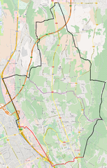
canton of Chambéry-Nord
- canton of France (until March 2015)
 Hiking in canton of Chambéry-Nord
Canton de Chambéry-Nord, located in the Savoie department of the Auvergne-Rhône-Alpes region in southeastern France, offers a variety of hiking opportunities that showcase the stunning natural beauty of the French Alps. Here are some highlights and tips for hiking in this area:...
