canton of Neuves-Maisons (canton de Neuves-Maisons)

- canton of France
- Country:

- Capital: Neuves-Maisons
- Coordinates: 48° 36' 34" N, 6° 6' 5" E


- GPS tracks (wikiloc): [Link]
- Population: 26712
- Wikipedia en: wiki(en)
- Wikipedia: wiki(fr)
- Wikidata storage: Wikidata: Q1400659
- Library of Congress authority ID: Alt: [n95030779]
- INSEE canton code: [5415]
Includes regions:
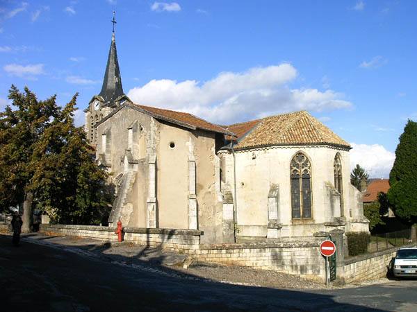

Pont-Saint-Vincent
- commune in Meurthe-et-Moselle, France
- Country:
- Postal Code: 54550
- Coordinates: 48° 36' 18" N, 6° 5' 50" E
- GPS tracks (wikiloc): [Link]
- AboveSeaLevel: 222 м m
- Area: 6.66 sq km
- Population: 1887

Chaligny
- commune in Meurthe-et-Moselle, France
- Country:
- Postal Code: 54230
- Coordinates: 48° 37' 28" N, 6° 4' 59" E
- GPS tracks (wikiloc): [Link]
- Area: 13.32 sq km
- Population: 2878


Chavigny
- commune in Meurthe-et-Moselle, France
- Country:
- Postal Code: 54230
- Coordinates: 48° 37' 45" N, 6° 7' 27" E
- GPS tracks (wikiloc): [Link]
- Area: 6.69 sq km
- Population: 1875
Méréville
- commune in Meurthe-et-Moselle, France
- Country:
- Postal Code: 54850
- Coordinates: 48° 35' 32" N, 6° 9' 9" E
- GPS tracks (wikiloc): [Link]
- Area: 8.43 sq km
- Population: 1372

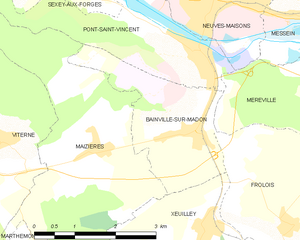
Bainville-sur-Madon
- commune in Meurthe-et-Moselle, France
- Country:
- Postal Code: 54550
- Coordinates: 48° 35' 14" N, 6° 5' 40" E
- GPS tracks (wikiloc): [Link]
- Area: 5.88 sq km
- Population: 1399

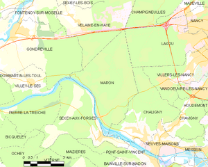
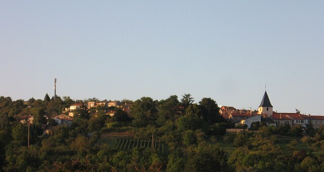
Maron
- commune in Meurthe-et-Moselle, France
- Country:
- Postal Code: 54230
- Coordinates: 48° 38' 5" N, 6° 2' 50" E
- GPS tracks (wikiloc): [Link]
- Area: 19.1 sq km
- Population: 847


Neuves-Maisons
- commune in Meurthe-et-Moselle, France
- Country:
- Postal Code: 54230
- Coordinates: 48° 36' 58" N, 6° 6' 13" E
- GPS tracks (wikiloc): [Link]
- Area: 4.44 sq km
- Population: 6912


Maizières
- commune in Meurthe-et-Moselle, France
- Country:
- Postal Code: 54550
- Coordinates: 48° 35' 3" N, 6° 3' 42" E
- GPS tracks (wikiloc): [Link]
- Area: 15.63 sq km
- Population: 1000


Messein
- commune in Meurthe-et-Moselle, France
- Country:
- Postal Code: 54850
- Coordinates: 48° 36' 42" N, 6° 8' 19" E
- GPS tracks (wikiloc): [Link]
- Area: 5.14 sq km
- Population: 1879