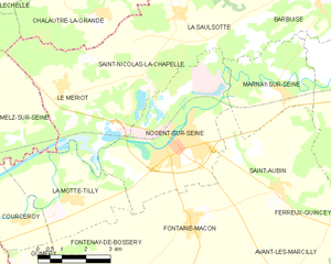
canton of Nogent-sur-Seine (canton de Nogent-sur-Seine)

- canton of France
- Country:

- Capital: Nogent-sur-Seine
- Coordinates: 48° 29' 39" N, 3° 30' 12" E


- GPS tracks (wikiloc): [Link]
- Area: 294.79 sq km
- Population: 16805
- Wikipedia en: wiki(en)
- Wikipedia: wiki(fr)
- Wikidata storage: Wikidata: Q1726524
- INSEE canton code: [1007]
Includes regions:

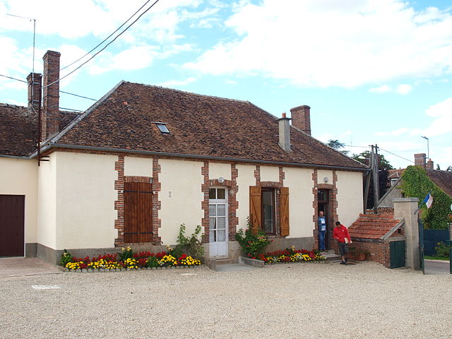
Courceroy
- commune in Aube, France
- Country:
- Postal Code: 10400
- Coordinates: 48° 27' 52" N, 3° 24' 50" E
- GPS tracks (wikiloc): [Link]
- Area: 6.69 sq km
- Population: 125


Saint-Nicolas-la-Chapelle
- commune in Aube, France
- Country:
- Postal Code: 10400
- Coordinates: 48° 31' 50" N, 3° 28' 2" E
- GPS tracks (wikiloc): [Link]
- Area: 11.54 sq km
- Population: 61


Marnay-sur-Seine
- commune in Aube, France
- Country:
- Postal Code: 10400
- Coordinates: 48° 30' 45" N, 3° 33' 31" E
- GPS tracks (wikiloc): [Link]
- Area: 10.1 sq km
- Population: 218


Ferreux-Quincey
- commune in Aube, France
- Country:
- Postal Code: 10400
- Coordinates: 48° 27' 2" N, 3° 36' 45" E
- GPS tracks (wikiloc): [Link]
- Area: 15.32 sq km
- Population: 365


Bouy-sur-Orvin
- commune in Aube, France
- Country:
- Postal Code: 10400
- Coordinates: 48° 24' 45" N, 3° 29' 54" E
- GPS tracks (wikiloc): [Link]
- Area: 6.7 sq km
- Population: 59


Gumery
- commune in Aube, France
- Country:
- Postal Code: 10400
- Coordinates: 48° 26' 54" N, 3° 25' 50" E
- GPS tracks (wikiloc): [Link]
- Area: 10.92 sq km
- Population: 256

La Louptière-Thénard
- commune in Aube, France
- Country:
- Postal Code: 10400
- Coordinates: 48° 23' 19" N, 3° 26' 9" E
- GPS tracks (wikiloc): [Link]
- Area: 13.68 sq km
- Population: 291


Soligny-les-Étangs
- commune in Aube, France
- Country:
- Postal Code: 10400
- Coordinates: 48° 24' 26" N, 3° 30' 36" E
- GPS tracks (wikiloc): [Link]
- Area: 15.94 sq km
- Population: 243

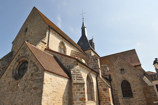
Nogent-sur-Seine
- commune in Aube, France
- Country:
- Postal Code: 10400
- Coordinates: 48° 29' 37" N, 3° 30' 9" E
- GPS tracks (wikiloc): [Link]
- Area: 20.08 sq km
- Population: 5965
- Web site: [Link]


Saint-Aubin
- commune in Aube, France
- Country:
- Postal Code: 10400
- Coordinates: 48° 28' 34" N, 3° 33' 31" E
- GPS tracks (wikiloc): [Link]
- Area: 17.76 sq km
- Population: 593


La Motte-Tilly
- commune in Aube, France
- Country:
- Postal Code: 10400
- Coordinates: 48° 28' 25" N, 3° 26' 13" E
- GPS tracks (wikiloc): [Link]
- Area: 11.59 sq km
- Population: 392


Fontaine-Mâcon
- commune in Aube, France
- Country:
- Postal Code: 10400
- Coordinates: 48° 27' 53" N, 3° 30' 32" E
- GPS tracks (wikiloc): [Link]
- Area: 16.01 sq km
- Population: 658


Fontenay-de-Bossery
- commune in Aube, France
- Country:
- Postal Code: 10400
- Coordinates: 48° 27' 12" N, 3° 27' 22" E
- GPS tracks (wikiloc): [Link]
- Area: 8.4 sq km
- Population: 74


Le Mériot
- commune in Aube, France
- Country:
- Postal Code: 10400
- Coordinates: 48° 30' 39" N, 3° 26' 10" E
- GPS tracks (wikiloc): [Link]
- AboveSeaLevel: 63 м m
- Area: 12.6 sq km
- Population: 601

Pont-sur-Seine
- commune in Aube, France
- Country:
- Postal Code: 10400
- Coordinates: 48° 31' 8" N, 3° 35' 41" E
- GPS tracks (wikiloc): [Link]
- Area: 16.15 sq km
- Population: 1147
- Web site: [Link]


Traînel
- commune in Aube, France
- Country:
- Postal Code: 10400
- Coordinates: 48° 24' 53" N, 3° 26' 27" E
- GPS tracks (wikiloc): [Link]
- Area: 19.99 sq km
- Population: 1089