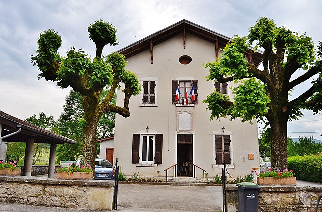
canton of Poncin (canton de Poncin)
- canton of France (until March 2015)
 Hiking in canton of Poncin
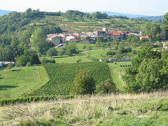
The Canton of Poncin, located in the Ain department of the Auvergne-Rhône-Alpes region in France, offers a range of beautiful hiking opportunities amidst picturesque landscapes. Here’s what you should know about hiking in this area:
Scenery and Trails
-
Diverse Landscape: The region features rolling hills, rivers, and lush forests, providing a scenic backdrop for hiking. You can expect to encounter a mix of open fields and wooded areas.
-
Trail Options: There are various marked trails ranging from easy to moderate difficulty levels. Some trails may lead you along the banks of the rivers or through charming villages, while others may take you higher into the hills for panoramic views.
-
Local Trails: Popular trails often include paths that connect to nearby natural sites and points of interest, such as the Rhône River or historical landmarks within the canton.
Hiking Tips
-
Maps and Guides: Before setting out, make sure to obtain a map or guide of the local hiking trails. Local tourist offices are good resources for trail information.
-
Weather Conditions: Check the weather before your hike, as conditions can change rapidly in mountainous or forested areas.
-
Proper Gear: Wear sturdy hiking boots and dress in layers to accommodate temperature changes. Bringing water and snacks is essential, especially on longer hikes.
-
Respect Nature: Stay on marked trails to protect the local flora and fauna, and always pack out what you pack in.
Accessibility
Depending on the specific route you choose, some trails may start close to parking areas or public transport access points, making them fairly accessible for day hikers.
Conclusion
Hiking in the Canton of Poncin offers an opportunity to immerse yourself in nature while enjoying the tranquillity and beauty of the French countryside. Whether you're a beginner or an experienced hiker, there is likely a trail that will suit your preferences and skill level. Always prepare adequately and enjoy your hiking adventure!
- Country:

- Capital: Poncin
- Coordinates: 46° 5' 15" N, 5° 24' 25" E


- GPS tracks (wikiloc): [Link]
- Area: 107.43 sq km
- Population: 6041
- Wikipedia en: wiki(en)
- Wikipedia: wiki(fr)
- Wikidata storage: Wikidata: Q1726765
- Wikipedia Commons Category: [Link]
- Freebase ID: [/m/04116gn]
- INSEE canton code: [0124]
Includes regions:

Cerdon
- commune in Ain, France
Hiking in Cerdon
Cerdon is a picturesque village located in the Ain department of the Auvergne-Rhône-Alpes region of France. It's known for its stunning landscapes, rich history, and vibrant nature, making it an excellent destination for hiking enthusiasts....
- Country:
- Postal Code: 01450
- Coordinates: 46° 4' 50" N, 5° 27' 57" E
- GPS tracks (wikiloc): [Link]
- Area: 12.3 sq km
- Population: 779

Boyeux-Saint-Jérôme
- commune in Ain, France
Hiking in Boyeux-Saint-Jérôme
Boyeux-Saint-Jérôme, located in the Auvergne-Rhône-Alpes region of France, is a picturesque area known for its natural beauty and outdoor activities, including hiking. The region offers a variety of trails suitable for hikers of different skill levels, ranging from easy walks to more challenging hikes....
- Country:
- Postal Code: 01640
- Coordinates: 46° 1' 48" N, 5° 27' 24" E
- GPS tracks (wikiloc): [Link]
- Area: 16.94 sq km
- Population: 362
- Web site: [Link]

Poncin
- commune in Ain, France
Hiking in Poncin
Poncin, a charming village located in the Ain department of France, offers a variety of hiking opportunities for outdoor enthusiasts. The region is characterized by its stunning landscapes, rolling hills, and lush greenery, making it an excellent destination for both casual walkers and seasoned hikers....
- Country:
- Postal Code: 01450
- Coordinates: 46° 5' 6" N, 5° 24' 24" E
- GPS tracks (wikiloc): [Link]
- Area: 19.77 sq km
- Population: 1688
- Web site: [Link]
Saint-Alban
- commune in Ain, France
Hiking in Saint-Alban
Saint-Alban, located in the Ain department in the Auvergne-Rhône-Alpes region of France, offers beautiful natural landscapes that are perfect for hiking enthusiasts. The area provides a variety of trails suitable for different skill levels, from easy walks to more challenging hikes....
- Country:
- Postal Code: 01450
- Coordinates: 46° 5' 44" N, 5° 27' 12" E
- GPS tracks (wikiloc): [Link]
- Area: 8.08 sq km
- Population: 175

Challes-la-Montagne
- commune in Ain, France
Hiking in Challes-la-Montagne
Challes-la-Montagne, located in the Auvergne region of France, is known for its beautiful natural landscapes that offer great hiking opportunities. Here are some aspects you might consider if you plan to hike in that area:...
- Country:
- Postal Code: 01450
- Coordinates: 46° 7' 30" N, 5° 27' 52" E
- GPS tracks (wikiloc): [Link]
- Area: 7.65 sq km
- Population: 189
Mérignat
- commune in Ain, France
Hiking in Mérignat
Mérignat is a charming village located in the Auvergne region of France, known for its picturesque landscapes and natural beauty, making it an excellent destination for hiking enthusiasts. Here are some highlights and tips for hiking in the Mérignat area:...
- Country:
- Postal Code: 01450
- Coordinates: 46° 4' 10" N, 5° 26' 12" E
- GPS tracks (wikiloc): [Link]
- Area: 3.17 sq km
- Population: 121

Jujurieux
- commune in Ain, France
Hiking in Jujurieux
Jujurieux is a charming commune located in the Ain department of the Auvergne-Rhône-Alpes region in eastern France. It offers various hiking opportunities that take advantage of its scenic landscapes, rolling hills, and picturesque countryside. Here are some highlights for hiking in and around Jujurieux:...
- Country:
- Postal Code: 01640
- Coordinates: 46° 2' 24" N, 5° 24' 32" E
- GPS tracks (wikiloc): [Link]
- Area: 15.39 sq km
- Population: 2191
- Web site: [Link]