canton of Saint-Bonnet-en-Champsaur (canton de Saint-Bonnet-en-Champsaur)

- canton of France
 Hiking in canton of Saint-Bonnet-en-Champsaur
The Canton of Saint-Bonnet-en-Champsaur, located in the French Alps in the Hautes-Alpes department, offers a stunning array of hiking opportunities for all skill levels. This region is characterized by its diverse landscapes, ranging from lush valleys to rugged mountain terrain, making it a fantastic destination for outdoor enthusiasts.
Highlights of Hiking in Saint-Bonnet-en-Champsaur:
-
Scenic Trails: The canton features numerous well-marked hiking trails that take you through beautiful alpine meadows, dense forests, and along crystal-clear rivers. Hiking here allows you to experience breathtaking views of the surrounding mountains, including the Dévoluy massif and the Ecrins.
-
Variety of Routes: Whether you're a beginner looking for a gentle walk or an experienced hiker seeking challenging ascents, there are a plethora of routes to choose from. Popular trails may include paths leading to local summits, such as those around the Pic de Bouchier or the Col de la Chevalière.
-
Flora and Fauna: The area is home to a diverse range of flora and fauna, making it a great location for nature lovers. During your hikes, you might spot a variety of wildlife, including chamois, marmots, and numerous bird species.
-
Cultural Experience: Hiking in Saint-Bonnet-en-Champsaur also offers the opportunity to immerse yourself in local culture. You can encounter charming alpine villages, historical architecture, and traditional mountain farming practices.
-
Accessibility: The canton is accessible from several surrounding towns, making it a convenient starting point for hikers. Depending on the season, trails may vary in accessibility, with some routes open year-round and others best explored during the summer months.
Tips for Hiking in the Canton:
- Prepare for the Weather: Mountain weather can be unpredictable. Dress in layers and be prepared for sudden changes in temperature or the possibility of rain.
- Stay Hydrated: Ensure you carry enough water, especially during warmer months, as services can be sparse on some trails.
- Respect Nature: Follow Leave No Trace principles to preserve the beauty of the landscapes and the wildlife that inhabits them.
- Safety First: Always inform someone about your hiking plans, carry a map or GPS device, and know your limits.
In summary, hiking in the Canton of Saint-Bonnet-en-Champsaur offers a rich experience for nature lovers and adventure seekers alike, with its stunning scenery, diverse trails, and unique cultural elements. Whether you're planning a day hike or a longer excursion, you'll find plenty to explore in this beautiful corner of the French Alps.
- Country:

- Coordinates: 44° 40' 55" N, 6° 4' 35" E


- GPS tracks (wikiloc): [Link]
- Population: 11056
- Wikipedia en: wiki(en)
- Wikipedia: wiki(fr)
- Wikidata storage: Wikidata: Q950332
- Wikipedia Commons Category: [Link]
- Freebase ID: [/m/0416p5f]
- INSEE canton code: [0512]
Includes regions:

Bénévent-et-Charbillac
- former commune in Hautes-Alpes, France
Hiking in Bénévent-et-Charbillac
Bénévent-et-Charbillac is a charming commune in the Drôme department of southeastern France, nestled in the beautiful landscape of the Vercors Massif. This region offers various opportunities for hiking enthusiasts, with trails that cater to different skill levels and preferences....
- Country:
- Postal Code: 05500
- Coordinates: 44° 41' 54" N, 6° 5' 12" E
- GPS tracks (wikiloc): [Link]
- AboveSeaLevel: 1120 м m
- Population: 274
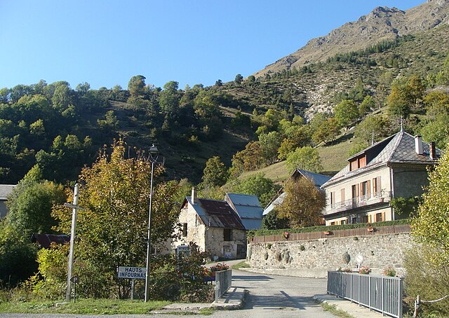
Les Infournas
- former commune in Hautes-Alpes, France
Hiking in Les Infournas
Les Infournas is a lesser-known yet stunning hiking destination located in the southern region of France, particularly in the Provence-Alpes-Côte d'Azur area. It is renowned for its rugged landscapes, striking rock formations, and a variety of trails that cater to different skill levels. Here are some key points to keep in mind if you're planning a hike there:...
- Country:
- Postal Code: 05500
- Coordinates: 44° 42' 57" N, 6° 5' 40" E
- GPS tracks (wikiloc): [Link]
- Area: 8.69 sq km
- Population: 24