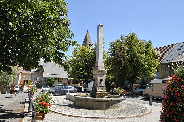
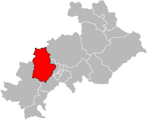
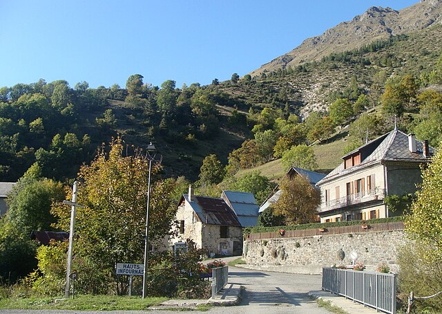
arrondissement of Gap (arrondissement de Gap)

- arrondissement of France
 Hiking in arrondissement of Gap
The Arrondissement of Gap, located in the Hautes-Alpes department in southeastern France, is a great destination for hiking enthusiasts. This area is characterized by its stunning landscapes, which include rolling hills, majestic mountains, deep valleys, and pristine alpine lakes. Here are some highlights and tips for hiking in this region:
Trails and Natural Parks
-
Ecrins National Park: One of the largest national parks in France, the Écrins is home to numerous trails that cater to various levels of hikers. Popular routes include the ascent to the Glacier de la Meije and the trail to Lac de l'Eychauda.
-
Pre-Alpes D'Azur Natural Regional Park: This park offers a variety of hiking paths that enable you to experience the unique flora and fauna of the region, along with breathtaking views.
-
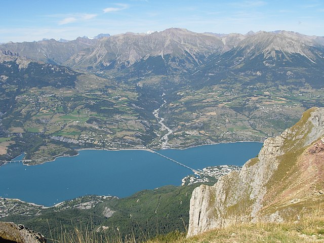
Lac de Serre-Ponçon: Hike around this stunning man-made lake, or ascend the surrounding hills for panoramic views of the water and the surrounding mountains.
Scenic Views and Wildlife
- The region is known for its diverse wildlife, including ibex, chamois, and a variety of birds. Early morning or late afternoon hikes can often provide the best opportunities for wildlife spotting.
- Many trails offer spectacular vistas of the surrounding peaks, particularly during sunrise or sunset.
Hiking Difficulty Levels
- Beginner: There are gentle trails, such as the loop around Lac de Serre-Ponçon, well-suited for families or novice hikers.
- Intermediate: Trails in the Écrins National Park can provide a moderate challenge, including routes that lead to beautiful alpine lakes.
- Advanced: More challenging hikes, including multi-day treks and ascents, are available for seasoned hikers, such as those leading to the high mountain passes.
Practical Tips
- Season: The best months for hiking are generally from late spring to early fall (May to October), while winter offers opportunities for snowshoeing or ski touring.
- Gear: Good hiking boots, weather-appropriate clothing, and enough water and food are essential. It’s also advisable to carry a map or a GPS device.
- Safety: Always check weather forecasts before setting out, inform someone of your plans, and consider hiring a local guide if tackling more challenging hikes.
Accommodations and Services
Gap and the surrounding area offer a range of accommodations, from hotels to campsites, catering to different budgets. Additionally, local tourism offices can provide maps, advice, and guided tour options.
Hiking in the Arrondissement of Gap can be a truly rewarding experience, combining adventure with breathtaking scenery and the opportunity to connect with nature.
- Country:

- Capital: Gap
- Coordinates: 44° 40' 0" N, 6° 0' 0" E


- GPS tracks (wikiloc): [Link]
- Area: 3411 sq km
- Population: 105243
- Wikipedia en: wiki(en)
- Wikipedia: wiki(fr)
- Wikidata storage: Wikidata: Q701227
- Freebase ID: [/m/095kn2]
- GeoNames ID: Alt: [3016701]
- INSEE arrondissement code: [052]
- GNS Unique Feature ID: -1428667
Includes regions:

canton of Barcillonnette
- canton of France (until March 2015)
Hiking in canton of Barcillonnette
The Canton of Barcillonnette is a picturesque area located in the Alpes-de-Haute-Provence department in southeastern France. Known for its stunning landscapes, the region is characterized by rolling hills, deep valleys, and access to the magnificent Alps, making it a popular destination for hiking enthusiasts....
- Country:
- Capital: Barcillonnette
- Coordinates: 44° 26' 10" N, 5° 55' 11" E
- GPS tracks (wikiloc): [Link]
canton of Savines-le-Lac
- canton of France (until March 2015)
Hiking in canton of Savines-le-Lac
The Canton of Savines-le-Lac, located in the Hautes-Alpes region of France, offers a stunning natural landscape ideal for hiking enthusiasts. Nestled near the shores of Lake Serre-Ponçon, the area is characterized by its picturesque alpine scenery, including mountains, forests, and crystal-clear waters....
- Country:
- Capital: Savines-le-Lac
- Coordinates: 44° 31' 37" N, 6° 24' 20" E
- GPS tracks (wikiloc): [Link]


canton of Laragne-Montéglin
- canton of France
Hiking in canton of Laragne-Montéglin
The Canton of Laragne-Montéglin, located in the Hautes-Alpes department in southeastern France, is an excellent destination for hiking enthusiasts. The region is characterized by its stunning natural landscapes, including rolling hills, rugged mountains, and picturesque valleys. Here are some highlights and tips for hiking in this area:...
- Country:
- Capital: Laragne-Montéglin
- Coordinates: 44° 18' 57" N, 5° 49' 20" E
- GPS tracks (wikiloc): [Link]
- Population: 7688

canton of Orcières
- canton of France (until March 2015)
Hiking in canton of Orcières
The Canton of Orcières, located in the Hautes-Alpes region of southeastern France, is a fantastic destination for hiking enthusiasts. Surrounded by stunning mountain landscapes, it is known for its diverse terrain, which includes alpine meadows, rocky peaks, and beautiful valleys. Here are some highlights about hiking in this area:...

canton of Chorges
- canton of France
Hiking in canton of Chorges
Chorges, located in the Hautes-Alpes region of France, is a picturesque area known for its stunning landscapes and excellent hiking opportunities. Nestled between the mountains and offering views of Lake Serre-Ponçon, Chorges is a great destination for both novice and experienced hikers....
- Country:
- Capital: Chorges
- Coordinates: 44° 32' 47" N, 6° 16' 38" E
- GPS tracks (wikiloc): [Link]
- Population: 10444

canton of Aspres-sur-Buëch
- canton of France
Hiking in canton of Aspres-sur-Buëch
The Canton of Aspres-sur-Buëch, located in the Hautes-Alpes region of southeastern France, offers a variety of hiking opportunities characterized by stunning landscapes, diverse ecosystems, and charming villages. Here’s what you need to know about hiking in this picturesque area:...
- Country:
- Capital: Aspres-sur-Buëch
- Coordinates: 44° 31' 28" N, 5° 45' 1" E
- GPS tracks (wikiloc): [Link]

canton of Gap-Nord-Ouest
- canton of France
Hiking in canton of Gap-Nord-Ouest
The Canton of Gap-Nord-Ouest, located in the Hautes-Alpes department in France, is a beautiful area for hiking. This region is part of the French Alps, characterized by stunning landscapes, varied terrains, and an abundance of natural beauty. Here are some highlights and tips for hiking in this region:...
canton of Gap-Centre
- canton of France
Hiking in canton of Gap-Centre
The Canton of Gap-Centre, located in the Hautes-Alpes region of southeastern France, offers stunning landscapes that are perfect for hiking enthusiasts. The region is known for its mountainous terrain, charming villages, and a variety of trails suitable for different skill levels....
canton of Gap-Sud-Ouest
- canton of France
Hiking in canton of Gap-Sud-Ouest
The Canton of Gap-Sud-Ouest, located in the Hautes-Alpes department in the Provence-Alpes-Côte d'Azur region of southeastern France, offers a diverse range of hiking opportunities that cater to various skill levels and preferences. Here are some key highlights about hiking in this area:...

canton of La Bâtie-Neuve
- canton of France
Hiking in canton of La Bâtie-Neuve
Canton of La Bâtie-Neuve, located in the Hautes-Alpes department of southeastern France, offers a variety of hiking opportunities for outdoor enthusiasts. This region is characterized by its stunning Alpine landscapes, picturesque villages, and rich biodiversity. Here are some aspects to consider when hiking in this area:...
- Country:
- Capital: La Bâtie-Neuve
- Coordinates: 44° 34' 3" N, 6° 11' 47" E
- GPS tracks (wikiloc): [Link]

canton of Orpierre
- canton of France
Hiking in canton of Orpierre
The Canton of Orpierre, located in the Hautes-Alpes department in southeastern France, is a fantastic destination for hiking enthusiasts. Known for its stunning natural landscapes, charming villages, and diverse hiking trails, it offers a mix of terrains that cater to various skill levels. Here are some highlights and tips for hiking in this area:...

canton of Ribiers
- canton of France
Hiking in canton of Ribiers
The Canton of Ribiers, located in the Hautes-Alpes region of France, is known for its stunning natural landscapes and diverse hiking opportunities. Here are some highlights to consider if you're planning a hiking trip in this beautiful area:...

canton of Rosans
- canton of France
Hiking in canton of Rosans
The Canton of Rosans is a picturesque region located in the Drôme department in southeastern France. It is known for its stunning landscapes, diverse flora and fauna, and charming villages....

canton of Saint-Firmin
- canton of France
Hiking in canton of Saint-Firmin
The Canton of Saint-Firmin, located in the French Alps, is a fantastic area for hiking enthusiasts. Known for its stunning natural landscapes, the region offers a variety of trails suited for different skill levels, making it accessible for both novice hikers and experienced mountaineers....
- Country:
- Capital: Saint-Firmin
- Coordinates: 44° 46' 56" N, 6° 1' 48" E
- GPS tracks (wikiloc): [Link]

canton of Dévoluy
- canton of France
Hiking in canton of Dévoluy
The Canton of Saint-Étienne-en-Dévoluy, located in the Hautes-Alpes region of southeastern France, offers a diverse range of hiking opportunities suitable for both novice and experienced hikers. Nestled in the Dévoluy massif, this area is characterized by stunning alpine landscapes, rugged mountain terrain, and a rich variety of flora and fauna....


canton of Tallard
- canton of France
Hiking in canton of Tallard
The Canton of Tallard is located in the Hautes-Alpes department of southeastern France. It offers a stunning natural landscape that is perfect for hiking enthusiasts. Here are some key points about hiking in this region:...
- Country:
- Capital: Tallard
- Coordinates: 44° 27' 45" N, 6° 3' 19" E
- GPS tracks (wikiloc): [Link]
- Population: 10239

canton of Veynes
- canton of France
Hiking in canton of Veynes
Hiking in the Canton of Veynes, located in the Hautes-Alpes region of France, offers breathtaking landscapes and a variety of trails suitable for different skill levels. The area is characterized by its stunning natural beauty, with mountains, valleys, and rich biodiversity....
- Country:
- Capital: Veynes
- Coordinates: 44° 41' 7" N, 6° 19' 33" E
- GPS tracks (wikiloc): [Link]
- Population: 6837


canton of Embrun
- canton of France
Hiking in canton of Embrun
The Canton of Embrun, located in the Hautes-Alpes region of southeastern France, is a stunning area that offers a variety of hiking opportunities. Known for its breathtaking landscapes, including alpine meadows, rugged mountains, and clear lakes, the region attracts outdoor enthusiasts from around the world....
- Country:
- Capital: Embrun
- Coordinates: 44° 33' 57" N, 6° 29' 46" E
- GPS tracks (wikiloc): [Link]
- Population: 10711
canton of Gap-Campagne
- administrative division in southeastern France
Hiking in canton of Gap-Campagne
The Canton of Gap-Campagne, located in the Hautes-Alpes department in the southeastern part of France, is known for its stunning landscapes, diverse hiking trails, and proximity to the Écrins National Park. Here are some highlights and tips for hiking in this beautiful region:...
canton of Gap-Nord-Est
- canton of France (until March 2015)
Hiking in canton of Gap-Nord-Est
The Canton of Gap-Nord-Est, located in the Hautes-Alpes region of southeastern France, offers stunning landscapes and a variety of hiking opportunities. This area is characterized by its beautiful mountains, valleys, and a rich natural heritage, making it a popular destination for outdoor enthusiasts....


canton of Serres
- canton of France
Hiking in canton of Serres
The Canton of Serres, located in northern Greece, offers a variety of hiking opportunities that cater to different skill levels and preferences. Here are some key highlights and tips for hiking in this beautiful region:...
- Country:
- Capital: Serres
- Coordinates: 44° 25' 46" N, 5° 42' 56" E
- GPS tracks (wikiloc): [Link]
- Population: 7492
canton of Gap-Sud-Est
- administrative division in southeastern France
Hiking in canton of Gap-Sud-Est
The Canton of Gap-Sud-Est, located in the French Alps, offers a stunning variety of hiking opportunities, thanks to its picturesque landscapes, diverse trails, and rich natural heritage. Here are some highlights of hiking in this region:...

canton of Saint-Bonnet-en-Champsaur
- canton of France
Hiking in canton of Saint-Bonnet-en-Champsaur
The Canton of Saint-Bonnet-en-Champsaur, located in the French Alps in the Hautes-Alpes department, offers a stunning array of hiking opportunities for all skill levels. This region is characterized by its diverse landscapes, ranging from lush valleys to rugged mountain terrain, making it a fantastic destination for outdoor enthusiasts....
- Country:
- Coordinates: 44° 40' 55" N, 6° 4' 35" E
- GPS tracks (wikiloc): [Link]
- Population: 11056