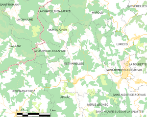
canton of Saint-Bonnet-le-Château (canton de Saint-Bonnet-le-Château)
- canton of France
- Country:

- Capital: Saint-Bonnet-le-Château
- Coordinates: 45° 23' 55" N, 4° 3' 37" E


- GPS tracks (wikiloc): [Link]
- Wikipedia en: wiki(en)
- Wikipedia: wiki(fr)
- Wikidata storage: Wikidata: Q1727075
- INSEE canton code: [4217]
Includes regions:


Saint-Maurice-en-Gourgois
- commune in Loire, France
- Country:
- Postal Code: 42240
- Coordinates: 45° 24' 5" N, 4° 11' 0" E
- GPS tracks (wikiloc): [Link]
- Area: 31.83 sq km
- Population: 1797
- Web site: [Link]


Usson-en-Forez
- commune in Loire, France
- Country:
- Postal Code: 42550
- Coordinates: 45° 23' 23" N, 3° 56' 29" E
- GPS tracks (wikiloc): [Link]
- Area: 47.24 sq km
- Population: 1500
- Web site: [Link]


Saint-Hilaire-Cusson-la-Valmitte
- commune in Loire, France
- Country:
- Postal Code: 42380
- Coordinates: 45° 22' 7" N, 4° 2' 31" E
- GPS tracks (wikiloc): [Link]
- AboveSeaLevel: 915 м m
- Area: 18.31 sq km
- Population: 332


Rozier-Côtes-d'Aurec
- commune in Loire, France
- Country:
- Postal Code: 42380
- Coordinates: 45° 22' 17" N, 4° 6' 15" E
- GPS tracks (wikiloc): [Link]
- Area: 13.89 sq km
- Population: 456
- Web site: [Link]


Saint-Bonnet-le-Château
- commune in Loire, France
- Country:
- Postal Code: 42380
- Coordinates: 45° 25' 26" N, 4° 3' 58" E
- GPS tracks (wikiloc): [Link]
- Area: 1.87 sq km
- Population: 1552
- Web site: [Link]


Merle-Leignec
- commune in Loire, France
- Country:
- Postal Code: 42380
- Coordinates: 45° 22' 29" N, 4° 1' 3" E
- GPS tracks (wikiloc): [Link]
- Area: 16.17 sq km
- Population: 319

Estivareilles
- commune in Loire, France
- Country:
- Postal Code: 42380
- Coordinates: 45° 25' 1" N, 4° 0' 38" E
- GPS tracks (wikiloc): [Link]
- Area: 22.56 sq km
- Population: 694
- Web site: [Link]
La Tourette
- commune in Loire, France
- Country:
- Postal Code: 42380
- Coordinates: 45° 24' 53" N, 4° 5' 4" E
- GPS tracks (wikiloc): [Link]
- AboveSeaLevel: 800 м m
- Area: 5.65 sq km
- Population: 571