canton of Sillé-le-Guillaume (canton de Sillé-le-Guillaume)
- canton of France (until March 2015)
- Country:

- Capital: Sillé-le-Guillaume
- Coordinates: 48° 10' 6" N, 0° 7' 52" E


- GPS tracks (wikiloc): [Link]
- Population: 30818
- Wikipedia en: wiki(en)
- Wikipedia: wiki(fr)
- Wikidata storage: Wikidata: Q533185
- INSEE canton code: [7220]
Includes regions:

Rouessé-Vassé
- commune in Sarthe, France
- Country:
- Postal Code: 72140
- Coordinates: 48° 9' 33" N, 0° 11' 55" E
- GPS tracks (wikiloc): [Link]
- Area: 31.49 sq km
- Population: 816

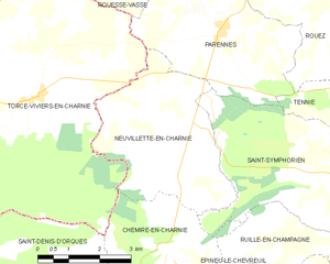
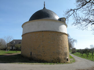
Neuvillette-en-Charnie
- commune in Sarthe, France
- Country:
- Postal Code: 72140
- Coordinates: 48° 5' 35" N, 0° 12' 44" E
- GPS tracks (wikiloc): [Link]
- Area: 14.54 sq km
- Population: 304
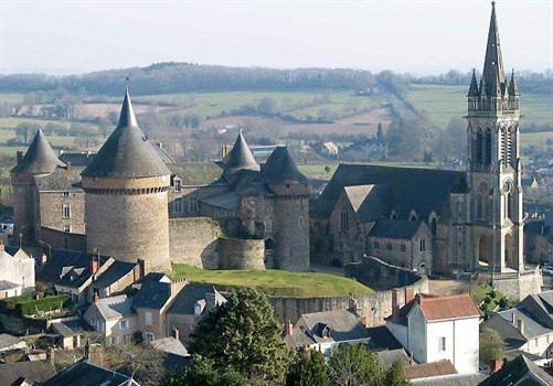

Sillé-le-Guillaume
- commune in Sarthe, France
- Country:
- Postal Code: 72140
- Coordinates: 48° 11' 0" N, 0° 7' 45" E
- GPS tracks (wikiloc): [Link]
- Area: 12.9 sq km
- Population: 2318
- Web site: [Link]


Pezé-le-Robert
- commune in Sarthe, France
- Country:
- Postal Code: 72140
- Coordinates: 48° 11' 37" N, 0° 3' 31" E
- GPS tracks (wikiloc): [Link]
- Area: 16.35 sq km
- Population: 370
Le Grez
- commune in Sarthe, France
- Country:
- Postal Code: 72140
- Coordinates: 48° 11' 23" N, 0° 9' 11" E
- GPS tracks (wikiloc): [Link]
- Area: 7.45 sq km
- Population: 393
Mont-Saint-Jean
- commune in Sarthe, France
- Country:
- Postal Code: 72140
- Coordinates: 48° 14' 47" N, 0° 6' 27" E
- GPS tracks (wikiloc): [Link]
- Area: 42.31 sq km
- Population: 661


Parennes
- commune in Sarthe, France
- Country:
- Postal Code: 72140
- Coordinates: 48° 7' 10" N, 0° 11' 7" E
- GPS tracks (wikiloc): [Link]
- Area: 14.5 sq km
- Population: 524


Crissé
- commune in Sarthe, France
- Country:
- Postal Code: 72140
- Coordinates: 48° 10' 7" N, 0° 3' 39" E
- GPS tracks (wikiloc): [Link]
- Area: 20.83 sq km
- Population: 601


Rouez
- commune in Sarthe, France
- Country:
- Postal Code: 72140
- Coordinates: 48° 8' 23" N, 0° 6' 51" E
- GPS tracks (wikiloc): [Link]
- AboveSeaLevel: 92 м m
- Area: 33.65 sq km
- Population: 777
- Web site: [Link]


Saint-Rémy-de-Sillé
- commune in Sarthe, France
- Country:
- Postal Code: 72140
- Coordinates: 48° 11' 10" N, 0° 5' 34" E
- GPS tracks (wikiloc): [Link]
- Area: 11.25 sq km
- Population: 844
- Web site: [Link]