Rouez (Rouez)

- commune in Sarthe, France
- Country:

- Postal Code: 72140
- Coordinates: 48° 8' 23" N, 0° 6' 51" E


- GPS tracks (wikiloc): [Link]
- AboveSeaLevel: 92 м m
- Area: 33.65 sq km
- Population: 777
- Web site: http://www.cc-paysdesille.fr/index.php/fr/territoire/rouez-en-champagne.html
- Wikipedia en: wiki(en)
- Wikipedia: wiki(fr)
- Wikidata storage: Wikidata: Q833427
- Wikipedia Commons Category: [Link]
- Freebase ID: [/m/03qk_pr]
- GeoNames ID: Alt: [2982637]
- SIREN number: [217202563]
- BnF ID: [15273810w]
- VIAF ID: Alt: [154919741]
- Library of Congress authority ID: Alt: [n93078272]
- INSEE municipality code: 72256
Shares border with regions:

Rouessé-Vassé
- commune in Sarthe, France
- Country:
- Postal Code: 72140
- Coordinates: 48° 9' 33" N, 0° 11' 55" E
- GPS tracks (wikiloc): [Link]
- Area: 31.49 sq km
- Population: 816

Sillé-le-Guillaume
- commune in Sarthe, France
- Country:
- Postal Code: 72140
- Coordinates: 48° 11' 0" N, 0° 7' 45" E
- GPS tracks (wikiloc): [Link]
- Area: 12.9 sq km
- Population: 2318
- Web site: [Link]


Tennie
- commune in Sarthe, France
- Country:
- Postal Code: 72240
- Coordinates: 48° 6' 29" N, 0° 4' 33" E
- GPS tracks (wikiloc): [Link]
- Area: 33.13 sq km
- Population: 1104

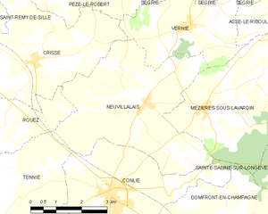
Neuvillalais
- commune in Sarthe, France
- Country:
- Postal Code: 72240
- Coordinates: 48° 9' 24" N, 0° 0' 3" E
- GPS tracks (wikiloc): [Link]
- Area: 18.86 sq km
- Population: 591
- Web site: [Link]


Parennes
- commune in Sarthe, France
- Country:
- Postal Code: 72140
- Coordinates: 48° 7' 10" N, 0° 11' 7" E
- GPS tracks (wikiloc): [Link]
- Area: 14.5 sq km
- Population: 524


Crissé
- commune in Sarthe, France
- Country:
- Postal Code: 72140
- Coordinates: 48° 10' 7" N, 0° 3' 39" E
- GPS tracks (wikiloc): [Link]
- Area: 20.83 sq km
- Population: 601


Saint-Rémy-de-Sillé
- commune in Sarthe, France
- Country:
- Postal Code: 72140
- Coordinates: 48° 11' 10" N, 0° 5' 34" E
- GPS tracks (wikiloc): [Link]
- Area: 11.25 sq km
- Population: 844
- Web site: [Link]