canton of Talant (canton de Talant)

- canton of France
- Country:

- Capital: Talant
- Coordinates: 47° 20' 14" N, 5° 0' 23" E


- GPS tracks (wikiloc): [Link]
- Area: 340.75 sq km
- Population: 24764
- Wikipedia en: wiki(en)
- Wikipedia: wiki(fr)
- Wikidata storage: Wikidata: Q17623303
- INSEE canton code: [2123]
Includes regions:


Agey
- commune in Côte-d'Or, France
- Country:
- Postal Code: 21410
- Coordinates: 47° 17' 3" N, 4° 45' 45" E
- GPS tracks (wikiloc): [Link]
- Area: 8.42 sq km
- Population: 297


Ancey
- commune in Côte-d'Or, France
- Country:
- Postal Code: 21410
- Coordinates: 47° 19' 46" N, 4° 49' 36" E
- GPS tracks (wikiloc): [Link]
- Area: 8.47 sq km
- Population: 433


Arcey
- commune in Côte-d'Or, France
- Country:
- Postal Code: 21410
- Coordinates: 47° 16' 31" N, 4° 49' 40" E
- GPS tracks (wikiloc): [Link]
- Area: 3.47 sq km
- Population: 52


Aubigny-lès-Sombernon
- commune in Côte-d'Or, France
- Country:
- Postal Code: 21540
- Coordinates: 47° 18' 16" N, 4° 38' 35" E
- GPS tracks (wikiloc): [Link]
- Area: 7.93 sq km
- Population: 147


Barbirey-sur-Ouche
- commune in Côte-d'Or, France
- Country:
- Postal Code: 21410
- Coordinates: 47° 15' 10" N, 4° 45' 17" E
- GPS tracks (wikiloc): [Link]
- Area: 10.76 sq km
- Population: 230

Baulme-la-Roche
- commune in Côte-d'Or, France
- Country:
- Postal Code: 21410
- Coordinates: 47° 20' 46" N, 4° 47' 56" E
- GPS tracks (wikiloc): [Link]
- Area: 6.69 sq km
- Population: 99


Blaisy-Bas
- commune in Côte-d'Or, France
- Country:
- Postal Code: 21540
- Coordinates: 47° 22' 22" N, 4° 44' 25" E
- GPS tracks (wikiloc): [Link]
- Area: 13.27 sq km
- Population: 701
Blaisy-Haut
- commune in Côte-d'Or, France
- Country:
- Postal Code: 21540
- Coordinates: 47° 21' 42" N, 4° 45' 39" E
- GPS tracks (wikiloc): [Link]
- Area: 8.31 sq km
- Population: 134


Drée
- commune in Côte-d'Or, France
- Country:
- Postal Code: 21540
- Coordinates: 47° 20' 57" N, 4° 41' 27" E
- GPS tracks (wikiloc): [Link]
- Area: 5.14 sq km
- Population: 56


Échannay
- commune in Côte-d'Or, France
- Country:
- Postal Code: 21540
- Coordinates: 47° 16' 54" N, 4° 40' 32" E
- GPS tracks (wikiloc): [Link]
- Area: 7.18 sq km
- Population: 130


Gergueil
- commune in Côte-d'Or, France
- Country:
- Postal Code: 21410
- Coordinates: 47° 14' 25" N, 4° 49' 6" E
- GPS tracks (wikiloc): [Link]
- Area: 9.93 sq km
- Population: 122

Gissey-sur-Ouche
- commune in Côte-d'Or, France
- Country:
- Postal Code: 21410
- Coordinates: 47° 15' 48" N, 4° 46' 3" E
- GPS tracks (wikiloc): [Link]
- Area: 14.48 sq km
- Population: 355

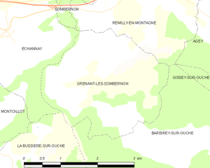
Grenant-lès-Sombernon
- commune in Côte-d'Or, France
- Country:
- Postal Code: 21540
- Coordinates: 47° 16' 17" N, 4° 42' 41" E
- GPS tracks (wikiloc): [Link]
- Area: 7.19 sq km
- Population: 212

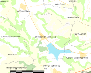
Grosbois-en-Montagne
- commune in Côte-d'Or, France
- Country:
- Postal Code: 21540
- Coordinates: 47° 19' 11" N, 4° 35' 47" E
- GPS tracks (wikiloc): [Link]
- Area: 14.16 sq km
- Population: 96


Mâlain
- commune in Côte-d'Or, France
- Country:
- Postal Code: 21410
- Coordinates: 47° 19' 33" N, 4° 47' 41" E
- GPS tracks (wikiloc): [Link]
- Area: 11.24 sq km
- Population: 737
Mesmont
- commune in Côte-d'Or, France
- Country:
- Postal Code: 21540
- Coordinates: 47° 18' 46" N, 4° 44' 40" E
- GPS tracks (wikiloc): [Link]
- Area: 6.37 sq km
- Population: 250
Montoillot
- commune in Côte-d'Or, France
- Country:
- Postal Code: 21540
- Coordinates: 47° 16' 11" N, 4° 39' 25" E
- GPS tracks (wikiloc): [Link]
- Area: 7.71 sq km
- Population: 77
Prâlon
- commune in Côte-d'Or, France
- Country:
- Postal Code: 21410
- Coordinates: 47° 18' 36" N, 4° 46' 31" E
- GPS tracks (wikiloc): [Link]
- Area: 3.09 sq km
- Population: 89

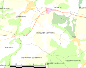
Remilly-en-Montagne
- commune in Côte-d'Or, France
- Country:
- Postal Code: 21540
- Coordinates: 47° 17' 32" N, 4° 44' 13" E
- GPS tracks (wikiloc): [Link]
- Area: 8.47 sq km
- Population: 148
Saint-Anthot
- commune in Côte-d'Or, France
- Country:
- Postal Code: 21540
- Coordinates: 47° 18' 57" N, 4° 38' 43" E
- GPS tracks (wikiloc): [Link]
- Area: 4.11 sq km
- Population: 71

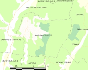
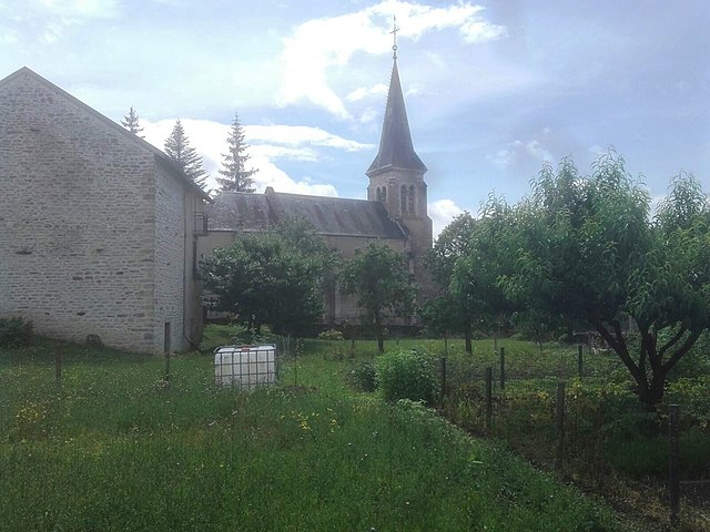
Saint-Jean-de-Bœuf
- commune in Côte-d'Or, France
- Country:
- Postal Code: 21410
- Coordinates: 47° 13' 3" N, 4° 44' 46" E
- GPS tracks (wikiloc): [Link]
- Area: 12.26 sq km
- Population: 116


Sainte-Marie-sur-Ouche
- commune in Côte-d'Or, France
- Country:
- Postal Code: 21410
- Coordinates: 47° 17' 13" N, 4° 47' 50" E
- GPS tracks (wikiloc): [Link]
- Area: 8.25 sq km
- Population: 698
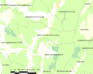
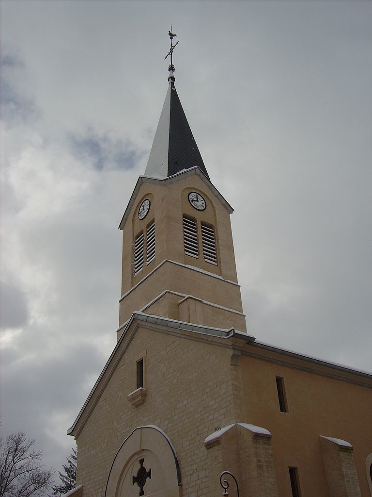
Saint-Victor-sur-Ouche
- commune in Côte-d'Or, France
- Country:
- Postal Code: 21410
- Coordinates: 47° 14' 2" N, 4° 44' 48" E
- GPS tracks (wikiloc): [Link]
- Area: 12.77 sq km
- Population: 274


Savigny-sous-Mâlain
- commune in Côte-d'Or, France
- Country:
- Postal Code: 21540
- Coordinates: 47° 19' 56" N, 4° 45' 34" E
- GPS tracks (wikiloc): [Link]
- Area: 6.35 sq km
- Population: 219


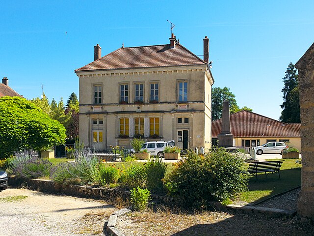
Sombernon
- commune in Côte-d'Or, France
- Country:
- Postal Code: 21540
- Coordinates: 47° 18' 28" N, 4° 42' 27" E
- GPS tracks (wikiloc): [Link]
- Area: 13.22 sq km
- Population: 944
- Web site: [Link]
Verrey-sous-Drée
- commune in Côte-d'Or, France
- Country:
- Postal Code: 21540
- Coordinates: 47° 21' 58" N, 4° 41' 20" E
- GPS tracks (wikiloc): [Link]
- Area: 3.44 sq km
- Population: 69


Vieilmoulin
- commune in Côte-d'Or, France
- Country:
- Postal Code: 21540
- Coordinates: 47° 18' 42" N, 4° 40' 44" E
- GPS tracks (wikiloc): [Link]
- AboveSeaLevel: 483 м m
- Area: 6.06 sq km
- Population: 121


Fleurey-sur-Ouche
- commune in Côte-d'Or, France
- Country:
- Postal Code: 21410
- Coordinates: 47° 18' 43" N, 4° 51' 34" E
- GPS tracks (wikiloc): [Link]
- Area: 29.76 sq km
- Population: 1225
- Web site: [Link]


Lantenay
- commune in Côte-d'Or, France
- Country:
- Postal Code: 21370
- Coordinates: 47° 20' 32" N, 4° 52' 0" E
- GPS tracks (wikiloc): [Link]
- Area: 17.13 sq km
- Population: 509
Pasques
- commune in Côte-d'Or, France
- Country:
- Postal Code: 21370
- Coordinates: 47° 21' 59" N, 4° 51' 44" E
- GPS tracks (wikiloc): [Link]
- Area: 20.41 sq km
- Population: 296
- Web site: [Link]

Velars-sur-Ouche
- commune in Côte-d'Or, France
- Country:
- Postal Code: 21370
- Coordinates: 47° 19' 14" N, 4° 54' 17" E
- GPS tracks (wikiloc): [Link]
- Area: 12.13 sq km
- Population: 1688


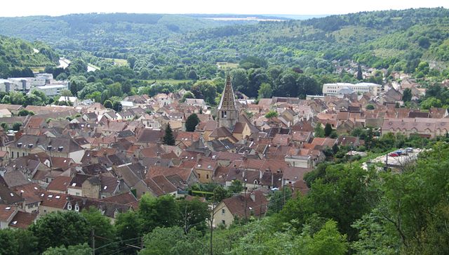
Talant
- commune in Côte-d'Or, France
- Country:
- Postal Code: 21240
- Coordinates: 47° 20' 11" N, 5° 0' 20" E
- GPS tracks (wikiloc): [Link]
- AboveSeaLevel: 359 м m
- Area: 4.9 sq km
- Population: 11439
- Web site: [Link]
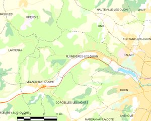
Plombières-lès-Dijon
- commune in Côte-d'Or, France
- Country:
- Postal Code: 21370
- Coordinates: 47° 20' 22" N, 4° 58' 20" E
- GPS tracks (wikiloc): [Link]
- Area: 16.21 sq km
- Population: 2653