Verrey-sous-Drée (Verrey-sous-Drée)

- commune in Côte-d'Or, France
- Country:

- Postal Code: 21540
- Coordinates: 47° 21' 58" N, 4° 41' 20" E


- GPS tracks (wikiloc): [Link]
- Area: 3.44 sq km
- Population: 69
- Wikipedia en: wiki(en)
- Wikipedia: wiki(fr)
- Wikidata storage: Wikidata: Q134503
- Wikipedia Commons Category: [Link]
- Freebase ID: [/m/03mfxk8]
- GeoNames ID: Alt: [6428946]
- SIREN number: [212106694]
- BnF ID: [15250956b]
- INSEE municipality code: 21669
Shares border with regions:


Saint-Mesmin
- commune in Côte-d'Or, France
- Country:
- Postal Code: 21540
- Coordinates: 47° 20' 32" N, 4° 39' 10" E
- GPS tracks (wikiloc): [Link]
- Area: 17.62 sq km
- Population: 131


Drée
- commune in Côte-d'Or, France
- Country:
- Postal Code: 21540
- Coordinates: 47° 20' 57" N, 4° 41' 27" E
- GPS tracks (wikiloc): [Link]
- Area: 5.14 sq km
- Population: 56

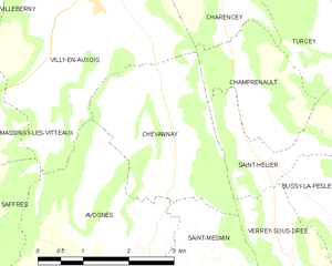
Chevannay
- commune in Côte-d'Or, France
- Country:
- Postal Code: 21540
- Coordinates: 47° 23' 47" N, 4° 39' 15" E
- GPS tracks (wikiloc): [Link]
- Area: 7.16 sq km
- Population: 46
Saint-Hélier
- commune in Côte-d'Or, France
- Country:
- Postal Code: 21690
- Coordinates: 47° 23' 6" N, 4° 40' 57" E
- GPS tracks (wikiloc): [Link]
- Area: 3.93 sq km
- Population: 39