Caorle (Caorle)
.svg)
- Italian comune
 Hiking in Caorle
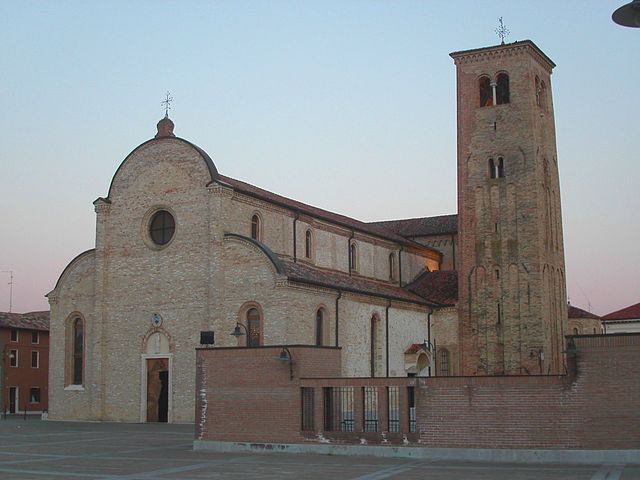
Caorle, located on the Adriatic coast of Italy in the Veneto region, is primarily known for its beautiful beaches and charming old town. While it may not be as famous for hiking as some other Italian destinations like the Dolomites or Cinque Terre, there are still opportunities for enjoyable outdoor activities in the surrounding areas.
Hiking Opportunities Near Caorle:
-
Litoranea Veneta: This coastal pathway stretches along the Veneto coastline, offering scenic views of the sea, wetlands, and local wildlife. It's a relatively flat route, perfect for a leisurely hike.
-
Natural Parks and Reserves:
- Lagoon of Caorle: The wetlands surrounding Caorle are rich in biodiversity. There are various walking paths, where you can observe numerous bird species and learn about the local ecosystem.
- Punta Sabbioni: A bit further from Caorle, this area offers trails that run through the nearby natural reserve, featuring both coastal and woodland landscapes.
-
Nearby Hills: If you’re willing to travel a bit further inland, the hills of the Veneto region provide more challenging hikes with rewarding views. Areas like the Colli Euganei offer a combination of nature and history.
-
Exploration of the Old Town: While not a traditional hike, strolling through the old town of Caorle can be an enjoyable experience. You can walk along the quaint streets, visit the historic churches, and sample local cuisine.
Tips for Hiking in the Caorle Area:
- Weather: Check the weather forecast before heading out, as it can get quite hot in summer. Early morning or late afternoon hikes are best for avoiding heat.
- Footwear: Wear comfortable hiking shoes, especially if you're planning on entering areas with uneven terrain.
- Hydration: Always carry enough water, especially if you're hiking during the warmer months.
- Maps and Information: Acquire maps of local hiking trails or guides from tourist information centers in Caorle. This will help in navigating the trails safely.
While Caorle may not be a hiking haven compared to Italy's mountainous regions, it does offer some lovely walks and outdoor experiences for those looking to explore the area beyond the beaches. Enjoy your hiking adventure!
- Country:

- Postal Code: 30021
- Local Dialing Code: 0421
- Licence Plate Code: VE
- Coordinates: 45° 36' 1" N, 12° 53' 15" E


- GPS tracks (wikiloc): [Link]
- AboveSeaLevel: 1 м m
- Area: 153.84 sq km
- Population: 11606
- Web site: http://www.caorle.it
- Wikipedia en: wiki(en)
- Wikipedia: wiki(it)
- Wikidata storage: Wikidata: Q47248
- Wikipedia Commons Category: [Link]
- Freebase ID: [/m/0dzsc1]
- GeoNames ID: Alt: [6540392]
- VIAF ID: Alt: [161991871]
- OSM relation ID: [45430]
- archINFORM location ID: [8552]
- UN/LOCODE: [ITAOR]
- Digital Atlas of the Roman Empire ID: [17993]
- ISTAT ID: 027005
- Italian cadastre code: B642
Shares border with regions:


Portogruaro
- Italian comune
Hiking in Portogruaro
Portogruaro, located in the Veneto region of Italy, is primarily known for its charming medieval architecture and proximity to the natural beauty of the surrounding areas. While Portogruaro itself may not be a prominent destination for extensive hiking trails, it serves as a great starting point for exploring nearby natural parks and landscapes....
- Country:
- Postal Code: 30026
- Local Dialing Code: 0421
- Licence Plate Code: VE
- Coordinates: 45° 47' 0" N, 12° 50' 0" E
- GPS tracks (wikiloc): [Link]
- AboveSeaLevel: 5 м m
- Area: 102.31 sq km
- Population: 24959
- Web site: [Link]

Concordia Sagittaria
- Italian comune
Hiking in Concordia Sagittaria
Concordia Sagittaria, located in the Veneto region of Italy, is not primarily known as a hiking destination compared to other areas in the region like the Dolomites or the Prosecco Hills. However, it does offer some scenic walks and routes that can be enjoyable for those looking to experience nature and the local culture....
- Country:
- Postal Code: 30023
- Local Dialing Code: 0421
- Licence Plate Code: VE
- Coordinates: 45° 46' 0" N, 12° 51' 0" E
- GPS tracks (wikiloc): [Link]
- AboveSeaLevel: 4 м m
- Area: 66.84 sq km
- Population: 10373
- Web site: [Link]
San Stino di Livenza
- Italian comune
Hiking in San Stino di Livenza
San Stino di Livenza is a charming town located in the Veneto region of Italy, not far from the beautiful landscapes of the surrounding countryside and coast. While it may not be as well-known for hiking as the nearby Dolomites or coastal routes, there are still opportunities for walking and exploring nature in and around the area....
- Country:
- Postal Code: 30020; 30029
- Local Dialing Code: 0421
- Licence Plate Code: VE
- Coordinates: 45° 44' 0" N, 12° 41' 0" E
- GPS tracks (wikiloc): [Link]
- AboveSeaLevel: 6 м m
- Area: 67.97 sq km
- Population: 12855
- Web site: [Link]


San Michele al Tagliamento
- Italian comune
Hiking in San Michele al Tagliamento
San Michele al Tagliamento is a charming town located in the northeastern part of Italy, surrounded by beautiful natural landscapes and offering various opportunities for hiking and outdoor activities. It’s situated in the Veneto region, close to the Adriatic Sea, which means you can enjoy a diverse hiking experience that includes both coastal and inland trails....
- Country:
- Postal Code: 30028
- Local Dialing Code: 0431
- Licence Plate Code: VE
- Coordinates: 45° 45' 49" N, 12° 59' 43" E
- GPS tracks (wikiloc): [Link]
- AboveSeaLevel: 7 м m
- Area: 114.39 sq km
- Population: 11822
- Web site: [Link]
Torre di Mosto
- Italian comune
Hiking in Torre di Mosto
Torre di Mosto is a charming town located in the Veneto region of Italy, and while not as widely known for hiking as some other areas, it does offer opportunities to explore the beautiful Italian countryside and enjoy nature. Here are some highlights for hiking in and around Torre di Mosto:...
- Country:
- Postal Code: 30020
- Local Dialing Code: 0421
- Licence Plate Code: VE
- Coordinates: 45° 41' 0" N, 12° 43' 0" E
- GPS tracks (wikiloc): [Link]
- AboveSeaLevel: 2 м m
- Area: 38 sq km
- Population: 4770
- Web site: [Link]


Eraclea
- Italian comune
Hiking in Eraclea
Eraclea, located on the Adriatic coast of Italy near Venice, is primarily known for its beaches and coastal attractions. While it may not be a traditional hiking destination like the Dolomites or other mountainous regions of Italy, there are still opportunities for outdoor enthusiasts to explore the natural beauty of the area....
- Country:
- Postal Code: 30020
- Local Dialing Code: 0421
- Licence Plate Code: VE
- Coordinates: 45° 35' 0" N, 12° 41' 0" E
- GPS tracks (wikiloc): [Link]
- AboveSeaLevel: 0 м m
- Area: 95.45 sq km
- Population: 12276
- Web site: [Link]