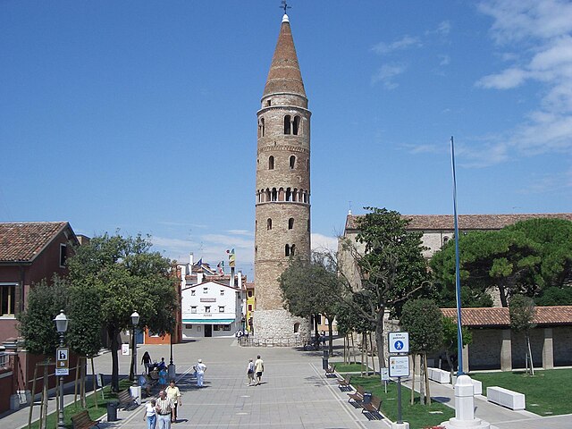
San Michele al Tagliamento (San Michele al Tagliamento)
.svg)
- Italian comune
 Hiking in San Michele al Tagliamento
San Michele al Tagliamento is a charming town located in the northeastern part of Italy, surrounded by beautiful natural landscapes and offering various opportunities for hiking and outdoor activities. It’s situated in the Veneto region, close to the Adriatic Sea, which means you can enjoy a diverse hiking experience that includes both coastal and inland trails.
Hiking Opportunities
-
Pinede di Eraclea: This coastal pine forest area is great for leisurely hikes. The trails are well-marked and provide a serene environment for walking or biking, with the scent of pine trees and views of the sea.
-
Ciclovia Alpe Adria: If you enjoy cycling as well as hiking, this scenic route passes through various landscapes from the Alps to the Adriatic coast. Portions of the trail can be hiked and offer stunning views and interesting stops along the way.
-
Laguna di Marano: This lagoon area offers beautiful scenery and wildlife, perfect for those who enjoy nature hikes. It’s a great spot for birdwatching as well and a quieter alternative to the more touristy spots.
-
Parco Regionale delle Dolomiti Friulane: While a bit further away, this national park offers breathtaking mountain ranges and numerous trails for more experienced hikers. It's well worth the trip for those looking for more demanding hikes.
Tips for Hiking in San Michele al Tagliamento
- Weather: Always check the local weather conditions before heading out, especially during spring and fall when conditions can change quickly.
- Proper Footwear: Wear appropriate hiking boots or shoes for comfort and safety, as some trails may be rocky or uneven.
- Hydration and Food: Carry enough water and some snacks to keep your energy levels up, especially on longer hikes.
- Trail Maps: While many trails are well marked, having a trail map or using a hiking app can be helpful to navigate unfamiliar paths.
- Wildlife Awareness: Be mindful of the local flora and fauna, and respect nature by staying on designated paths.
Whether you prefer a gentle stroll or a more vigorous hike, San Michele al Tagliamento and its surrounding areas have something to offer for every level of hiker. Enjoy the beautiful Italian scenery and immerse yourself in nature!
- Country:

- Postal Code: 30028
- Local Dialing Code: 0431
- Licence Plate Code: VE
- Coordinates: 45° 45' 49" N, 12° 59' 43" E


- GPS tracks (wikiloc): [Link]
- AboveSeaLevel: 7 м m
- Area: 114.39 sq km
- Population: 11822
- Web site: http://www.comunesanmichele.it/
- Wikipedia en: wiki(en)
- Wikipedia: wiki(it)
- Wikidata storage: Wikidata: Q47271
- Wikipedia Commons Gallery: [Link]
- Wikipedia Commons Category: [Link]
- Freebase ID: [/m/0g9nst]
- GeoNames ID: Alt: [6536292]
- VIAF ID: Alt: [159535787]
- OSM relation ID: [45606]
- Gran Enciclopèdia Catalana ID: [0267321]
- ISTAT ID: 027034
- Italian cadastre code: I040
Shares border with regions:
Morsano al Tagliamento
- Italian comune
Hiking in Morsano al Tagliamento
Morsano al Tagliamento is a picturesque village located in the Friuli Venezia Giulia region of northeastern Italy. The area surrounding Morsano al Tagliamento is characterized by its gentle rolling hills, lush farmlands, and scenic landscapes, making it a delightful spot for hiking enthusiasts....
- Country:
- Postal Code: 33075
- Local Dialing Code: 0434
- Licence Plate Code: PN
- Coordinates: 45° 52' 23" N, 12° 57' 12" E
- GPS tracks (wikiloc): [Link]
- AboveSeaLevel: 14 м m
- Area: 32.54 sq km
- Population: 2788
- Web site: [Link]


Portogruaro
- Italian comune
Hiking in Portogruaro
Portogruaro, located in the Veneto region of Italy, is primarily known for its charming medieval architecture and proximity to the natural beauty of the surrounding areas. While Portogruaro itself may not be a prominent destination for extensive hiking trails, it serves as a great starting point for exploring nearby natural parks and landscapes....
- Country:
- Postal Code: 30026
- Local Dialing Code: 0421
- Licence Plate Code: VE
- Coordinates: 45° 47' 0" N, 12° 50' 0" E
- GPS tracks (wikiloc): [Link]
- AboveSeaLevel: 5 м m
- Area: 102.31 sq km
- Population: 24959
- Web site: [Link]

Caorle
- Italian comune
Hiking in Caorle
Caorle, located on the Adriatic coast of Italy in the Veneto region, is primarily known for its beautiful beaches and charming old town. While it may not be as famous for hiking as some other Italian destinations like the Dolomites or Cinque Terre, there are still opportunities for enjoyable outdoor activities in the surrounding areas....
- Country:
- Postal Code: 30021
- Local Dialing Code: 0421
- Licence Plate Code: VE
- Coordinates: 45° 36' 1" N, 12° 53' 15" E
- GPS tracks (wikiloc): [Link]
- AboveSeaLevel: 1 м m
- Area: 153.84 sq km
- Population: 11606
- Web site: [Link]
Fossalta di Portogruaro
- Italian comune
Hiking in Fossalta di Portogruaro
Fossalta di Portogruaro, located in the Veneto region of Italy, offers a unique hiking experience characterized by its picturesque landscapes, lush countryside, and tranquil surroundings. While it may not be as famed for hiking as some other Italian regions like the Dolomites, it still provides opportunities for outdoor enthusiasts to explore its natural beauty....
- Country:
- Postal Code: 30025
- Local Dialing Code: 0421
- Licence Plate Code: VE
- Coordinates: 45° 47' 0" N, 12° 55' 0" E
- GPS tracks (wikiloc): [Link]
- AboveSeaLevel: 9 м m
- Area: 31.1 sq km
- Population: 6190
- Web site: [Link]

Latisana
- Italian comune
Hiking in Latisana
Latisana, located in the Friuli Venezia Giulia region of Italy, offers a variety of outdoor activities, including hiking, thanks to its proximity to both the coast and the beautiful surrounding landscapes. While Latisana itself is not a mountainous area, it serves as a great base for exploring nearby natural attractions....
- Country:
- Postal Code: 33053
- Local Dialing Code: 0431
- Licence Plate Code: UD
- Coordinates: 45° 47' 0" N, 13° 0' 0" E
- GPS tracks (wikiloc): [Link]
- AboveSeaLevel: 7 м m
- Area: 37.8 sq km
- Population: 13478
- Web site: [Link]


Lignano Sabbiadoro
- Italian comune
Hiking in Lignano Sabbiadoro
Lignano Sabbiadoro, located on the Adriatic coast in Italy, is primarily known for its beautiful beaches and vibrant summer tourism atmosphere. While it's not a mountainous area renowned for traditional hiking, it does offer various opportunities for outdoor enthusiasts to enjoy nature and explore the surrounding areas....
- Country:
- Postal Code: 33054
- Local Dialing Code: 0431
- Licence Plate Code: UD
- Coordinates: 45° 39' 18" N, 13° 5' 35" E
- GPS tracks (wikiloc): [Link]
- AboveSeaLevel: 2 м m
- Area: 15.71 sq km
- Population: 6950
- Web site: [Link]
Ronchis
- Italian comune
Hiking in Ronchis
Ronchis is a small village located in the Friuli Venezia Giulia region of northeastern Italy. While it may not be a prominent hiking destination in itself, the surrounding area offers several opportunities for hiking and outdoor activities, especially in the nearby natural parks and hills....
- Country:
- Postal Code: 33050
- Local Dialing Code: 0431
- Licence Plate Code: UD
- Coordinates: 45° 49' 0" N, 13° 7' 0" E
- GPS tracks (wikiloc): [Link]
- AboveSeaLevel: 15 м m
- Area: 18.4 sq km
- Population: 2013
- Web site: [Link]

Varmo
- Italian comune
Hiking in Varmo
Varmo, located in the Friuli Venezia Giulia region of northeastern Italy, is not widely known as a hiking destination compared to other areas in Italy, but it offers some beautiful landscapes and trails that can be enjoyed by hikers. The region is characterized by its stunning natural scenery, including rolling hills, rivers, and nearby mountains....
- Country:
- Postal Code: 33030
- Local Dialing Code: 0432
- Licence Plate Code: UD
- Coordinates: 45° 53' 0" N, 12° 59' 0" E
- GPS tracks (wikiloc): [Link]
- AboveSeaLevel: 18 м m
- Area: 34.92 sq km
- Population: 2725
- Web site: [Link]