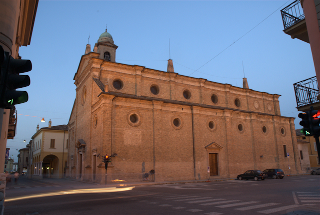
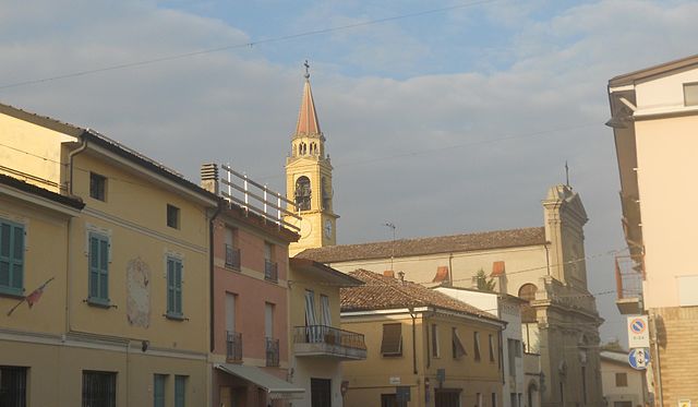
Cappella Cantone (Cappella Cantone)
.svg)
- Italian comune
 Hiking in Cappella Cantone
Cappella Cantone is a charming town located in the province of Cremona in Italy. While it may not be as widely known for hiking as some of Italy's more famous regions, it is surrounded by beautiful landscapes and offers opportunities for outdoor activities.
Hiking Opportunities
-
Suburban Trails: The area around Cappella Cantone features various trails that can often be explored on foot or by bike. You can expect a mix of flat routes and gentle hills, making it suitable for hikers of all skill levels.
-
Natural Reserves: Nearby, there are natural reserves and parks, such as the Oglio Park, where hiking trails wind through lush vegetation and alongside rivers. The park is known for its biodiversity, making it an excellent spot for nature lovers.
-
Local Routes: Look for routes that traverse vineyards and farmland, offering a unique glimpse into the agricultural practices of the area. The scenery can be quite picturesque, especially during the harvest season.
-
Cultural Hikes: Incorporate history into your hiking by following paths that lead to nearby villages or historical sites. Exploring local architecture, churches, and monuments can enrich the hiking experience.
Tips for Hiking in Cappella Cantone
-
Preparation: Always check the weather beforehand and dress accordingly. The climate can vary depending on the season.
-
Maps and Guides: Utilize local maps or seek out guided tours if you are unfamiliar with the terrain. There might be local hiking groups that can provide insights.
-
Hydration and Snacks: Carry enough water and snacks, especially during longer hikes. Availability of services may be limited in rural areas.
-
Wildlife Awareness: Be mindful of local wildlife, and respect their habitats.
-
Leave No Trace: Follow the principles of Leave No Trace to preserve the natural beauty of the area.
By incorporating these elements, hiking in and around Cappella Cantone can be a rewarding experience, offering both natural beauty and cultural insights. Enjoy your trek!
- Country:

- Postal Code: 26020
- Local Dialing Code: 0374
- Licence Plate Code: CR
- Coordinates: 45° 15' 0" N, 9° 50' 0" E


- GPS tracks (wikiloc): [Link]
- AboveSeaLevel: 60 м m
- Area: 13.15 sq km
- Population: 576
- Web site: http://www.comune.cappellacantone.cr.it
- Wikipedia en: wiki(en)
- Wikipedia: wiki(it)
- Wikidata storage: Wikidata: Q42714
- Wikipedia Commons Category: [Link]
- Freebase ID: [/m/0gjyjt]
- GeoNames ID: Alt: [6542608]
- OSM relation ID: [44470]
- UN/LOCODE: [ITCC5]
- ISTAT ID: 019013
- Italian cadastre code: B679
Shares border with regions:

Castelleone
- Italian comune
Hiking in Castelleone
Castelleone is a charming town located in the Lombardy region of Italy, and while it may not be the most well-known hiking destination, it offers access to some lovely spots worth exploring....
- Country:
- Postal Code: 26012
- Local Dialing Code: 0374
- Licence Plate Code: CR
- Coordinates: 45° 17' 45" N, 9° 45' 39" E
- GPS tracks (wikiloc): [Link]
- AboveSeaLevel: 66 м m
- Area: 45.08 sq km
- Population: 9374
- Web site: [Link]


Annicco
- Italian comune
Hiking in Annicco
Annicco is a small town located in the Lombardy region of Italy. While it may not be as widely known for hiking as some other areas in Italy, it can serve as a gateway for exploring nearby regions that offer beautiful hiking opportunities....
- Country:
- Postal Code: 26021
- Local Dialing Code: 0374
- Licence Plate Code: CR
- Coordinates: 45° 15' 0" N, 9° 53' 0" E
- GPS tracks (wikiloc): [Link]
- AboveSeaLevel: 60 м m
- Area: 19.2 sq km
- Population: 2053
- Web site: [Link]


Pizzighettone
- Italian comune
Hiking in Pizzighettone
Pizzighettone, located in the Lombardy region of Italy, offers a unique blend of history and nature for hiking enthusiasts. While it may not be as famous for hiking trails as some of the mountainous regions in Italy, it does have its own charm, particularly with its scenic surroundings and historical features....
- Country:
- Postal Code: 26026
- Local Dialing Code: 0372
- Licence Plate Code: CR
- Coordinates: 45° 11' 0" N, 9° 47' 0" E
- GPS tracks (wikiloc): [Link]
- AboveSeaLevel: 46 м m
- Area: 32.06 sq km
- Population: 6501
- Web site: [Link]

San Bassano
- Italian comune
Hiking in San Bassano
San Bassano is a picturesque area known for its natural beauty and hiking opportunities. While it may specifically refer to a region in Italy, I can provide general insights into hiking in regions that might be similar in nature or atmosphere. The following are some considerations and tips for hiking in such areas:...
- Country:
- Postal Code: 26020
- Local Dialing Code: 0374
- Licence Plate Code: CR
- Coordinates: 45° 14' 38" N, 9° 48' 32" E
- GPS tracks (wikiloc): [Link]
- AboveSeaLevel: 59 м m
- Area: 13.93 sq km
- Population: 2162
- Web site: [Link]


Grumello Cremonese ed Uniti
- Italian comune
Hiking in Grumello Cremonese ed Uniti
Grumello Cremonese ed Uniti, a small municipality in the province of Cremona in Lombardy, Italy, is a lesser-known gem for hiking enthusiasts. While it may not have the established hiking trails found in larger national parks or mountainous regions, the area offers some delightful countryside routes and opportunities to explore the scenic landscapes....
- Country:
- Postal Code: 26023
- Local Dialing Code: 0372
- Licence Plate Code: CR
- Coordinates: 45° 11' 39" N, 9° 51' 52" E
- GPS tracks (wikiloc): [Link]
- AboveSeaLevel: 50 м m
- Area: 22.29 sq km
- Population: 1789
- Web site: [Link]


Soresina
- Italian comune
Hiking in Soresina
Soresina, located in the Lombardy region of Italy, is primarily known for its agricultural landscape and historical significance rather than traditional hiking trails. However, there are several options for enjoying the outdoors and exploring the surrounding areas....
- Country:
- Postal Code: 26015
- Local Dialing Code: 0374
- Licence Plate Code: CR
- Coordinates: 45° 17' 17" N, 9° 51' 31" E
- GPS tracks (wikiloc): [Link]
- AboveSeaLevel: 45 м m
- Area: 28.57 sq km
- Population: 8948
- Web site: [Link]