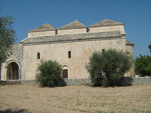
Casamassima (Casamassima)
.svg)
- Italian comune
 Hiking in Casamassima
Casamassima is a charming town in the Apulia region of Italy, located near the metropolitan area of Bari. It is known for its picturesque landscapes, historical sites, and nature trails, making it a great destination for hiking enthusiasts. Here are some highlights about hiking in and around Casamassima:
Scenic Trails
-
Nature Reserves: Explore the nearby nature reserves, such as the Parco Nazionale dell'Alta Murgia. This park features unique karst landscapes, diverse flora and fauna, and various trails for different skill levels.
-
Rural Paths: Many rustic paths wind through olive groves and agricultural fields, providing a glimpse into the traditional Apulian countryside. These trails often lead to hidden gems, including ancient stone farms and quaint rural churches.
-
Historical Walks: Casamassima itself has historical significance. You can hike within the town, enjoying the architecture of the old town, churches, and the beautiful surrounding countryside while learning about the local culture and history.
Tips for Hiking in Casamassima
-
Best Time to Hike: The ideal seasons for hiking in Casamassima are spring (April to June) and fall (September to October) when temperatures are comfortable, and the landscape is vibrant.
-
Gear: Make sure to wear sturdy hiking shoes and bring enough water and snacks. Sun protection, including hats and sunscreen, is essential, especially in summer.
-
Local Guides: Consider hiring a local guide who is familiar with the area to discover off-the-beaten-path trails and learn more about the natural and cultural history of the region.
Safety Considerations
-
Before heading out, check the weather and trail conditions. It’s essential to stay on marked trails and inform someone about your hiking plans for safety.
-
Wildlife is present in the area, including some wild boars, so it's wise to be aware of your surroundings.
Hiking in Casamassima offers a blend of natural beauty, cultural richness, and a chance to enjoy the great outdoors in a less touristy part of Italy. Enjoy your adventure!
- Country:

- Postal Code: 70010
- Local Dialing Code: 080
- Licence Plate Code: BA
- Coordinates: 40° 57' 0" N, 16° 55' 0" E


- GPS tracks (wikiloc): [Link]
- AboveSeaLevel: 223 м m
- Area: 78.43 sq km
- Population: 19777
- Web site: http://www.comune.casamassima.ba.it/
- Wikipedia en: wiki(en)
- Wikipedia: wiki(it)
- Wikidata storage: Wikidata: Q51819
- Wikipedia Commons Category: [Link]
- Freebase ID: [/m/0fw_jh]
- GeoNames ID: Alt: [6538942]
- VIAF ID: Alt: [142080938]
- OSM relation ID: [40888]
- WOEID: [712876]
- TGN ID: [1043939]
- UN/LOCODE: [ITCSQ]
- DMOZ ID: Alt: [Regional/Europe/Italy/Puglia/Localities/Casamassima/]
- ISTAT ID: 072015
- Italian cadastre code: B923
Shares border with regions:
Cellamare
- comune of Italy
Hiking in Cellamare
Cellamare is a charming village located in the region of Apulia, southern Italy. While it may not be as well-known for hiking as some other destinations, its surrounding areas offer beautiful landscapes and opportunities for outdoor activities....
- Country:
- Postal Code: 70010
- Local Dialing Code: 080
- Licence Plate Code: BA
- Coordinates: 41° 1' 13" N, 16° 55' 45" E
- GPS tracks (wikiloc): [Link]
- AboveSeaLevel: 110 м m
- Area: 5.91 sq km
- Population: 5792
- Web site: [Link]


Acquaviva delle Fonti
- Italian comune
Hiking in Acquaviva delle Fonti
Acquaviva delle Fonti, located in the Apulia region of Italy, is a charming town surrounded by beautiful countryside, making it an appealing destination for hikers. The area is characterized by rolling hills, vineyards, olive groves, and a rich cultural heritage, providing a unique hiking experience....
- Country:
- Postal Code: 70021
- Local Dialing Code: 080
- Licence Plate Code: BA
- Coordinates: 40° 54' 0" N, 16° 51' 0" E
- GPS tracks (wikiloc): [Link]
- AboveSeaLevel: 300 м m
- Area: 132.03 sq km
- Population: 20600
- Web site: [Link]
Adelfia
- Italian comune
Hiking in Adelfia
Adelfia, a town located in the Puglia region of Italy, is not primarily known for its extensive hiking trails. However, the surrounding areas offer lovely landscapes and potential hiking experiences....
- Country:
- Postal Code: 70010
- Local Dialing Code: 080
- Licence Plate Code: BA
- Coordinates: 41° 0' 0" N, 16° 52' 0" E
- GPS tracks (wikiloc): [Link]
- AboveSeaLevel: 154 м m
- Area: 29.81 sq km
- Population: 16963
- Web site: [Link]
Capurso
- Italian comune
Hiking in Capurso
Capurso is a charming town located in the Apulia region of southern Italy, known for its rich history and beautiful landscapes. While it may not be a major hiking destination like some mountainous areas, it can serve as a great base for exploring the surrounding countryside and enjoying lighter trails. Here are some aspects to consider when hiking in and around Capurso:...
- Country:
- Postal Code: 70010
- Local Dialing Code: 080
- Licence Plate Code: BA
- Coordinates: 41° 3' 0" N, 16° 55' 0" E
- GPS tracks (wikiloc): [Link]
- AboveSeaLevel: 72 м m
- Area: 15.14 sq km
- Population: 15682
- Web site: [Link]


Conversano
- Conversano is an ancient town and comune in the southern Italian province of Bari, Apulia
Hiking in Conversano
Conversano, located in the Apulia region of Italy, offers beautiful landscapes and a rich historical context, making it a great destination for hiking enthusiasts. Here are some key points to consider for hiking in and around Conversano:...
- Country:
- Postal Code: 70014
- Local Dialing Code: 080
- Licence Plate Code: BA
- Coordinates: 40° 58' 0" N, 17° 7' 0" E
- GPS tracks (wikiloc): [Link]
- AboveSeaLevel: 219 м m
- Area: 128.42 sq km
- Population: 26171
- Web site: [Link]


Noicattaro
- Italian comune
Hiking in Noicattaro
Noicàttaro is a charming town located in the Apulia region of Italy, known for its agricultural landscapes and a rich cultural heritage. While it may not be as famous for hiking as some other areas in Italy, it offers several opportunities for walking and exploring the natural beauty of the region. Here are some insights about hiking in and around Noicàttaro:...
- Country:
- Postal Code: 70016
- Local Dialing Code: 080-478
- Licence Plate Code: BA
- Coordinates: 41° 2' 0" N, 16° 59' 0" E
- GPS tracks (wikiloc): [Link]
- AboveSeaLevel: 99 м m
- Area: 40.79 sq km
- Population: 26325
- Web site: [Link]


Rutigliano
- Italian comune
Hiking in Rutigliano
Rutigliano is a charming town located in the Apulia region of Italy, known for its beautiful landscapes, historical sites, and outdoor activities. While Rutigliano itself is more urban and has a rich cultural heritage, there are several hiking opportunities in the surrounding areas, particularly in the nearby countryside and natural parks....
- Country:
- Postal Code: 70018
- Local Dialing Code: 080
- Licence Plate Code: BA
- Coordinates: 40° 56' 0" N, 16° 54' 0" E
- GPS tracks (wikiloc): [Link]
- AboveSeaLevel: 125 м m
- Area: 53.85 sq km
- Population: 18591
- Web site: [Link]
Sammichele di Bari
- Italian comune
Hiking in Sammichele di Bari
Sammichele di Bari is a charming town located in the Puglia region of Italy, and while it may not be as widely recognized for hiking as other areas in the country, it offers some beautiful countryside and trails that can be explored....
- Country:
- Postal Code: 70010
- Local Dialing Code: 080
- Licence Plate Code: BA
- Coordinates: 40° 53' 0" N, 16° 57' 0" E
- GPS tracks (wikiloc): [Link]
- AboveSeaLevel: 280 м m
- Area: 33 sq km
- Population: 6454
- Web site: [Link]


Turi, Apulia
- Italian comune
Hiking in Turi, Apulia
Turi, located in the Apulia region of southern Italy, is a charming town that offers unique opportunities for hiking and exploring the beautiful countryside. The region is characterized by its picturesque landscapes, historic sites, and a rich variety of flora and fauna....
- Country:
- Postal Code: 70010
- Local Dialing Code: 080
- Licence Plate Code: BA
- Coordinates: 40° 55' 0" N, 17° 1' 0" E
- GPS tracks (wikiloc): [Link]
- AboveSeaLevel: 254 м m
- Area: 70 sq km
- Population: 13080
- Web site: [Link]

Valenzano
- Italian comune
Hiking in Valenzano
Valenzano, located in the Apulia region of Italy, offers a charming setting for outdoor activities, including hiking. Although a smaller town, it is surrounded by lush landscapes and the natural beauty typical of the Apulian countryside....
- Country:
- Postal Code: 70010
- Local Dialing Code: 080
- Licence Plate Code: BA
- Coordinates: 41° 3' 0" N, 16° 53' 0" E
- GPS tracks (wikiloc): [Link]
- AboveSeaLevel: 85 м m
- Area: 15.98 sq km
- Population: 17952
- Web site: [Link]