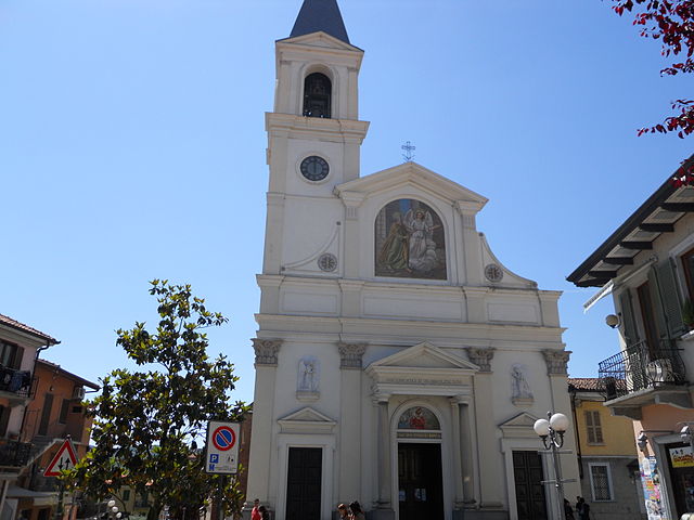
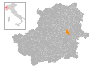
Caselle Torinese (Caselle Torinese)
- Italian comune
Caselle Torinese is a small town located in the Piedmont region of Italy, close to the city of Turin. While it may not be as well-known as some larger hiking destinations, it offers a variety of outdoor activities, including hiking. The surrounding area is characterized by beautiful landscapes, rolling hills, and picturesque views of the surrounding countryside and the Alps.
Hiking Trails and Areas
-
Parco del Pò: This park offers scenic views along the banks of the Po River. The trails here are suitable for leisurely walks and offer opportunities for wildlife observation and photography.
-
Monte dei Cappuccini: A short drive from Caselle Torinese, this area has trails that provide stunning panoramic views of the surrounding regions, including Turin and the Alps. It's a great location for both hiking and picnicking.
-
Collina Torinese: The hills around Turin feature many trails that range from easy walks to more challenging hikes. These trails often pass through vineyards and historic sites.
-
Val di Susa: A bit further afield, this valley offers a wealth of hiking opportunities, from easy day hikes to multi-day treks in the Alps. Trails range from family-friendly walks to more challenging mountain hikes.
General Tips for Hiking in Caselle Torinese
- Preparation: Always check weather conditions before heading out. The weather can be unpredictable, especially in mountainous areas.
- Trail Maps: Carry a detailed map or GPS device to help navigate. Local resources or visitor centers can provide useful maps and information.
- Appropriate Gear: Wear sturdy, comfortable hiking shoes and dress in layers. Bring water, snacks, and a first-aid kit.
- Respect Nature: Stay on marked trails, and follow Leave No Trace principles to preserve the natural beauty of the area.
Local Attractions
After a day of hiking, you can explore the town of Caselle Torinese itself, which has charming streets, local shops, and restaurants. Don’t miss trying local Piedmontese cuisine and wines.
Conclusion
Hiking in and around Caselle Torinese can offer a peaceful escape into nature, suitable for both beginner and experienced hikers. With its proximity to larger parks and the Alps, it can serve as a great base for exploring the natural beauty of Piedmont. Enjoy your hiking adventures!
- Country:

- Postal Code: 10072
- Local Dialing Code: 011
- Licence Plate Code: TO
- Coordinates: 45° 11' 0" N, 7° 39' 0" E


- GPS tracks (wikiloc): [Link]
- AboveSeaLevel: 300 м m
- Area: 23.58 sq km
- Population: 13935
- Web site: http://www.comune.caselle-torinese.to.it
- Wikipedia en: wiki(en)
- Wikipedia: wiki(it)
- Wikidata storage: Wikidata: Q9210
- Wikipedia Commons Category: [Link]
- Freebase ID: [/m/0g6t_5]
- GeoNames ID: Alt: [6540660]
- VIAF ID: Alt: [244299178]
- OSM relation ID: [44326]
- TGN ID: [1043948]
- UN/LOCODE: [ITCTI]
- Gran Enciclopèdia Catalana ID: [0264698]
- ISTAT ID: 001063
- Italian cadastre code: B960
Shares border with regions:


Robassomero
- Italian comune
Robassomero is a picturesque town located in the Piedmont region of Italy, north of Turin. It's surrounded by beautiful natural landscapes, making it a great destination for hikers and outdoor enthusiasts. Here are some aspects to consider if you're planning a hiking trip to Robassomero:...
- Country:

- Postal Code: 10070
- Local Dialing Code: 011
- Licence Plate Code: TO
- Coordinates: 45° 12' 0" N, 7° 34' 0" E


- GPS tracks (wikiloc): [Link]
- AboveSeaLevel: 360 м m
- Area: 8.58 sq km
- Population: 3089
- Web site: [Link]
San Maurizio Canavese
- Italian comune
 Hiking in San Maurizio Canavese
San Maurizio Canavese is a charming town located in the province of Turin, in the Piedmont region of northern Italy. While it is not particularly famous for its hiking routes, it is situated in a region that offers beautiful landscapes, including the surrounding hills and proximity to the Alps....
- Country:

- Postal Code: 10077
- Local Dialing Code: 011
- Licence Plate Code: TO
- Coordinates: 45° 13' 1" N, 7° 37' 50" E


- GPS tracks (wikiloc): [Link]
- AboveSeaLevel: 317 м m
- Area: 17.34 sq km
- Population: 10312
- Web site: [Link]

Settimo Torinese
- Italian comune
Settimo Torinese, located in the Piedmont region of Italy, is primarily an urban area, but it serves as a great starting point for exploring the surrounding natural landscapes. While the town itself may not offer extensive hiking trails, you can easily access numerous hiking opportunities in the nearby hills and parks....
- Country:

- Postal Code: 10036
- Local Dialing Code: 011
- Licence Plate Code: TO
- Coordinates: 45° 8' 0" N, 7° 46' 0" E


- GPS tracks (wikiloc): [Link]
- AboveSeaLevel: 207 м m
- Area: 31.46 sq km
- Population: 47220
- Web site: [Link]


Venaria Reale
- Italian comune
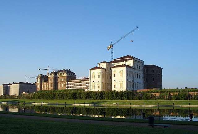
Venaria Reale, located just outside of Turin, Italy, is best known for the Royal Palace of Venaria, a UNESCO World Heritage site. Though it may not be a traditional hiking destination, the surrounding area offers various outdoor activities, including walking and biking trails that can be enjoyed by hikers of all levels....
- Country:

- Postal Code: 10078
- Local Dialing Code: 011
- Licence Plate Code: TO
- Coordinates: 45° 7' 0" N, 7° 38' 0" E


- GPS tracks (wikiloc): [Link]
- AboveSeaLevel: 262 м m
- Area: 20.44 sq km
- Population: 33781
- Web site: [Link]

Mappano
- human settlement in Italy
Mappano is a small municipality located in the Piedmont region of Italy, near the city of Turin. While it may not be as famous as other hiking destinations in the region, it offers access to beautiful natural landscapes and is a good starting point for exploring nearby areas....
- Country:

- Postal Code: 10072
- Local Dialing Code: 011
- Licence Plate Code: TO
- Coordinates: 45° 8' 54" N, 7° 42' 28" E


- GPS tracks (wikiloc): [Link]
- AboveSeaLevel: 235 м m
- Area: 9.73 sq km
- Population: 7286
- Web site: [Link]


Borgaro Torinese
- Italian comune
Borgaro Torinese, located in the province of Turin in Northern Italy, offers a range of hiking opportunities amidst its beautiful natural landscapes and proximity to the Susa Valley and the Italian Alps. Here are some points to consider when hiking in and around Borgaro Torinese:...
- Country:

- Postal Code: 10071
- Local Dialing Code: 011
- Licence Plate Code: TO
- Coordinates: 45° 9' 0" N, 7° 39' 0" E


- GPS tracks (wikiloc): [Link]
- AboveSeaLevel: 240 м m
- Area: 11.18 sq km
- Population: 11889
- Web site: [Link]


Leinì
- Italian comune
Leinì is a town located in the Metropolitan City of Turin, in the Piedmont region of northern Italy. While it might not be as famous for hiking as some other regions in Italy, there are several opportunities for outdoor activities and nature enjoyment in and around Leinì....
- Country:

- Postal Code: 10040
- Local Dialing Code: 011
- Licence Plate Code: TO
- Coordinates: 45° 11' 1" N, 7° 42' 55" E


- GPS tracks (wikiloc): [Link]
- AboveSeaLevel: 245 м m
- Area: 31.90 sq km
- Population: 16375
- Web site: [Link]
