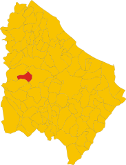
Casoli (Casoli)
.svg)
- Italian comune
 Hiking in Casoli
Casoli, located in the Abruzzo region of Italy, offers a variety of hiking opportunities for enthusiasts of all levels. The area is rich in natural beauty, including rolling hills, ancient forests, and stunning views of the surrounding mountains and valleys. Here are some highlights and tips for hiking in Casoli:
Trails
-
Local Trails: There are numerous local trails that lead you through picturesque landscapes, often with stops at charming villages and historical sites along the way. Many of these trails are well-marked and maintained.
-
Casoli to the Maiella National Park: For a more immersive experience, you can venture towards the nearby Maiella National Park. Here, you'll find trails that range from easy walks to challenging hikes, providing access to rugged terrain and breathtaking vistas.
-
Vallescura Trail: This specific trail takes you through the valley and showcases the local flora and fauna. It's great for both hiking and photography.
Wildlife
The region around Casoli is also known for its diverse wildlife. Be on the lookout for various bird species, deer, and other animals that inhabit the forests and hills.
Best Time to Hike
The best time for hiking in Casoli is during the spring (April to June) and fall (September to October) when the weather is mild, and the landscapes are particularly vibrant. Summer can be hot, so early morning hikes are advisable.
Tips for Hikers
- Footwear: Wear sturdy hiking boots with good traction, as some trails may be rocky or uneven.
- Hydration: Always bring enough water, especially if you're heading out for a longer hike.
- Navigation: While many trails are marked, it's a good idea to have a map or a GPS device if venturing into less familiar areas.
- Weather Awareness: Check the weather forecast before you head out, as conditions can change quickly in mountainous regions.
Cultural Aspects
Besides the natural beauty, hiking in Casoli allows you to experience local culture. You may encounter traditional rural architecture, local cuisine at small trattorias, and the warmth of the Abruzzese people.
Overall, hiking in Casoli promises a blend of stunning scenery, rich culture, and a chance to enjoy the great outdoors. Make sure to take your time exploring the trails and soaking in the natural beauty of this charming region!
- Country:

- Postal Code: 66043
- Local Dialing Code: 0872
- Licence Plate Code: CH
- Coordinates: 42° 6' 54" N, 14° 17' 26" E


- GPS tracks (wikiloc): [Link]
- AboveSeaLevel: 378 м m
- Area: 67.04 sq km
- Population: 5585
- Web site: http://www.casoli.gov.it
- Wikipedia en: wiki(en)
- Wikipedia: wiki(it)
- Wikidata storage: Wikidata: Q51198
- Wikipedia Commons Category: [Link]
- Freebase ID: [/m/0fg2b_]
- GeoNames ID: Alt: [6540015]
- OSM relation ID: [41765]
- UN/LOCODE: [IT2CS]
- Digital Atlas of the Roman Empire ID: [42244]
- DMOZ ID: Alt: [Regional/Europe/Italy/Abruzzo/Localities/Casoli/]
- ISTAT ID: 069017
- Italian cadastre code: B985
Shares border with regions:


Altino, Abruzzo
- Italian comune
Hiking in Altino, Abruzzo
Altino, located in the Abruzzo region of Italy, offers a variety of hiking opportunities that showcase its stunning natural landscapes, rich history, and diverse ecosystems. Here are some highlights and tips for hiking in this picturesque area:...
- Country:
- Postal Code: 66040
- Local Dialing Code: 0872
- Licence Plate Code: CH
- Coordinates: 42° 6' 0" N, 14° 20' 0" E
- GPS tracks (wikiloc): [Link]
- AboveSeaLevel: 345 м m
- Area: 15.33 sq km
- Population: 3104
- Web site: [Link]


Civitella Messer Raimondo
- Italian comune
Hiking in Civitella Messer Raimondo
Civitella Messer Raimondo is a beautiful village located in the Abruzzo region of Italy, surrounded by scenic landscapes, rolling hills, and rugged mountains. Hiking in this area offers a variety of trails suitable for different experience levels, making it a great destination for outdoor enthusiasts....
- Country:
- Postal Code: 66010
- Local Dialing Code: 0872
- Licence Plate Code: CH
- Coordinates: 42° 5' 0" N, 14° 13' 0" E
- GPS tracks (wikiloc): [Link]
- AboveSeaLevel: 613 м m
- Area: 12.72 sq km
- Population: 818
- Web site: [Link]


Gessopalena
- Italian comune
Hiking in Gessopalena
Gessopalena is a charming village located in the Abruzzo region of Italy, known for its stunning natural landscapes and outdoor activities, including hiking. The area offers a range of trails that cater to different skill levels, making it an excellent destination for both novice and experienced hikers....
- Country:
- Postal Code: 66010
- Local Dialing Code: 0872
- Licence Plate Code: CH
- Coordinates: 42° 3' 0" N, 14° 16' 0" E
- GPS tracks (wikiloc): [Link]
- AboveSeaLevel: 654 м m
- Area: 31.47 sq km
- Population: 1360
- Web site: [Link]


Guardiagrele
- Italian comune
Hiking in Guardiagrele
Guardiagrele, located in the Abruzzo region of Italy, is a beautiful destination for hiking enthusiasts. Surrounded by the stunning landscapes of the Majella National Park, Guardiagrele offers diverse trails that cater to various skill levels, from beginners to experienced hikers....
- Country:
- Postal Code: 66016
- Local Dialing Code: 0871
- Licence Plate Code: CH
- Coordinates: 42° 11' 21" N, 14° 13' 18" E
- GPS tracks (wikiloc): [Link]
- AboveSeaLevel: 576 м m
- Area: 56.4 sq km
- Population: 8966
- Web site: [Link]

Palombaro
- Italian comune
Hiking in Palombaro
Palombaro is a charming village located in the Abruzzo region of Italy. Nestled in the Apennine Mountains, it offers a variety of hiking opportunities characterized by beautiful landscapes, dense forests, and picturesque views. Here are some highlights and tips for hiking in and around Palombaro:...
- Country:
- Postal Code: 66010
- Local Dialing Code: 0871
- Licence Plate Code: CH
- Coordinates: 42° 7' 24" N, 14° 13' 48" E
- GPS tracks (wikiloc): [Link]
- AboveSeaLevel: 536 м m
- Area: 17.19 sq km
- Population: 1001
- Web site: [Link]


Pennapiedimonte
- Italian comune
Hiking in Pennapiedimonte
Pennapiedimonte is a charming village located in the Abruzzo region of Italy, known for its stunning natural landscapes and rich biodiversity. The surrounding area offers various hiking opportunities that cater to different skill levels, making it a fantastic destination for both novice and experienced hikers....
- Country:
- Postal Code: 66010
- Local Dialing Code: 0871
- Licence Plate Code: CH
- Coordinates: 42° 9' 8" N, 14° 11' 41" E
- GPS tracks (wikiloc): [Link]
- AboveSeaLevel: 669 м m
- Area: 47.03 sq km
- Population: 445
- Web site: [Link]


Roccascalegna
- Italian comune
Hiking in Roccascalegna
Roccascalegna, a scenic village in the Abruzzo region of Italy, is renowned for its stunning landscapes, historical sites, and outdoor activities, making it a fantastic destination for hiking enthusiasts. Here’s some information that can help you plan your hiking experience:...
- Country:
- Postal Code: 66040
- Local Dialing Code: 0872
- Licence Plate Code: CH
- Coordinates: 42° 3' 44" N, 14° 18' 23" E
- GPS tracks (wikiloc): [Link]
- AboveSeaLevel: 430 м m
- Area: 23.01 sq km
- Population: 1172
- Web site: [Link]


Sant'Eusanio del Sangro
- Italian comune
Hiking in Sant'Eusanio del Sangro
Sant'Eusanio del Sangro, located in the province of Chieti in the Abruzzo region of Italy, offers a picturesque setting for hiking enthusiasts. This charming village is nestled in the lush landscapes of the Apennine mountains and is surrounded by beautiful countryside, making it an excellent destination for outdoor activities....
- Country:
- Postal Code: 66037
- Local Dialing Code: 0872
- Licence Plate Code: CH
- Coordinates: 42° 10' 0" N, 14° 20' 0" E
- GPS tracks (wikiloc): [Link]
- AboveSeaLevel: 200 м m
- Area: 23.83 sq km
- Population: 2471
- Web site: [Link]