
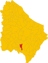
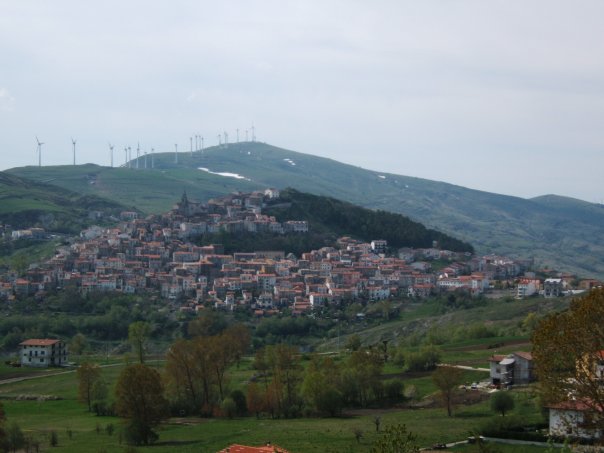
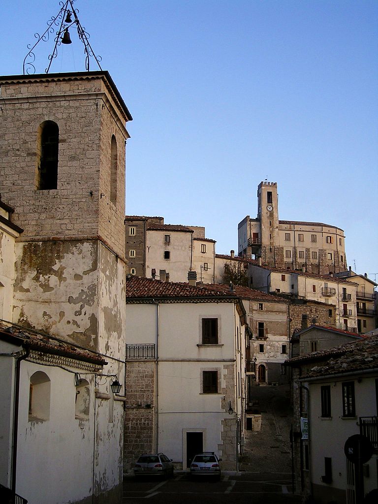
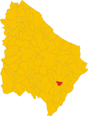
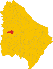
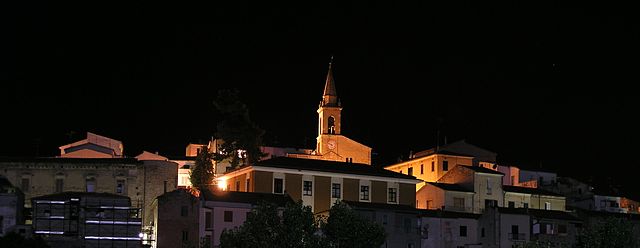
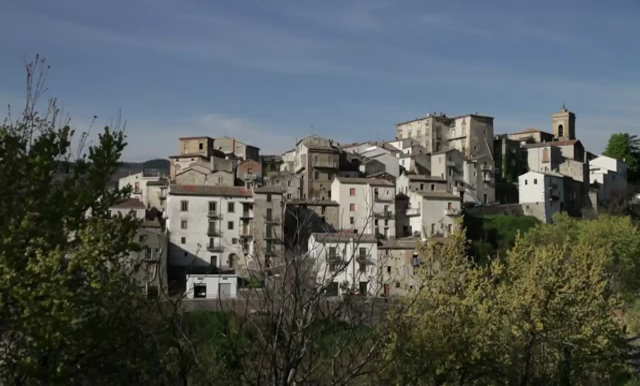
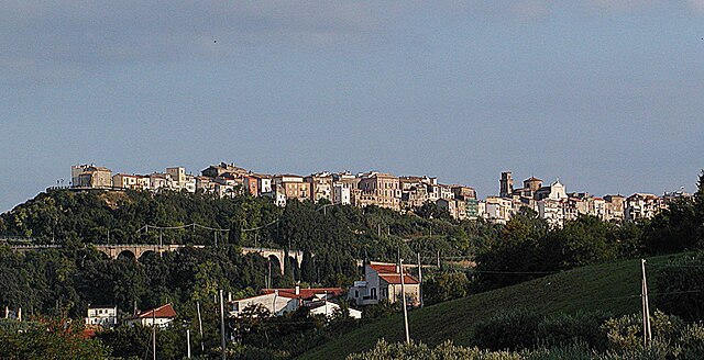
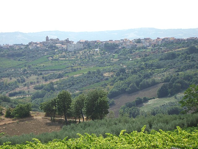
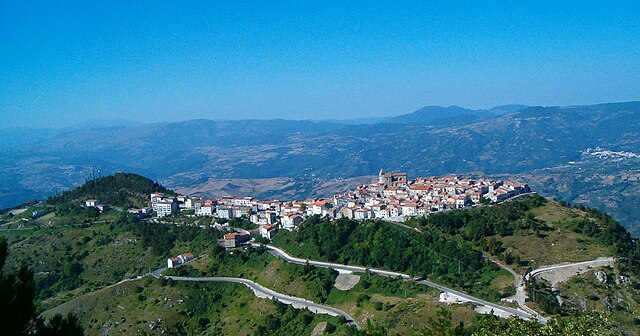
Province of Chieti (provincia di Chieti)

- province of Italy
 Hiking in Province of Chieti
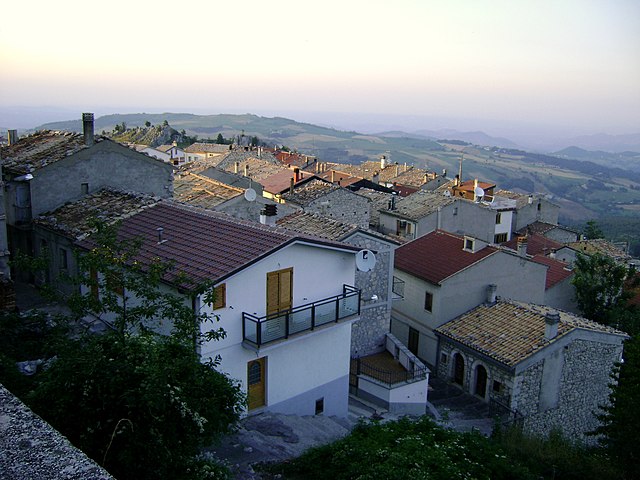
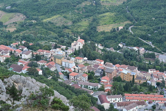
The Province of Chieti, located in the Abruzzo region of Italy, is a fantastic destination for hiking enthusiasts. With its diverse landscapes, ranging from rugged mountains to serene coastal areas, Chieti offers numerous trails suitable for all levels of hikers.
Key Highlights for Hiking in Chieti:
-
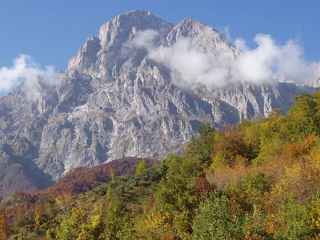
Majella National Park: This national park is home to some of the most beautiful hiking trails in the region. The park features rugged mountains, deep gorges, and picturesque villages. Trails vary from easy walks to challenging hikes, with routes like the Valle dell’Orfento and the summit of Monte Amaro (the second-highest peak in the Apennines).
-
Gran Sasso and Monti della Laga National Park: Just a bit beyond Chieti, this park offers breathtaking views, impressive limestone formations, and rich biodiversity. Trails here can lead you to beautiful lakes and unique geological formations.
-
Costa dei Trabocchi: Hike along the Adriatic coastline on the "Via Verde" (Greenway). This scenic route connects coastal towns and takes you past the iconic trabocchi, traditional fishing structures built on stilts. It’s an easier hike and perfect for those looking to combine hiking with views of the sea and local culture.
-
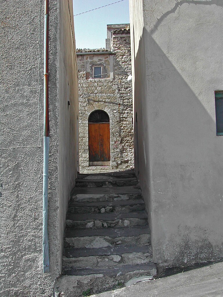
Local Routes and Villages: The province is dotted with charming medieval villages like Lanciano, Vasto, and Ortona. Many hiking routes connect these towns, offering not only natural beauty but also a chance to experience local culture, history, and cuisine.
-
Flora and Fauna: The varied ecosystems in the Province of Chieti support a wide range of wildlife, including deer, foxes, and a diverse array of bird species. Hiking here provides an excellent opportunity for birdwatching and enjoying the local flora, which includes a number of endemic species.
Tips for Hiking in Chieti:
- Prepare for Varying Weather: The weather can change rapidly, especially in mountainous areas. Dress in layers and bring waterproof gear if needed.
- Trail Maps: While many trails are marked, having a detailed map or a GPS device can help you navigate unfamiliar areas.
- Respect Nature: Follow Leave No Trace principles to preserve the natural beauty of the region.
- Stay Hydrated and Nourished: Always carry enough water and snacks, especially for longer hikes.
- Local Guides: For those unfamiliar with the terrain, hiring a local guide can enhance your experience and ensure safety.
Overall, hiking in the Province of Chieti offers a blend of natural beauty, cultural heritage, and outdoor adventure, making it a rewarding experience for hikers of all skill levels.
- Country:

- Capital: Chieti
- Postal Code: 66054; 66050–66052; 66045–66047; 66040–66043; 66036–66038; 66030–66034; 66026; 66014–66023; 66010-66100-66012
- Local Dialing Code: 0873; 0872; 0871; 085
- Licence Plate Code: CH
- Coordinates: 42° 21' 0" N, 14° 10' 0" E


- GPS tracks (wikiloc): [Link]
- Area: 2588.35 sq km
- Web site: http://www.provincia.chieti.it
- Wikipedia en: wiki(en)
- Wikipedia: wiki(it)
- Wikidata storage: Wikidata: Q16160
- Wikipedia Commons Gallery: [Link]
- Wikipedia Commons Category: [Link]
- Freebase ID: [/m/041kpf]
- GeoNames ID: Alt: [3178795]
- BnF ID: [11980616j]
- GND ID: Alt: [4216900-8]
- archINFORM location ID: [2364]
- MusicBrainz area ID: [3c90eeea-7a15-4660-96dc-7c0688b56021]
- TGN ID: [7003000]
- Gran Enciclopèdia Catalana ID: [0017565]
- NUTS code: [ITF14]
- ISTAT ID: 069
- ISO 3166-2 code: IT-CH
Includes regions:


Chieti
- Italian comune
Hiking in Chieti
Chieti, located in the Abruzzo region of Italy, offers a variety of hiking opportunities that showcase its beautiful landscapes, historical sites, and natural parks. Here are some key points about hiking in the Chieti area:...
- Country:
- Postal Code: 66100
- Local Dialing Code: 0871
- Licence Plate Code: CH
- Coordinates: 42° 21' 4" N, 14° 10' 3" E
- GPS tracks (wikiloc): [Link]
- AboveSeaLevel: 330 м m
- Area: 59.57 sq km
- Population: 51330
- Web site: [Link]
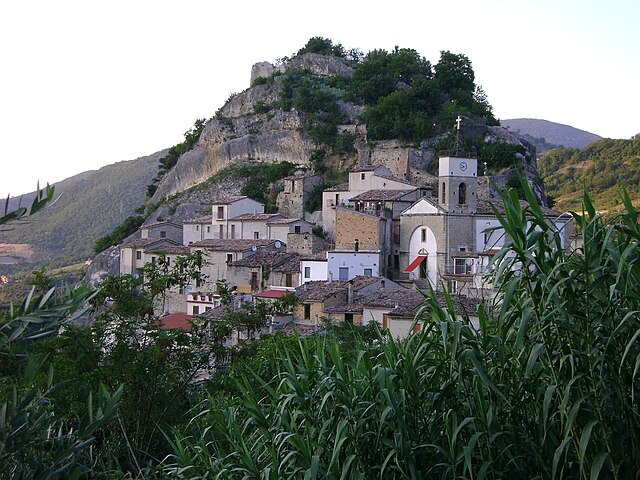

Pietraferrazzana
- Italian comune
Hiking in Pietraferrazzana
Pietraferrazzana is a charming village in the province of Chieti, situated in the Abruzzo region of Italy. It's nestled within the scenic landscapes of the Apennines, making it a wonderful destination for hikers and nature lovers. Here are some highlights and tips for hiking in the area:...
- Country:
- Postal Code: 66040
- Local Dialing Code: 0872
- Licence Plate Code: CH
- Coordinates: 41° 58' 0" N, 14° 22' 0" E
- GPS tracks (wikiloc): [Link]
- AboveSeaLevel: 357 м m
- Area: 4.37 sq km
- Population: 133
- Web site: [Link]


Fallo
- Italian comune
Hiking in Fallo
It seems there may be a misunderstanding or a typographical error with "Fallo," as it does not refer to a well-known hiking location or area. However, if you're referring to a specific place, it could be helpful to clarify which region or country you mean....
- Country:
- Postal Code: 66040
- Local Dialing Code: 0872
- Licence Plate Code: CH
- Coordinates: 41° 56' 0" N, 14° 19' 0" E
- GPS tracks (wikiloc): [Link]
- AboveSeaLevel: 575 м m
- Area: 6.1 sq km
- Population: 138
- Web site: [Link]


Roio del Sangro
- Italian comune
Hiking in Roio del Sangro
Roio del Sangro is a charming town located in the Abruzzo region of Italy, surrounded by beautiful natural landscapes, making it a great destination for hiking enthusiasts. The area is characterized by its varied terrain, including mountains, forests, and rivers, offering a wide range of hiking trails suitable for different skill levels....
- Country:
- Postal Code: 66040
- Local Dialing Code: 0872
- Licence Plate Code: CH
- Coordinates: 41° 55' 0" N, 14° 22' 0" E
- GPS tracks (wikiloc): [Link]
- AboveSeaLevel: 840 м m
- Area: 11.81 sq km
- Population: 101
- Web site: [Link]


Montelapiano
- Italian comune
Hiking in Montelapiano
Montelapiano is a charming village located in the Apennine Mountains of Italy, particularly known for its beautiful landscapes, tranquility, and opportunities for outdoor activities. Hiking in this area can be a rewarding experience for nature enthusiasts and those looking to explore the natural beauty of the region....
- Country:
- Postal Code: 66040
- Local Dialing Code: 0872
- Licence Plate Code: CH
- Coordinates: 41° 58' 0" N, 14° 21' 0" E
- GPS tracks (wikiloc): [Link]
- AboveSeaLevel: 740 м m
- Area: 8.27 sq km
- Population: 79
- Web site: [Link]
Montebello sul Sangro
- Italian comune
Hiking in Montebello sul Sangro
Montebello sul Sangro is a charming municipality located in the Abruzzo region of Italy, surrounded by stunning natural landscapes that are perfect for hiking enthusiasts. Here’s what you can expect when hiking in and around Montebello sul Sangro:...
- Country:
- Postal Code: 66040
- Local Dialing Code: 0872
- Licence Plate Code: CH
- Coordinates: 41° 59' 0" N, 14° 20' 0" E
- GPS tracks (wikiloc): [Link]
- AboveSeaLevel: 810 м m
- Area: 5.38 sq km
- Population: 88
- Web site: [Link]

Monteferrante
- Italian comune
Hiking in Monteferrante
Monteferrante, located in the Abruzzo region of Italy, offers beautiful hiking opportunities surrounded by stunning scenery and rich natural biodiversity. Here are some highlights to consider for your hiking trip in Monteferrante:...
- Country:
- Postal Code: 66040
- Local Dialing Code: 0872
- Licence Plate Code: CH
- Coordinates: 41° 57' 0" N, 14° 23' 0" E
- GPS tracks (wikiloc): [Link]
- AboveSeaLevel: 850 м m
- Area: 15.29 sq km
- Population: 123
- Web site: [Link]


Altino, Abruzzo
- Italian comune
Hiking in Altino, Abruzzo
Altino, located in the Abruzzo region of Italy, offers a variety of hiking opportunities that showcase its stunning natural landscapes, rich history, and diverse ecosystems. Here are some highlights and tips for hiking in this picturesque area:...
- Country:
- Postal Code: 66040
- Local Dialing Code: 0872
- Licence Plate Code: CH
- Coordinates: 42° 6' 0" N, 14° 20' 0" E
- GPS tracks (wikiloc): [Link]
- AboveSeaLevel: 345 м m
- Area: 15.33 sq km
- Population: 3104
- Web site: [Link]


Archi, Abruzzo
- Italian comune
Hiking in Archi, Abruzzo
Archi is a charming small village located in the province of L'Aquila in the Abruzzo region of Italy. The area around Archi is known for its stunning natural scenery, making it a great destination for hiking enthusiasts....
- Country:
- Postal Code: 66044
- Local Dialing Code: 0872
- Licence Plate Code: CH
- Coordinates: 42° 5' 0" N, 14° 23' 0" E
- GPS tracks (wikiloc): [Link]
- AboveSeaLevel: 492 м m
- Area: 28.54 sq km
- Population: 2136
- Web site: [Link]


Ari, Abruzzo
- Italian comune
Hiking in Ari, Abruzzo
Ari, located in the Abruzzo region of Italy, is a charming village that offers various hiking opportunities, especially for those interested in exploring the natural beauty of this mountainous area. Abruzzo is known for its diverse landscapes, including mountains, hills, and lakes, making it a great destination for hikers....
- Country:
- Postal Code: 66010
- Local Dialing Code: 0871
- Licence Plate Code: CH
- Coordinates: 42° 18' 0" N, 14° 16' 0" E
- GPS tracks (wikiloc): [Link]
- AboveSeaLevel: 289 м m
- Area: 11.39 sq km
- Population: 1148
- Web site: [Link]
Arielli
- Italian comune
Hiking in Arielli
Arielli isn’t widely recognized as a hiking destination, but if you’re referring to a specific area or region by that name, it could be lesser-known or a local gem. However, if you're talking about hiking in Italy, the Arielli mountains or nearby regions—like the Abruzzo region—are known for their stunning landscapes and diverse hiking trails....
- Country:
- Postal Code: 66030
- Local Dialing Code: 0871
- Licence Plate Code: CH
- Coordinates: 42° 16' 0" N, 14° 18' 0" E
- GPS tracks (wikiloc): [Link]
- AboveSeaLevel: 298 м m
- Area: 11.72 sq km
- Population: 1129
- Web site: [Link]


Atessa
- Italian comune
Hiking in Atessa
Atessa, located in the Abruzzo region of Italy, offers a range of hiking opportunities that showcase the area's beautiful landscapes, rich history, and cultural heritage. Here are some key points about hiking in Atessa:...
- Country:
- Postal Code: 66041
- Local Dialing Code: 0872
- Licence Plate Code: CH
- Coordinates: 42° 4' 0" N, 14° 27' 0" E
- GPS tracks (wikiloc): [Link]
- AboveSeaLevel: 435 м m
- Area: 110.98 sq km
- Population: 10580
- Web site: [Link]

Bomba
- Italian comune
Hiking in Bomba
Bomba is a charming small town located in the province of Chieti in the Abruzzo region of Italy. Nestled within the foothills of the Appennine mountains and surrounded by stunning natural landscapes, it offers a variety of hiking opportunities for both beginners and experienced hikers....
- Country:
- Postal Code: 66042
- Local Dialing Code: 0872
- Licence Plate Code: CH
- Coordinates: 42° 2' 0" N, 14° 22' 0" E
- GPS tracks (wikiloc): [Link]
- AboveSeaLevel: 424 м m
- Area: 17.26 sq km
- Population: 785
- Web site: [Link]


Borrello
- Italian comune
Hiking in Borrello
Borrello is a small village located in the Abruzzo region of Italy, characterized by its beautiful landscapes, charming hillsides, and proximity to both the mountains and the Adriatic Sea. Hiking in this region can offer stunning views and a chance to explore the natural beauty of Italy....
- Country:
- Postal Code: 66040
- Local Dialing Code: 0872
- Licence Plate Code: CH
- Coordinates: 41° 55' 0" N, 14° 18' 0" E
- GPS tracks (wikiloc): [Link]
- AboveSeaLevel: 804 м m
- Area: 14.51 sq km
- Population: 335
- Web site: [Link]


Bucchianico
- Italian comune
Hiking in Bucchianico
Bucchianico is a charming town located in the Abruzzo region of Italy, known for its picturesque landscapes and historical significance. The surrounding area offers various hiking opportunities that cater to different levels of experience. Here are some highlights for hiking in and around Bucchianico:...
- Country:
- Postal Code: 66011
- Local Dialing Code: 0871
- Licence Plate Code: CH
- Coordinates: 42° 18' 16" N, 14° 10' 50" E
- GPS tracks (wikiloc): [Link]
- AboveSeaLevel: 360 м m
- Area: 38.08 sq km
- Population: 5126
- Web site: [Link]
Canosa Sannita
- Italian comune
Hiking in Canosa Sannita
Canosa Sannita, nestled in the Abruzzo region of Italy, offers beautiful landscapes and a rich history, making it an excellent destination for hiking enthusiasts. The area is characterized by its rugged terrain, panoramic views, and a variety of trails suitable for different skill levels....
- Country:
- Postal Code: 66010
- Local Dialing Code: 0871
- Licence Plate Code: CH
- Coordinates: 42° 18' 0" N, 14° 18' 0" E
- GPS tracks (wikiloc): [Link]
- AboveSeaLevel: 231 м m
- Area: 13.91 sq km
- Population: 1345
- Web site: [Link]


Carpineto Sinello
- Italian comune
Hiking in Carpineto Sinello
Carpineto Sinello, located in the Abruzzo region of Italy, is a charming destination for hiking enthusiasts, offering a mix of scenic views, rich natural landscapes, and cultural heritage. Here are some details about what you can expect when hiking in this area:...
- Country:
- Postal Code: 66030
- Local Dialing Code: 0872
- Licence Plate Code: CH
- Coordinates: 42° 1' 0" N, 14° 30' 0" E
- GPS tracks (wikiloc): [Link]
- AboveSeaLevel: 381 м m
- Area: 29.85 sq km
- Population: 574
- Web site: [Link]


Carunchio
- Italian comune
Hiking in Carunchio
Carunchio is a charming village located in the Abruzzo region of Italy. Nestled in the beautiful hills of the Apennines, it offers stunning landscapes, rich history, and a variety of hiking opportunities for outdoor enthusiasts....
- Country:
- Postal Code: 66050
- Local Dialing Code: 0873
- Licence Plate Code: CH
- Coordinates: 41° 55' 0" N, 14° 32' 0" E
- GPS tracks (wikiloc): [Link]
- AboveSeaLevel: 714 м m
- Area: 32.56 sq km
- Population: 640
- Web site: [Link]
Casacanditella
- Italian comune
Hiking in Casacanditella
Casacanditella, a charming village in the Abruzzo region of Italy, offers stunning natural landscapes, making it an excellent destination for hiking enthusiasts. Nestled in the foothills of the Apennines, the area is characterized by rolling hills, lush forests, and picturesque views....
- Country:
- Postal Code: 66010
- Local Dialing Code: 0871
- Licence Plate Code: CH
- Coordinates: 42° 14' 51" N, 14° 12' 0" E
- GPS tracks (wikiloc): [Link]
- AboveSeaLevel: 432 м m
- Area: 12.54 sq km
- Population: 1262
- Web site: [Link]


Casalanguida
- Italian comune
Hiking in Casalanguida
Casalanguida, a small village in the Abruzzo region of Italy, offers a picturesque setting for hiking enthusiasts. Nestled in the foothills of the Apennines, it provides access to a range of hiking trails that showcase the region's stunning natural beauty, diverse landscapes, and rich cultural heritage....
- Country:
- Postal Code: 66031
- Local Dialing Code: 0872
- Licence Plate Code: CH
- Coordinates: 42° 2' 0" N, 14° 30' 0" E
- GPS tracks (wikiloc): [Link]
- AboveSeaLevel: 470 м m
- Area: 13.67 sq km
- Population: 889
- Web site: [Link]

Casalbordino
- Italian comune
Hiking in Casalbordino
Casalbordino is a picturesque town located in the Abruzzo region of Italy, known for its beautiful landscapes, charming historical sites, and proximity to the Adriatic coast. If you're looking to explore the area on foot, there are a variety of hiking opportunities in and around Casalbordino....
- Country:
- Postal Code: 66021
- Local Dialing Code: 0873
- Licence Plate Code: CH
- Coordinates: 42° 9' 0" N, 14° 35' 0" E
- GPS tracks (wikiloc): [Link]
- AboveSeaLevel: 203 м m
- Area: 46.02 sq km
- Population: 6090
- Web site: [Link]
Casalincontrada
- Italian comune
Hiking in Casalincontrada
Casalincontrada, nestled in the Abruzzo region of Italy, offers a serene hiking experience surrounded by beautiful landscapes and rich biodiversity. The area features rolling hills, picturesque valleys, and a variety of trails suited for different skill levels. Here’s what you should know about hiking in Casalincontrada:...
- Country:
- Postal Code: 66012
- Local Dialing Code: 0871
- Licence Plate Code: CH
- Coordinates: 42° 18' 0" N, 14° 8' 0" E
- GPS tracks (wikiloc): [Link]
- AboveSeaLevel: 333 м m
- Area: 16 sq km
- Population: 3047
- Web site: [Link]


Casoli
- Italian comune
Hiking in Casoli
Casoli, located in the Abruzzo region of Italy, offers a variety of hiking opportunities for enthusiasts of all levels. The area is rich in natural beauty, including rolling hills, ancient forests, and stunning views of the surrounding mountains and valleys. Here are some highlights and tips for hiking in Casoli:...
- Country:
- Postal Code: 66043
- Local Dialing Code: 0872
- Licence Plate Code: CH
- Coordinates: 42° 6' 54" N, 14° 17' 26" E
- GPS tracks (wikiloc): [Link]
- AboveSeaLevel: 378 м m
- Area: 67.04 sq km
- Population: 5585
- Web site: [Link]


Castel Frentano
- Italian comune
Hiking in Castel Frentano
Castel Frentano is a picturesque town located in the province of Chieti, in the Abruzzo region of Italy. Surrounded by stunning landscapes, it offers a mix of cultural history and natural beauty, making it an attractive destination for hiking enthusiasts....
- Country:
- Postal Code: 66032
- Local Dialing Code: 0872
- Licence Plate Code: CH
- Coordinates: 42° 12' 0" N, 14° 21' 0" E
- GPS tracks (wikiloc): [Link]
- AboveSeaLevel: 400 м m
- Area: 21.89 sq km
- Population: 4385
- Web site: [Link]
Castelguidone
- Italian comune
Hiking in Castelguidone
Castelguidone is a charming small town located in the Molise region of Italy, known for its beautiful landscapes and historical significance. Hiking in and around Castelguidone offers a blend of natural beauty, cultural heritage, and opportunities for outdoor adventure....
- Country:
- Postal Code: 66040
- Local Dialing Code: 0873
- Licence Plate Code: CH
- Coordinates: 41° 49' 0" N, 14° 31' 0" E
- GPS tracks (wikiloc): [Link]
- AboveSeaLevel: 775 м m
- Area: 15.07 sq km
- Population: 363
- Web site: [Link]

Castiglione Messer Marino
- Italian comune
Hiking in Castiglione Messer Marino
Castiglione Messer Marino is a charming village in the Abruzzo region of Italy, known for its beautiful landscapes, rich history, and traditional architecture. The area is surrounded by the stunning scenery of the Abruzzo National Park and offers a variety of hiking opportunities for both novice and experienced hikers....
- Country:
- Postal Code: 66033
- Local Dialing Code: 0873
- Licence Plate Code: CH
- Coordinates: 41° 52' 0" N, 14° 27' 0" E
- GPS tracks (wikiloc): [Link]
- AboveSeaLevel: 1081 м m
- Area: 47.99 sq km
- Population: 1712
- Web site: [Link]


Celenza sul Trigno
- Italian comune
Hiking in Celenza sul Trigno
Celenza sul Trigno is a picturesque village located in the Molise region of Italy, surrounded by beautiful landscapes that are ideal for hiking enthusiasts. The area is characterized by rolling hills, wooded areas, and the Trigno River, providing a backdrop for a variety of hiking experiences....
- Country:
- Postal Code: 66050
- Local Dialing Code: 0873
- Licence Plate Code: CH
- Coordinates: 41° 52' 0" N, 14° 34' 0" E
- GPS tracks (wikiloc): [Link]
- AboveSeaLevel: 646 м m
- Area: 22.68 sq km
- Population: 904
- Web site: [Link]


Civitaluparella
- Italian comune
Hiking in Civitaluparella
Civitaluparella is a charming village located in the Abruzzo region of Italy, known for its stunning natural landscapes and historic architecture. It offers various hiking opportunities that cater to different skill levels, allowing hikers to explore the beautiful surroundings, including mountains, forests, and rivers....
- Country:
- Postal Code: 66040
- Local Dialing Code: 0872
- Licence Plate Code: CH
- Coordinates: 41° 57' 0" N, 14° 18' 0" E
- GPS tracks (wikiloc): [Link]
- AboveSeaLevel: 903 м m
- Area: 22.46 sq km
- Population: 327
- Web site: [Link]


Civitella Messer Raimondo
- Italian comune
Hiking in Civitella Messer Raimondo
Civitella Messer Raimondo is a beautiful village located in the Abruzzo region of Italy, surrounded by scenic landscapes, rolling hills, and rugged mountains. Hiking in this area offers a variety of trails suitable for different experience levels, making it a great destination for outdoor enthusiasts....
- Country:
- Postal Code: 66010
- Local Dialing Code: 0872
- Licence Plate Code: CH
- Coordinates: 42° 5' 0" N, 14° 13' 0" E
- GPS tracks (wikiloc): [Link]
- AboveSeaLevel: 613 м m
- Area: 12.72 sq km
- Population: 818
- Web site: [Link]
Colledimacine
- Italian comune
Hiking in Colledimacine
Colledimacine, located in the Abruzzo region of Italy, is a fantastic destination for hiking enthusiasts. Nestled within the Gran Sasso e Monti della Laga National Park, it offers breathtaking landscapes, diverse ecosystems, and a variety of hiking trails suitable for different skill levels....
- Country:
- Postal Code: 66010
- Local Dialing Code: 0872
- Licence Plate Code: CH
- Coordinates: 42° 0' 0" N, 14° 12' 0" E
- GPS tracks (wikiloc): [Link]
- AboveSeaLevel: 770 м m
- Area: 11.3 sq km
- Population: 188
- Web site: [Link]

Colledimezzo
- Italian comune
Hiking in Colledimezzo
Colledimezzo is a picturesque village in the Abruzzo region of Italy, situated in the province of Chieti. This area is characterized by its stunning landscapes, rolling hills, and a mix of natural beauty and rich cultural heritage, making it an ideal destination for hiking enthusiasts....
- Country:
- Postal Code: 66040
- Local Dialing Code: 0872
- Licence Plate Code: CH
- Coordinates: 41° 59' 0" N, 14° 23' 0" E
- GPS tracks (wikiloc): [Link]
- AboveSeaLevel: 425 м m
- Area: 11.05 sq km
- Population: 482
- Web site: [Link]


Crecchio
- Italian comune
Hiking in Crecchio
Crecchio is a charming village located in the Abruzzo region of Italy, known for its rich history and picturesque landscapes. While it may not be as widely recognized as some other hiking destinations in Italy, it offers several opportunities for outdoor enthusiasts to explore the beautiful countryside....
- Country:
- Postal Code: 66014
- Local Dialing Code: 0871
- Licence Plate Code: CH
- Coordinates: 42° 17' 48" N, 14° 19' 34" E
- GPS tracks (wikiloc): [Link]
- AboveSeaLevel: 208 м m
- Area: 19.23 sq km
- Population: 2842
- Web site: [Link]


Cupello
- Italian comune
Hiking in Cupello
Cupello, located in the Abruzzo region of Italy, is a charming spot for hiking enthusiasts. While it may not be as famous as other hiking destinations in Italy, it offers beautiful landscapes and trails that allow you to experience the natural beauty of the region....
- Country:
- Postal Code: 66051
- Local Dialing Code: 0873
- Licence Plate Code: CH
- Coordinates: 42° 4' 0" N, 14° 40' 0" E
- GPS tracks (wikiloc): [Link]
- AboveSeaLevel: 380 м m
- Area: 48.39 sq km
- Population: 4832
- Web site: [Link]

Dogliola
- Italian comune
Hiking in Dogliola
Dogliola is a small village located in the Abruzzo region of Italy. It’s surrounded by beautiful landscapes that make it a great destination for hiking enthusiasts looking to explore nature and enjoy the tranquility of the Italian countryside....
- Country:
- Postal Code: 66050
- Local Dialing Code: 0873
- Licence Plate Code: CH
- Coordinates: 41° 57' 0" N, 14° 38' 0" E
- GPS tracks (wikiloc): [Link]
- AboveSeaLevel: 445 м m
- Area: 11.85 sq km
- Population: 346
- Web site: [Link]

Fara Filiorum Petri
- Italian comune
Hiking in Fara Filiorum Petri
Fara Filiorum Petri is a charming village located in the Abruzzo region of Italy, known for its picturesque landscapes and rich natural beauty. Hiking in and around Fara Filiorum Petri offers a range of trails that cater to different skill levels, allowing hikers to experience the stunning scenery typical of the Apennine Mountains....
- Country:
- Postal Code: 66010
- Local Dialing Code: 0871
- Licence Plate Code: CH
- Coordinates: 42° 14' 54" N, 14° 11' 9" E
- GPS tracks (wikiloc): [Link]
- AboveSeaLevel: 227 м m
- Area: 14.96 sq km
- Population: 1986
- Web site: [Link]


Fara San Martino
- Italian comune
Hiking in Fara San Martino
Fara San Martino, located in the Abruzzo region of Italy, is a beautiful destination for hiking enthusiasts. Nestled in the Majella National Park, this area is characterized by stunning natural landscapes, dramatic mountains, and a rich array of flora and fauna. Here are some key points about hiking in Fara San Martino:...
- Country:
- Postal Code: 66015
- Local Dialing Code: 0872
- Licence Plate Code: CH
- Coordinates: 42° 5' 28" N, 14° 12' 22" E
- GPS tracks (wikiloc): [Link]
- AboveSeaLevel: 440 м m
- Area: 44.69 sq km
- Population: 1379
- Web site: [Link]
Filetto
- Italian comune
Hiking in Filetto
Filletto is a charming destination located in the Liguria region of Italy, known for its picturesque landscapes and outdoor activities. While the area isn't as widely known as some major hiking hotspots in Italy, it does offer some beautiful trails and opportunities for nature lovers....
- Country:
- Postal Code: 66030
- Local Dialing Code: 0871
- Licence Plate Code: CH
- Coordinates: 42° 13' 46" N, 14° 14' 42" E
- GPS tracks (wikiloc): [Link]
- AboveSeaLevel: 403 м m
- Area: 13.53 sq km
- Population: 918
- Web site: [Link]


Fossacesia
- Italian comune
Hiking in Fossacesia
Fossacesia, located in the Abruzzo region of Italy, offers a wonderful setting for hikers due to its diverse landscapes, ranging from coastal views to hilly terrain. Here are some key points to consider if you're planning to hike in this area:...
- Country:
- Postal Code: 66022
- Local Dialing Code: 0872
- Licence Plate Code: CH
- Coordinates: 42° 15' 0" N, 14° 29' 0" E
- GPS tracks (wikiloc): [Link]
- AboveSeaLevel: 142 м m
- Area: 30.14 sq km
- Population: 6358
- Web site: [Link]


Fraine
- Italian comune
Hiking in Fraine
Fraine is a small town located in the province of Chieti in the Abruzzo region of Italy. While it might not be as widely known as other hiking destinations, it offers access to beautiful landscapes and outdoor experiences for adventurous hikers. Here are some details about hiking in and around Fraine:...
- Country:
- Postal Code: 66050
- Local Dialing Code: 0873
- Licence Plate Code: CH
- Coordinates: 41° 54' 22" N, 14° 29' 16" E
- GPS tracks (wikiloc): [Link]
- AboveSeaLevel: 751 м m
- Area: 16.09 sq km
- Population: 318
- Web site: [Link]


Francavilla al Mare
- Italian comune
Hiking in Francavilla al Mare
Francavilla al Mare is a beautiful coastal town in the Abruzzo region of Italy, known for its sandy beaches and stunning sea views. While it is primarily recognized for its beach tourism, the surrounding area also offers excellent hiking opportunities, particularly in the nearby hills and mountains. Here are some aspects to consider when hiking in and around Francavilla al Mare:...
- Country:
- Postal Code: 66023
- Local Dialing Code: 085
- Licence Plate Code: CH
- Coordinates: 42° 25' 5" N, 14° 17' 31" E
- GPS tracks (wikiloc): [Link]
- AboveSeaLevel: 3 м m
- Area: 23.09 sq km
- Population: 25663
- Web site: [Link]


Fresagrandinaria
- Italian comune
Hiking in Fresagrandinaria
Fresagrandinaria is a picturesque location in the Abruzzo region of Italy, surrounded by beautiful natural landscapes, dense forests, and striking mountain scenery. It is part of the larger area known for its outdoor recreational opportunities, particularly hiking....
- Country:
- Postal Code: 66050
- Local Dialing Code: 0873
- Licence Plate Code: CH
- Coordinates: 41° 59' 0" N, 14° 40' 0" E
- GPS tracks (wikiloc): [Link]
- AboveSeaLevel: 460 м m
- Area: 25.15 sq km
- Population: 946
- Web site: [Link]
Frisa
- Italian comune
Hiking in Frisa
Frisa, a small town located in the Abruzzo region of Italy, is surrounded by the beautiful landscapes of the Apennine Mountains and offers a variety of hiking opportunities. Although Frisa itself may not be as widely known for hiking as some of the larger destinations, the surrounding areas boast numerous trails that cater to different skill levels....
- Country:
- Postal Code: 66030
- Local Dialing Code: 0872
- Licence Plate Code: CH
- Coordinates: 42° 16' 0" N, 14° 22' 0" E
- GPS tracks (wikiloc): [Link]
- AboveSeaLevel: 237 м m
- Area: 11.49 sq km
- Population: 1737
- Web site: [Link]
Furci
- Italian comune
Hiking in Furci
Furci is a charming town located in Sicily, Italy. While it may not be as known for hiking as some larger national parks or mountain ranges, the surrounding areas do offer some opportunities for outdoor activities and exploration. Here are a few aspects to consider when hiking in and around Furci:...
- Country:
- Postal Code: 66050
- Local Dialing Code: 0873
- Licence Plate Code: CH
- Coordinates: 42° 0' 0" N, 14° 35' 0" E
- GPS tracks (wikiloc): [Link]
- AboveSeaLevel: 550 м m
- Area: 25.99 sq km
- Population: 926
- Web site: [Link]

Gamberale
- Italian comune
Hiking in Gamberale
Gamberale, a charming village located in the Abruzzo region of Italy, offers a fantastic hiking experience surrounded by stunning natural landscapes. The area is characterized by mountainous terrain, lush forests, and picturesque views, making it an excellent destination for outdoor enthusiasts....
- Country:
- Postal Code: 66040
- Local Dialing Code: 0872
- Licence Plate Code: CH
- Coordinates: 41° 54' 0" N, 14° 13' 0" E
- GPS tracks (wikiloc): [Link]
- AboveSeaLevel: 1343 м m
- Area: 15.56 sq km
- Population: 300
- Web site: [Link]


Gessopalena
- Italian comune
Hiking in Gessopalena
Gessopalena is a charming village located in the Abruzzo region of Italy, known for its stunning natural landscapes and outdoor activities, including hiking. The area offers a range of trails that cater to different skill levels, making it an excellent destination for both novice and experienced hikers....
- Country:
- Postal Code: 66010
- Local Dialing Code: 0872
- Licence Plate Code: CH
- Coordinates: 42° 3' 0" N, 14° 16' 0" E
- GPS tracks (wikiloc): [Link]
- AboveSeaLevel: 654 м m
- Area: 31.47 sq km
- Population: 1360
- Web site: [Link]


Gissi
- Italian comune
Hiking in Gissi
Gissi is a charming town located in the Abruzzo region of Italy, known for its stunning landscapes and natural beauty. Hiking in and around Gissi can provide an opportunity to explore picturesque trails, beautiful countryside, and potentially some interesting historical sites....
- Country:
- Postal Code: 66052
- Local Dialing Code: 0873
- Licence Plate Code: CH
- Coordinates: 42° 1' 0" N, 14° 33' 0" E
- GPS tracks (wikiloc): [Link]
- AboveSeaLevel: 499 м m
- Area: 36.65 sq km
- Population: 2706
- Web site: [Link]
Giuliano Teatino
- Italian comune
Hiking in Giuliano Teatino
Giuliano Teatino, located in the Abruzzo region of Italy, is known for its beautiful landscapes, rolling hills, and proximity to natural parks, making it an appealing destination for hiking enthusiasts. Here’s what you can expect when hiking in and around Giuliano Teatino:...
- Country:
- Postal Code: 66010
- Local Dialing Code: 0871
- Licence Plate Code: CH
- Coordinates: 42° 18' 0" N, 14° 17' 0" E
- GPS tracks (wikiloc): [Link]
- AboveSeaLevel: 270 м m
- Area: 9.89 sq km
- Population: 1220
- Web site: [Link]


Guardiagrele
- Italian comune
Hiking in Guardiagrele
Guardiagrele, located in the Abruzzo region of Italy, is a beautiful destination for hiking enthusiasts. Surrounded by the stunning landscapes of the Majella National Park, Guardiagrele offers diverse trails that cater to various skill levels, from beginners to experienced hikers....
- Country:
- Postal Code: 66016
- Local Dialing Code: 0871
- Licence Plate Code: CH
- Coordinates: 42° 11' 21" N, 14° 13' 18" E
- GPS tracks (wikiloc): [Link]
- AboveSeaLevel: 576 м m
- Area: 56.4 sq km
- Population: 8966
- Web site: [Link]
Guilmi
- Italian comune
Hiking in Guilmi
Guilmi is a picturesque village located in the Abruzzo region of Italy, nestled within the Apennine Mountains. The area is known for its stunning natural landscapes, making it an excellent destination for hiking enthusiasts. Here are some key aspects of hiking in Guilmi:...
- Country:
- Postal Code: 66050
- Local Dialing Code: 0872
- Licence Plate Code: CH
- Coordinates: 42° 0' 0" N, 14° 29' 0" E
- GPS tracks (wikiloc): [Link]
- AboveSeaLevel: 674 м m
- Area: 12.56 sq km
- Population: 412
- Web site: [Link]


Lama dei Peligni
- Italian comune
Hiking in Lama dei Peligni
Lama dei Peligni is a picturesque village located in the mountains of the Abruzzo region in Italy. It's an excellent destination for hikers due to its stunning natural landscapes, varied terrain, and beautiful views of the surrounding Apennine mountains. Here are some highlights of hiking in this area:...
- Country:
- Postal Code: 66010
- Local Dialing Code: 0872
- Licence Plate Code: CH
- Coordinates: 42° 3' 0" N, 14° 11' 0" E
- GPS tracks (wikiloc): [Link]
- AboveSeaLevel: 669 м m
- Area: 31.37 sq km
- Population: 1200
- Web site: [Link]
Lentella
- Italian comune
Hiking in Lentella
Lentella, a charming village located in the Abruzzo region of Italy, offers breathtaking landscapes and a variety of hiking opportunities for both novice and experienced hikers. The surrounding area features rolling hills, picturesque valleys, and stunning views of the Majella and Gran Sasso mountains, making it a great destination for outdoor enthusiasts....
- Country:
- Postal Code: 66050
- Local Dialing Code: 0873
- Licence Plate Code: CH
- Coordinates: 42° 0' 0" N, 14° 41' 0" E
- GPS tracks (wikiloc): [Link]
- AboveSeaLevel: 398 м m
- Area: 12.62 sq km
- Population: 714
- Web site: [Link]
Lettopalena
- Italian comune
Hiking in Lettopalena
Lettopalena is a charming village located in the Abruzzo region of Italy, surrounded by stunning natural landscapes, mountains, and historical sites. Hiking in and around Lettopalena offers a rich experience due to the diverse terrain, scenic views, and opportunities to explore the local flora and fauna....
- Country:
- Postal Code: 66010
- Local Dialing Code: 0872
- Licence Plate Code: CH
- Coordinates: 42° 0' 0" N, 14° 10' 0" E
- GPS tracks (wikiloc): [Link]
- AboveSeaLevel: 680 м m
- Area: 21.13 sq km
- Population: 339
- Web site: [Link]
Liscia
- Italian comune
Hiking in Liscia
Liscia is a beautiful region in Sardinia, Italy, known for its stunning landscapes, rich history, and diverse flora and fauna, making it an excellent destination for hiking enthusiasts. Here's an overview of what you can expect when hiking in the area:...
- Country:
- Postal Code: 66050
- Local Dialing Code: 0873
- Licence Plate Code: CH
- Coordinates: 41° 57' 19" N, 14° 33' 19" E
- GPS tracks (wikiloc): [Link]
- AboveSeaLevel: 740 м m
- Area: 8.18 sq km
- Population: 700
- Web site: [Link]


Miglianico
- Italian comune
Hiking in Miglianico
Miglianico, located in the Abruzzo region of Italy, is a charming destination for outdoor enthusiasts, offering scenic landscapes and various hiking opportunities. Here are some highlights of hiking in the area:...
- Country:
- Postal Code: 66010
- Local Dialing Code: 0871
- Licence Plate Code: CH
- Coordinates: 42° 21' 28" N, 14° 17' 30" E
- GPS tracks (wikiloc): [Link]
- AboveSeaLevel: 136 м m
- Area: 22.73 sq km
- Population: 4754
- Web site: [Link]


Montazzoli
- Italian comune
Hiking in Montazzoli
Montazzoli is a charming village located in the Abruzzo region of Italy, known for its stunning landscapes and rich natural beauty. The surrounding area offers a variety of hiking opportunities for both beginners and experienced hikers....
- Country:
- Postal Code: 66030
- Local Dialing Code: 0872
- Licence Plate Code: CH
- Coordinates: 41° 57' 0" N, 14° 26' 0" E
- GPS tracks (wikiloc): [Link]
- AboveSeaLevel: 850 м m
- Area: 39.46 sq km
- Population: 930
- Web site: [Link]

Montenerodomo
- Italian comune
Hiking in Montenerodomo
Montenerodomo is a charming village located in the Abruzzo region of Italy, surrounded by stunning natural landscapes that are perfect for hiking enthusiasts. Here are some key points to consider if you're thinking about hiking in and around Montenerodomo:...
- Country:
- Postal Code: 66010
- Local Dialing Code: 0872
- Licence Plate Code: CH
- Coordinates: 41° 59' 0" N, 14° 15' 0" E
- GPS tracks (wikiloc): [Link]
- AboveSeaLevel: 1165 м m
- Area: 30 sq km
- Population: 656
- Web site: [Link]

Monteodorisio
- Italian comune
Hiking in Monteodorisio
Monteodorisio is a charming village located in the Abruzzo region of Italy, known for its stunning landscapes, rich history, and close proximity to the Adriatic Sea. While it may not be among the most famous hiking destinations, it offers some beautiful trails and opportunities for those looking to explore the natural beauty of the area....
- Country:
- Postal Code: 66050
- Local Dialing Code: 0873
- Licence Plate Code: CH
- Coordinates: 42° 5' 0" N, 14° 39' 0" E
- GPS tracks (wikiloc): [Link]
- AboveSeaLevel: 315 м m
- Area: 25.21 sq km
- Population: 2474
- Web site: [Link]


Mozzagrogna
- Italian comune
Hiking in Mozzagrogna
Mozzagrogna is a beautiful area located in the Abruzzo region of Italy, offering a variety of landscapes that are perfect for hiking. The region is characterized by rolling hills, vineyards, olive groves, and scenic views of the surrounding countryside and the Majella mountain range....
- Country:
- Postal Code: 66030
- Local Dialing Code: 0872
- Licence Plate Code: CH
- Coordinates: 42° 12' 41" N, 14° 26' 45" E
- GPS tracks (wikiloc): [Link]
- AboveSeaLevel: 223 м m
- Area: 14.1 sq km
- Population: 2444
- Web site: [Link]
Orsogna
- Italian comune
Hiking in Orsogna
Orsogna is a charming town located in the Abruzzo region of Italy, known for its beautiful landscapes and rich cultural heritage. The surrounding area offers fantastic opportunities for hiking, with a mix of scenic views, rolling hills, vineyards, and historical sites....
- Country:
- Postal Code: 66036
- Local Dialing Code: 0871
- Licence Plate Code: CH
- Coordinates: 42° 13' 0" N, 14° 17' 0" E
- GPS tracks (wikiloc): [Link]
- AboveSeaLevel: 432 м m
- Area: 25.45 sq km
- Population: 3821
- Web site: [Link]


Ortona
- town and municipality in the Province of Chieti, Italy
Hiking in Ortona
Ortona, a charming coastal town in the Abruzzo region of Italy, offers several opportunities for hiking enthusiasts to explore its beautiful landscapes, historical sites, and natural wonders. While Ortona itself is known for its beaches and medieval architecture, the surrounding areas provide a range of hiking trails that cater to various skill levels....
- Country:
- Postal Code: 66026
- Local Dialing Code: 085
- Licence Plate Code: CH
- Coordinates: 42° 21' 20" N, 14° 24' 13" E
- GPS tracks (wikiloc): [Link]
- AboveSeaLevel: 72 м m
- Area: 70.88 sq km
- Population: 23111
- Web site: [Link]

Paglieta
- Italian comune
Hiking in Paglieta
Paglieta is a small town located in the Abruzzo region of Italy. While it's not as widely known as some major hiking destinations, it offers access to beautiful landscapes and trails that can appeal to hiking enthusiasts looking for a more off-the-beaten-path experience....
- Country:
- Postal Code: 66020
- Local Dialing Code: 0872
- Licence Plate Code: CH
- Coordinates: 42° 10' 0" N, 14° 30' 0" E
- GPS tracks (wikiloc): [Link]
- AboveSeaLevel: 235 м m
- Area: 33.78 sq km
- Population: 4308
- Web site: [Link]


Palena, Abruzzo
- Italian comune
Hiking in Palena, Abruzzo
Palena, located in the Abruzzo region of Italy, is a hidden gem for hikers and nature enthusiasts. Nestled in the Majella National Park, it offers stunning landscapes, diverse flora and fauna, and a range of hiking trails suitable for all skill levels....
- Country:
- Postal Code: 66017
- Local Dialing Code: 0872
- Licence Plate Code: CH
- Coordinates: 41° 58' 54" N, 14° 8' 3" E
- GPS tracks (wikiloc): [Link]
- AboveSeaLevel: 767 м m
- Area: 93.63 sq km
- Population: 1332
- Web site: [Link]

Palmoli
- Italian comune
Hiking in Palmoli
Palmoli is a small town in the Abruzzo region of Italy, surrounded by beautiful natural landscapes and offering a variety of hiking opportunities. The area is characterized by rolling hills, lush valleys, and nearby mountain ranges, making it a great destination for both beginner and experienced hikers....
- Country:
- Postal Code: 66050
- Local Dialing Code: 0873
- Licence Plate Code: CH
- Coordinates: 41° 56' 22" N, 14° 34' 53" E
- GPS tracks (wikiloc): [Link]
- AboveSeaLevel: 711 м m
- Area: 32.78 sq km
- Population: 922
- Web site: [Link]

Palombaro
- Italian comune
Hiking in Palombaro
Palombaro is a charming village located in the Abruzzo region of Italy. Nestled in the Apennine Mountains, it offers a variety of hiking opportunities characterized by beautiful landscapes, dense forests, and picturesque views. Here are some highlights and tips for hiking in and around Palombaro:...
- Country:
- Postal Code: 66010
- Local Dialing Code: 0871
- Licence Plate Code: CH
- Coordinates: 42° 7' 24" N, 14° 13' 48" E
- GPS tracks (wikiloc): [Link]
- AboveSeaLevel: 536 м m
- Area: 17.19 sq km
- Population: 1001
- Web site: [Link]
Pennadomo
- Italian comune
Hiking in Pennadomo
Pennadomo, located in the Province of L'Aquila in the Abruzzo region of Italy, is a wonderful spot for hiking enthusiasts. The area is known for its stunning natural landscapes, including lush forests, rolling hills, and breathtaking views of the surrounding Apennine mountains....
- Country:
- Postal Code: 66040
- Local Dialing Code: 0872
- Licence Plate Code: CH
- Coordinates: 42° 0' 0" N, 14° 19' 0" E
- GPS tracks (wikiloc): [Link]
- AboveSeaLevel: 460 м m
- Area: 11.02 sq km
- Population: 251
- Web site: [Link]


Pennapiedimonte
- Italian comune
Hiking in Pennapiedimonte
Pennapiedimonte is a charming village located in the Abruzzo region of Italy, known for its stunning natural landscapes and rich biodiversity. The surrounding area offers various hiking opportunities that cater to different skill levels, making it a fantastic destination for both novice and experienced hikers....
- Country:
- Postal Code: 66010
- Local Dialing Code: 0871
- Licence Plate Code: CH
- Coordinates: 42° 9' 8" N, 14° 11' 41" E
- GPS tracks (wikiloc): [Link]
- AboveSeaLevel: 669 м m
- Area: 47.03 sq km
- Population: 445
- Web site: [Link]


Perano
- Italian comune
Hiking in Perano
Perano is a beautiful and lesser-known hiking destination that can offer a range of scenic trails and outdoor experiences, depending on your location. However, it's essential to note that "Perano" may not be widely recognized as a hiking hub like national parks or famous nature reserves....
- Country:
- Postal Code: 66040
- Local Dialing Code: 0872
- Licence Plate Code: CH
- Coordinates: 42° 6' 0" N, 14° 24' 0" E
- GPS tracks (wikiloc): [Link]
- AboveSeaLevel: 256 м m
- Area: 6.48 sq km
- Population: 1592
- Web site: [Link]


Pizzoferrato
- Italian comune
Hiking in Pizzoferrato
Pizzoferrato, a picturesque village located in the Abruzzo region of Italy, offers a variety of hiking opportunities for outdoor enthusiasts. Nestled in the Majella National Park, the area is characterized by stunning natural landscapes, rugged mountains, and diverse flora and fauna....
- Country:
- Postal Code: 66040
- Local Dialing Code: 0872
- Licence Plate Code: CH
- Coordinates: 41° 55' 0" N, 14° 14' 0" E
- GPS tracks (wikiloc): [Link]
- AboveSeaLevel: 1251 м m
- Area: 30.92 sq km
- Population: 1062
- Web site: [Link]
Poggiofiorito
- Italian comune
Hiking in Poggiofiorito
Poggiofiorito is a charming village located in the Abruzzo region of Italy, known for its stunning landscapes and rural charm. While it may not be as internationally recognized as some other hiking destinations in Italy, it offers scenic trails and beautiful nature, making it an appealing choice for those looking to explore off the beaten path....
- Country:
- Postal Code: 66030
- Local Dialing Code: 0871
- Licence Plate Code: CH
- Coordinates: 42° 15' 0" N, 14° 19' 0" E
- GPS tracks (wikiloc): [Link]
- AboveSeaLevel: 299 м m
- Area: 9.95 sq km
- Population: 861
- Web site: [Link]
Pollutri
- Italian comune
Hiking in Pollutri
Pollutri is a charming village located in the Abruzzo region of Italy, nestled among the rolling hills and beautiful landscapes. While it may not be as widely known for hiking as some other areas in Italy, it offers plenty of opportunities for outdoor enthusiasts to explore nature....
- Country:
- Postal Code: 66020
- Local Dialing Code: 0873
- Licence Plate Code: CH
- Coordinates: 42° 8' 0" N, 14° 36' 0" E
- GPS tracks (wikiloc): [Link]
- AboveSeaLevel: 180 м m
- Area: 26.17 sq km
- Population: 2188
- Web site: [Link]


Pretoro
- Italian comune
Hiking in Pretoro
Pretoro is a picturesque village located in the Abruzzo region of Italy, known for its stunning landscapes and outdoor recreational opportunities. Nestled in the Majella National Park, it offers a range of hiking trails that cater to various skill levels, making it a great destination for both novice and experienced hikers....
- Country:
- Postal Code: 66010
- Local Dialing Code: 0871
- Licence Plate Code: CH
- Coordinates: 42° 12' 59" N, 14° 8' 35" E
- GPS tracks (wikiloc): [Link]
- AboveSeaLevel: 560 м m
- Area: 26.13 sq km
- Population: 965
- Web site: [Link]


Quadri
- Italian comune
Hiking in Quadri
Quadri is a small village located in the eastern part of the Italian Alps, specifically within the province of Cosenza in the Calabria region. While not as widely recognized as some other hiking destinations in Italy, Quadri offers beautiful natural landscapes, including mountains, forests, and scenic views....
- Country:
- Postal Code: 66040
- Local Dialing Code: 0872
- Licence Plate Code: CH
- Coordinates: 41° 55' 26" N, 14° 17' 16" E
- GPS tracks (wikiloc): [Link]
- AboveSeaLevel: 590 м m
- Area: 7.45 sq km
- Population: 778
- Web site: [Link]


Rapino
- Italian comune
Hiking in Rapino
Rapino is a small town located in the Abruzzo region of Italy, known for its stunning landscapes, historical charm, and proximity to the Majella National Park. Hiking in and around Rapino offers a variety of trails that cater to different skill levels, from leisurely walks to more challenging treks. Here are some key points to consider when hiking in this area:...
- Country:
- Postal Code: 66010
- Local Dialing Code: 0871
- Licence Plate Code: CH
- Coordinates: 42° 12' 40" N, 14° 11' 14" E
- GPS tracks (wikiloc): [Link]
- AboveSeaLevel: 420 м m
- Area: 20.3 sq km
- Population: 1275
- Web site: [Link]


Roccamontepiano
- Italian comune
Hiking in Roccamontepiano
Roccamontepiano is a charming small town located in the beautiful Abruzzo region of Italy, surrounded by stunning natural landscapes, making it a great destination for hiking enthusiasts. Here are some details about hiking in and around Roccamontepiano:...
- Country:
- Postal Code: 66010
- Local Dialing Code: 0871
- Licence Plate Code: CH
- Coordinates: 42° 14' 41" N, 14° 7' 38" E
- GPS tracks (wikiloc): [Link]
- AboveSeaLevel: 500 м m
- Area: 18.22 sq km
- Population: 1671
- Web site: [Link]


Rocca San Giovanni
- Italian comune
Hiking in Rocca San Giovanni
Rocca San Giovanni, located in the Abruzzo region of Italy, is a charming village that sits near the stunning Adriatic coast. It's renowned for its beautiful landscapes, historic architecture, and proximity to the Maiella National Park, making it a great destination for hikers....
- Country:
- Postal Code: 66020
- Local Dialing Code: 0872
- Licence Plate Code: CH
- Coordinates: 42° 15' 0" N, 14° 28' 0" E
- GPS tracks (wikiloc): [Link]
- AboveSeaLevel: 150 м m
- Area: 21.7 sq km
- Population: 2333
- Web site: [Link]


Roccascalegna
- Italian comune
Hiking in Roccascalegna
Roccascalegna, a scenic village in the Abruzzo region of Italy, is renowned for its stunning landscapes, historical sites, and outdoor activities, making it a fantastic destination for hiking enthusiasts. Here’s some information that can help you plan your hiking experience:...
- Country:
- Postal Code: 66040
- Local Dialing Code: 0872
- Licence Plate Code: CH
- Coordinates: 42° 3' 44" N, 14° 18' 23" E
- GPS tracks (wikiloc): [Link]
- AboveSeaLevel: 430 м m
- Area: 23.01 sq km
- Population: 1172
- Web site: [Link]


Roccaspinalveti
- Italian comune
Hiking in Roccaspinalveti
Roccaspinalveti is a charming village located in the Abruzzo region of Italy, known for its beautiful landscapes, diverse trails, and rich natural and cultural heritage. Hiking in and around Roccaspinalveti offers an excellent opportunity to experience the area's scenic beauty, ranging from rolling hills to lush valleys and breathtaking views of the surrounding mountains....
- Country:
- Postal Code: 66050
- Local Dialing Code: 0873
- Licence Plate Code: CH
- Coordinates: 41° 56' 0" N, 14° 28' 0" E
- GPS tracks (wikiloc): [Link]
- AboveSeaLevel: 731 м m
- Area: 33.01 sq km
- Population: 1275
- Web site: [Link]


Rosello
- Italian comune
Hiking in Rosello
Hiking in Rosello, a location known for its natural beauty and scenic trails, offers a variety of experiences for outdoor enthusiasts. While specific details about the area can vary, here are some general highlights and tips for hiking in Rosello:...
- Country:
- Postal Code: 66040
- Local Dialing Code: 0872
- Licence Plate Code: CH
- Coordinates: 41° 54' 4" N, 14° 20' 57" E
- GPS tracks (wikiloc): [Link]
- AboveSeaLevel: 927 м m
- Area: 19.23 sq km
- Population: 226
- Web site: [Link]

Ripa Teatina
- Italian comune
Hiking in Ripa Teatina
Ripa Teatina is a charming town located in the Abruzzo region of Italy, situated near the Adriatic Sea and surrounded by beautiful landscapes that make it an excellent destination for hiking enthusiasts. Here are some key points to consider when planning a hiking trip in and around Ripa Teatina:...
- Country:
- Postal Code: 66010
- Local Dialing Code: 0871
- Licence Plate Code: CH
- Coordinates: 42° 21' 0" N, 14° 14' 0" E
- GPS tracks (wikiloc): [Link]
- AboveSeaLevel: 199 м m
- Area: 20.16 sq km
- Population: 4050
- Web site: [Link]

San Buono
- Italian comune
Hiking in San Buono
San Buono is a charming village located in the Abruzzo region of Italy, nestled within the foothills of the Apennine Mountains. This area is known for its lush landscapes, stunning views, and a variety of hiking opportunities suitable for different skill levels. Here are some highlights regarding hiking in and around San Buono:...
- Country:
- Postal Code: 66050
- Local Dialing Code: 0873
- Licence Plate Code: CH
- Coordinates: 41° 59' 0" N, 14° 34' 0" E
- GPS tracks (wikiloc): [Link]
- AboveSeaLevel: 470 м m
- Area: 25.27 sq km
- Population: 928
- Web site: [Link]


San Giovanni Lipioni
- Italian comune
Hiking in San Giovanni Lipioni
San Giovanni Lipioni is a charming village located in the Molise region of Italy, surrounded by the beautiful Apennine Mountains. It offers a range of hiking opportunities for outdoor enthusiasts, characterized by stunning landscapes, rich biodiversity, and cultural heritage....
- Country:
- Postal Code: 66050
- Local Dialing Code: 0873
- Licence Plate Code: CH
- Coordinates: 41° 51' 0" N, 14° 34' 0" E
- GPS tracks (wikiloc): [Link]
- AboveSeaLevel: 545 м m
- Area: 8.67 sq km
- Population: 164
- Web site: [Link]


San Giovanni Teatino
- Italian comune
Hiking in San Giovanni Teatino
San Giovanni Teatino is a charming town located in the Abruzzo region of Italy, just outside of Chieti and near the Adriatic coast. While it’s not as famous for hiking as some of the bigger national parks in Italy, there are still some beautiful areas and tracks in and around the town that are worth exploring, especially for those looking for a more off-the-beaten-path experience....
- Country:
- Postal Code: 66020
- Local Dialing Code: 085
- Licence Plate Code: CH
- Coordinates: 42° 25' 20" N, 14° 11' 12" E
- GPS tracks (wikiloc): [Link]
- AboveSeaLevel: 145 м m
- Area: 18 sq km
- Population: 14380
- Web site: [Link]
San Martino sulla Marrucina
- Italian commune
Hiking in San Martino sulla Marrucina
San Martino sulla Marrucina, located in the Abruzzo region of Italy, offers beautiful hiking opportunities amidst stunning natural landscapes. The area is characterized by its rolling hills, lush forests, and panoramic views of the surrounding countryside, making it a great destination for both novice and experienced hikers....
- Country:
- Postal Code: 66010
- Local Dialing Code: 0871
- Licence Plate Code: CH
- Coordinates: 42° 13' 30" N, 14° 12' 52" E
- GPS tracks (wikiloc): [Link]
- AboveSeaLevel: 420 м m
- Area: 7.41 sq km
- Population: 920
- Web site: [Link]


San Salvo
- Italian comune
Hiking in San Salvo
San Salvo, located on the Adriatic coast of Italy in the Abruzzo region, is a charming town that offers a range of outdoor activities, including hiking. While it may not be as famous for hiking as some other areas in Italy, it provides beautiful landscapes and opportunities for exploration....
- Country:
- Postal Code: 66050
- Local Dialing Code: 0873
- Licence Plate Code: CH
- Coordinates: 42° 2' 44" N, 14° 43' 53" E
- GPS tracks (wikiloc): [Link]
- AboveSeaLevel: 100 м m
- Area: 19.7 sq km
- Population: 20184
- Web site: [Link]

San Vito Chietino
- Italian comune
Hiking in San Vito Chietino
San Vito Chietino, located in the Abruzzo region of Italy, is a charming coastal town known for its beautiful landscapes, historical sites, and access to the stunning Adriatic Sea. Hiking in this area offers a range of experiences, from coastal trails to inland paths that lead through picturesque villages and natural parks. Here are some highlights of hiking in and around San Vito Chietino:...
- Country:
- Postal Code: 66038
- Local Dialing Code: 0872
- Licence Plate Code: CH
- Coordinates: 42° 18' 0" N, 14° 27' 0" E
- GPS tracks (wikiloc): [Link]
- AboveSeaLevel: 122 м m
- Area: 17 sq km
- Population: 5270
- Web site: [Link]


Santa Maria Imbaro
- Italian comune
Hiking in Santa Maria Imbaro
Santa Maria Imbaro is a charming village located in the Abruzzo region of Italy, known for its beautiful landscapes and natural beauty. When it comes to hiking in and around Santa Maria Imbaro, you'll find a variety of trails that offer stunning views of the surrounding countryside, the Maiella mountain range, and the Adriatic Sea....
- Country:
- Postal Code: 66030
- Local Dialing Code: 0872
- Licence Plate Code: CH
- Coordinates: 42° 13' 0" N, 14° 27' 0" E
- GPS tracks (wikiloc): [Link]
- AboveSeaLevel: 224 м m
- Area: 5.71 sq km
- Population: 2013
- Web site: [Link]


Sant'Eusanio del Sangro
- Italian comune
Hiking in Sant'Eusanio del Sangro
Sant'Eusanio del Sangro, located in the province of Chieti in the Abruzzo region of Italy, offers a picturesque setting for hiking enthusiasts. This charming village is nestled in the lush landscapes of the Apennine mountains and is surrounded by beautiful countryside, making it an excellent destination for outdoor activities....
- Country:
- Postal Code: 66037
- Local Dialing Code: 0872
- Licence Plate Code: CH
- Coordinates: 42° 10' 0" N, 14° 20' 0" E
- GPS tracks (wikiloc): [Link]
- AboveSeaLevel: 200 м m
- Area: 23.83 sq km
- Population: 2471
- Web site: [Link]

Scerni
- Italian comune
Hiking in Scerni
Scerni is a picturesque village located in the Abruzzo region of Italy, known for its stunning natural landscapes and access to hiking trails. While the village itself is small, it is surrounded by beautiful hills, vineyards, and the nearby Maiella National Park, which offers a wealth of hiking opportunities....
- Country:
- Postal Code: 66020
- Local Dialing Code: 0873
- Licence Plate Code: CH
- Coordinates: 42° 7' 0" N, 14° 34' 0" E
- GPS tracks (wikiloc): [Link]
- AboveSeaLevel: 281 м m
- Area: 41.26 sq km
- Population: 3227
- Web site: [Link]

Schiavi di Abruzzo
- Italian comune
Hiking in Schiavi di Abruzzo
Schiavi di Abruzzo is a charming village located in the province of Chieti, nestled in the heart of the Apennine Mountains in Italy. Hiking in this area offers beautiful landscapes, rich biodiversity, and a chance to experience the local culture and historical sites....
- Country:
- Postal Code: 66045
- Local Dialing Code: 0873
- Licence Plate Code: CH
- Coordinates: 41° 48' 58" N, 14° 29' 5" E
- GPS tracks (wikiloc): [Link]
- AboveSeaLevel: 1172 м m
- Area: 45.58 sq km
- Population: 815
- Web site: [Link]

Taranta Peligna
- Italian comune
Hiking in Taranta Peligna
Taranta Peligna is a quaint village located in the Abruzzo region of Italy, surrounded by stunning natural landscapes that make it a great destination for hiking enthusiasts. The area boasts a mix of rolling hills, mountainous terrain, and picturesque views, making it ideal for various hiking experiences....
- Country:
- Postal Code: 66018
- Local Dialing Code: 0872
- Licence Plate Code: CH
- Coordinates: 42° 1' 0" N, 14° 10' 0" E
- GPS tracks (wikiloc): [Link]
- AboveSeaLevel: 460 м m
- Area: 21.9 sq km
- Population: 353
- Web site: [Link]
Tollo
- Italian comune
Hiking in Tollo
Tollo is a picturesque village in the Abruzzo region of Italy, known for its beautiful landscapes, historical sites, and proximity to nature. Hiking in and around Tollo offers a variety of experiences, ideal for both beginners and seasoned hikers....
- Country:
- Postal Code: 66010
- Local Dialing Code: 0871
- Licence Plate Code: CH
- Coordinates: 42° 20' 0" N, 14° 19' 0" E
- GPS tracks (wikiloc): [Link]
- AboveSeaLevel: 152 м m
- Area: 14.96 sq km
- Population: 4091
- Web site: [Link]


Torino di Sangro
- Italian comune
Hiking in Torino di Sangro
Torino di Sangro is a charming town located in the Abruzzo region of Italy, nestled between the Adriatic Sea and the foothills of the Apennines. It offers a variety of hiking opportunities that cater to different skill levels, making it an appealing destination for outdoor enthusiasts. Here are some highlights and tips for hiking in and around Torino di Sangro:...
- Country:
- Postal Code: 66020
- Local Dialing Code: 0873
- Licence Plate Code: CH
- Coordinates: 42° 11' 0" N, 14° 32' 0" E
- GPS tracks (wikiloc): [Link]
- AboveSeaLevel: 164 м m
- Area: 32.12 sq km
- Population: 3049
- Web site: [Link]


Tornareccio
- Italian comune
Hiking in Tornareccio
Tornareccio, a charming village located in the Abruzzo region of Italy, is surrounded by stunning natural landscapes that are perfect for hiking enthusiasts. The area is characterized by rolling hills, scenic valleys, and rugged mountain terrain, making it an excellent destination for both casual walkers and more experienced hikers....
- Country:
- Postal Code: 66046
- Local Dialing Code: 0872
- Licence Plate Code: CH
- Coordinates: 42° 2' 0" N, 14° 25' 0" E
- GPS tracks (wikiloc): [Link]
- AboveSeaLevel: 630 м m
- Area: 27.53 sq km
- Population: 1784
- Web site: [Link]
Torrebruna
- Italian comune
Hiking in Torrebruna
Torrebruna is a small town located in the Abruzzo region of Italy, known for its beautiful landscapes and access to hiking trails. The surrounding area features a mix of mountainous terrain, lush forests, and charming villages, making it a great destination for outdoor enthusiasts....
- Country:
- Postal Code: 66050
- Local Dialing Code: 0873
- Licence Plate Code: CH
- Coordinates: 41° 52' 0" N, 14° 32' 0" E
- GPS tracks (wikiloc): [Link]
- AboveSeaLevel: 857 м m
- Area: 23.29 sq km
- Population: 801
- Web site: [Link]
Torrevecchia Teatina
- Italian comune
Hiking in Torrevecchia Teatina
Torrevecchia Teatina is a charming village located in the Abruzzo region of Italy, known for its beautiful landscapes and proximity to the Majella National Park. While it may not be as widely recognized as some larger hiking destinations, it offers several opportunities for outdoor enthusiasts to explore the surrounding nature....
- Country:
- Postal Code: 66010
- Local Dialing Code: 0871
- Licence Plate Code: CH
- Coordinates: 42° 23' 0" N, 14° 12' 0" E
- GPS tracks (wikiloc): [Link]
- AboveSeaLevel: 220 м m
- Area: 14.68 sq km
- Population: 4206
- Web site: [Link]


Torricella Peligna
- Italian comune
Hiking in Torricella Peligna
Torricella Peligna is a picturesque village located in the Abruzzo region of Italy. Nestled in the Apennine Mountains, it is surrounded by stunning natural landscapes, making it an excellent destination for hiking enthusiasts. Here are some highlights and tips for hiking in Torricella Peligna:...
- Country:
- Postal Code: 66019
- Local Dialing Code: 0872
- Licence Plate Code: CH
- Coordinates: 42° 1' 0" N, 14° 16' 0" E
- GPS tracks (wikiloc): [Link]
- AboveSeaLevel: 910 м m
- Area: 36.11 sq km
- Population: 1292
- Web site: [Link]
Treglio
- Italian comune
Hiking in Treglio
Treglio is a small town located in the Abruzzo region of Italy, not too far from the Adriatic coast. While Treglio itself may not be a major hiking destination, the surrounding region offers a variety of outdoor activities and breathtaking trails for hikers....
- Country:
- Postal Code: 66030
- Local Dialing Code: 0872
- Licence Plate Code: CH
- Coordinates: 42° 16' 0" N, 14° 25' 0" E
- GPS tracks (wikiloc): [Link]
- AboveSeaLevel: 183 м m
- Area: 4.88 sq km
- Population: 1669
- Web site: [Link]
Tufillo
- Italian comune
Hiking in Tufillo
Tufillo, a charming town in Italy, is located in the Abruzzo region. It is surrounded by stunning natural landscapes, making it a great destination for hiking enthusiasts. Here are some key points about hiking in and around Tufillo:...
- Country:
- Postal Code: 66050
- Local Dialing Code: 0873
- Licence Plate Code: CH
- Coordinates: 41° 55' 0" N, 14° 37' 0" E
- GPS tracks (wikiloc): [Link]
- AboveSeaLevel: 578 м m
- Area: 21.44 sq km
- Population: 390
- Web site: [Link]


Vacri
- Italian comune
Hiking in Vacri
Vacri is a charming village located in the Abruzzo region of Italy, offering a variety of stunning landscapes and opportunities for hiking enthusiasts. The area is characterized by its rolling hills, olive groves, and scenic views of the surrounding mountains....
- Country:
- Postal Code: 66010
- Local Dialing Code: 0871
- Licence Plate Code: CH
- Coordinates: 42° 17' 52" N, 14° 13' 58" E
- GPS tracks (wikiloc): [Link]
- AboveSeaLevel: 310 м m
- Area: 12.27 sq km
- Population: 1631
- Web site: [Link]


Vasto
- Italian comune in Abruzzo
Hiking in Vasto
Vasto is a beautiful coastal town in the Abruzzo region of Italy, known for its stunning landscapes and diverse natural surroundings. Hiking in and around Vasto offers an incredible opportunity to explore picturesque coastal views, lush forests, and charming rural landscapes. Here are some key points about hiking in Vasto:...
- Country:
- Postal Code: 66054
- Local Dialing Code: 0873
- Licence Plate Code: CH
- Coordinates: 42° 6' 42" N, 14° 42' 30" E
- GPS tracks (wikiloc): [Link]
- AboveSeaLevel: 138 м m
- Area: 71.35 sq km
- Population: 41433
- Web site: [Link]


Villalfonsina
- Italian comune
Hiking in Villalfonsina
Villalfonsina is a charming village located in the Abruzzo region of Italy, near the Adriatic Sea. While it may not be as famous as some other hiking destinations, it offers a number of beautiful trails and scenic routes, especially for those looking to explore nature in a less crowded, more tranquil setting....
- Country:
- Postal Code: 66020
- Local Dialing Code: 0873
- Licence Plate Code: CH
- Coordinates: 42° 10' 0" N, 14° 34' 0" E
- GPS tracks (wikiloc): [Link]
- AboveSeaLevel: 203 м m
- Area: 9.13 sq km
- Population: 952
- Web site: [Link]


Villamagna
- Italian comune
Hiking in Villamagna
Villamagna, located in the province of Chieti in the Abruzzo region of Italy, is a charming area that offers a great experience for hikers and nature lovers. Here are some highlights and tips for hiking in Villamagna:...
- Country:
- Postal Code: 66010
- Local Dialing Code: 0871
- Licence Plate Code: CH
- Coordinates: 42° 19' 47" N, 14° 14' 13" E
- GPS tracks (wikiloc): [Link]
- AboveSeaLevel: 255 м m
- Area: 12.73 sq km
- Population: 2306
- Web site: [Link]

Villa Santa Maria
- Italian comune
Hiking in Villa Santa Maria
Villa Santa Maria is a beautiful destination located in the heart of Italy, surrounded by stunning landscapes that make it an excellent spot for hiking and outdoor activities. The area is characterized by rolling hills, lush forests, and breathtaking views of the surrounding mountains....
- Country:
- Postal Code: 66047
- Local Dialing Code: 0872
- Licence Plate Code: CH
- Coordinates: 41° 57' 5" N, 14° 21' 5" E
- GPS tracks (wikiloc): [Link]
- AboveSeaLevel: 390 м m
- Area: 16.23 sq km
- Population: 1338
- Web site: [Link]


Lanciano
- Italian comune
Hiking in Lanciano
Lanciano is a charming city in the Abruzzo region of Italy, known for its rich history, beautiful landscapes, and proximity to natural parks, making it a great starting point for hiking enthusiasts....
- Country:
- Postal Code: 66034
- Local Dialing Code: 0872
- Licence Plate Code: CH
- Coordinates: 42° 13' 52" N, 14° 23' 26" E
- GPS tracks (wikiloc): [Link]
- AboveSeaLevel: 265 м m
- Area: 66.94 sq km
- Population: 35002
- Web site: [Link]
Shares border with regions:


Province of Campobasso
- province of Italy
Hiking in Province of Campobasso
The Province of Campobasso, located in the Molise region of Italy, offers a range of hiking opportunities for both beginners and experienced trekkers. The area is characterized by its stunning landscapes, which include mountains, forests, and picturesque villages. Here are some highlights to consider for hiking in this region:...
- Country:
- Capital: Campobasso
- Postal Code: 86049; 86010; 86100
- Local Dialing Code: 0875; 0874
- Licence Plate Code: CB
- Coordinates: 41° 34' 0" N, 14° 40' 0" E
- GPS tracks (wikiloc): [Link]
- Area: 2908.80 sq km
- Web site: [Link]


Province of Isernia
- province of Italy
Hiking in Province of Isernia
The Province of Isernia, located in the Molise region of Italy, offers a variety of hiking opportunities for outdoor enthusiasts. The area is known for its beautiful landscapes, featuring rolling hills, mountains, and a rich diversity of flora and fauna. Here are some highlights of hiking in the Province of Isernia:...
- Country:
- Capital: Isernia
- Postal Code: 86170; 86070–86097
- Local Dialing Code: 0874; 0865
- Licence Plate Code: IS
- Coordinates: 41° 39' 0" N, 14° 16' 0" E
- GPS tracks (wikiloc): [Link]
- Area: 1528.85 sq km
- Web site: [Link]
Province of L'Aquila
- province of Italy
Hiking in Province of L'Aquila
The Province of L'Aquila, located in the Abruzzo region of Italy, is a fantastic destination for hiking enthusiasts. Known for its diverse landscapes, it offers a variety of trails that range from easy walks to challenging mountain treks, appealing to hikers of all levels. Here are some highlights:...
- Country:
- Capital: L'Aquila
- Postal Code: 67066–67069; 67019–67041; 67017; 67012–67015; 67010; 67100
- Local Dialing Code: 0863; 0864; 0862
- Licence Plate Code: AQ
- Coordinates: 42° 25' 22" N, 13° 23' 40" E
- GPS tracks (wikiloc): [Link]
- Area: 5034.46 sq km
- Web site: [Link]

Province of Pescara
- province of Italy
Hiking in Province of Pescara
The Province of Pescara, located in the Abruzzo region of Italy, offers a variety of hiking opportunities that allow you to experience picturesque landscapes, diverse ecosystems, and charming villages. Here are some highlights and tips for hiking in this beautiful area:...
- Country:
- Capital: Pescara
- Postal Code: 65026–65029; 65022–65024; 65019–65020; 65016–65017; 65010–65014; 65121–65129
- Local Dialing Code: 085
- Licence Plate Code: PE
- Coordinates: 42° 27' 50" N, 14° 12' 51" E
- GPS tracks (wikiloc): [Link]
- Area: 1224.67 sq km
- Web site: [Link]