Castel del Rio (Castel del Rio)
.svg)
- Italian comune
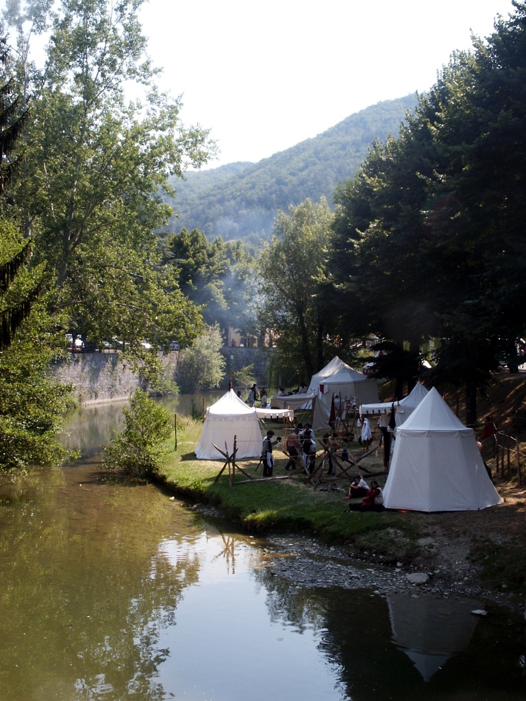
 Hiking in Castel del Rio
Castel del Rio, located in the Emilia-Romagna region of Italy, is an excellent destination for hiking enthusiasts. Nestled in the Apennine mountains and surrounded by lush forests, this area offers a variety of trails that cater to different skill levels.
Hiking Trails
-
Sentiero degli Dei: This is a popular trail that takes you through stunning landscapes with views of the surrounding valleys and hills. The hike is moderately challenging and can take a few hours to complete.
-
Colomberti Trail: A picturesque route that runs alongside the river and through dense woodlands. This trail is suitable for families and beginners, offering a chance to enjoy the natural beauty without strenuous effort.
-
Monte della Guardia: For those looking for a more challenging hike, this trail leads to higher elevations and provides incredible panoramic views of the region. It’s advisable to start early and ensure you’re well-prepared with sufficient water and snacks.
Best Time to Hike
The ideal times for hiking in Castel del Rio are during spring (April to June) and autumn (September to October). During these months, the weather is usually mild, making it pleasant to explore the outdoors.
What to Bring
- Footwear: Sturdy hiking boots or shoes with good traction.
- Clothing: Dress in layers, as temperatures can change throughout the day.
- Navigation: A map or a GPS device, especially for less-marked trails.
- Supplies: Water, snacks, and a first aid kit.
Additional Activities
Aside from hiking, Castel del Rio is known for its rich history and culture. Consider taking time to explore local landmarks, such as the historic castle or enjoying local cuisine in the village restaurants.
Safety Tips
- Always check weather conditions before heading out.
- Inform someone of your hiking plan and estimated return time.
- Respect nature by following the Leave No Trace principles.
Whether you’re looking for a leisurely stroll or a challenging trek, Castel del Rio offers the perfect backdrop for an unforgettable hiking experience.
- Country:

- Postal Code: 40022
- Local Dialing Code: 0542
- Licence Plate Code: BO
- Coordinates: 44° 12' 50" N, 11° 30' 15" E


- GPS tracks (wikiloc): [Link]
- AboveSeaLevel: 215 м m
- Area: 52.58 sq km
- Population: 1209
- Web site: http://www.comune.casteldelrio.bo.it/
- Wikipedia en: wiki(en)
- Wikipedia: wiki(it)
- Wikidata storage: Wikidata: Q94717
- Wikipedia Commons Category: [Link]
- Freebase ID: [/m/0gkh6c]
- GeoNames ID: Alt: [6541835]
- VIAF ID: Alt: [149132744]
- OSM relation ID: [42913]
- WOEID: [713216]
- ISTAT ID: 037014
- Italian cadastre code: C086
Shares border with regions:


Casola Valsenio
- Italian comune
Hiking in Casola Valsenio
Casola Valsenio is a charming village located in the Emilia-Romagna region of Italy, surrounded by the lush landscapes of the Apennine Mountains. It offers a variety of hiking opportunities that cater to different skill levels, making it an excellent destination for both novice and experienced hikers....
- Country:
- Postal Code: 48010
- Local Dialing Code: 0546
- Licence Plate Code: RA
- Coordinates: 44° 13' 0" N, 11° 37' 0" E
- GPS tracks (wikiloc): [Link]
- AboveSeaLevel: 195 м m
- Area: 84.42 sq km
- Population: 2601
- Web site: [Link]

Firenzuola
- Italian comune
Hiking in Firenzuola
Firenzuola is a charming town located in the Tuscan-Emilian Apennines, just north of Florence, Italy. The area is known for its beautiful landscapes, scenic trails, and rich natural and historical heritage, making it a great destination for hikers....
- Country:
- Postal Code: 50033
- Local Dialing Code: 055
- Licence Plate Code: FI
- Coordinates: 44° 7' 11" N, 11° 22' 55" E
- GPS tracks (wikiloc): [Link]
- AboveSeaLevel: 422 м m
- Area: 271.99 sq km
- Population: 4599
- Web site: [Link]
Palazzuolo sul Senio
- Italian comune
Hiking in Palazzuolo sul Senio
Palazzuolo sul Senio is a picturesque village located in the Emilia-Romagna region of Italy, nestled in the southern part of the Tuscan-Emilian Apennines. This area is known for its stunning natural landscapes, rich cultural heritage, and a variety of hiking opportunities for outdoor enthusiasts. Here’s what you can expect when hiking in Palazzuolo sul Senio:...
- Country:
- Postal Code: 50035
- Local Dialing Code: 055
- Licence Plate Code: FI
- Coordinates: 44° 7' 0" N, 11° 33' 0" E
- GPS tracks (wikiloc): [Link]
- AboveSeaLevel: 437 м m
- Area: 109.11 sq km
- Population: 1141
- Web site: [Link]


Casalfiumanese
- Italian comune
Hiking in Casalfiumanese
Casalfiumanese, a small municipality located in the Emilia-Romagna region of Italy, is surrounded by beautiful hills and countryside, making it a delightful destination for hiking enthusiasts. The area's natural landscapes, rich in flora and fauna, provide numerous trails that cater to various skill levels, from easy walks to more challenging hikes....
- Country:
- Postal Code: 40020
- Local Dialing Code: 0542
- Licence Plate Code: BO
- Coordinates: 44° 18' 0" N, 11° 38' 0" E
- GPS tracks (wikiloc): [Link]
- AboveSeaLevel: 125 м m
- Area: 82 sq km
- Population: 3460
- Web site: [Link]

Fontanelice
- Italian comune
Hiking in Fontanelice
Fontanelice is a small town located in the region of Emilia-Romagna, Italy, known for its beautiful landscapes and picturesque countryside. Hiking in and around Fontanelice offers a wonderful opportunity to explore the natural beauty of the area, which is characterized by rolling hills, lush forests, and charming villages....
- Country:
- Postal Code: 40025
- Local Dialing Code: 0542
- Licence Plate Code: BO
- Coordinates: 44° 16' 0" N, 11° 34' 0" E
- GPS tracks (wikiloc): [Link]
- AboveSeaLevel: 165 м m
- Area: 36.56 sq km
- Population: 1944
- Web site: [Link]


Monterenzio
- Italian comune
Hiking in Monterenzio
Monterenzio is a charming municipality located in the Emilia-Romagna region of Italy, surrounded by beautiful hills and natural landscapes, making it a fantastic location for hiking enthusiasts. Here are some highlights and things to consider if you're planning to hike in Monterenzio:...
- Country:
- Postal Code: 40050
- Local Dialing Code: 051
- Licence Plate Code: BO
- Coordinates: 44° 20' 0" N, 11° 24' 0" E
- GPS tracks (wikiloc): [Link]
- AboveSeaLevel: 207 м m
- Area: 105.26 sq km
- Population: 6110
- Web site: [Link]