
Castelfidardo (Castelfidardo)
.svg)
- Italian comune
 Hiking in Castelfidardo
Castelfidardo is a charming town located in the Marche region of Italy, known for its scenic landscapes and rich cultural heritage. Hiking in Castelfidardo offers a wonderful experience as it combines the beauty of nature with historical sites and stunning views of the surrounding countryside, including the nearby Adriatic Sea.
Popular Hiking Trails and Areas:
-
Conero Regional Park: Located just a short distance from Castelfidardo, this park boasts breathtaking views of the Adriatic coast, rugged cliffs, and lush forests. There are several well-marked trails ranging in difficulty, suitable for both novice and experienced hikers. The trails often lead to picturesque viewpoints, secluded beaches, and ancient ruins.
-
Monte Conero: This prominent mountain is within the Conero Regional Park and features various trails that provide panoramic views of the coast and surrounding regions. The hike to the summit of Monte Conero is a must for those looking for more challenging terrain.
-
Pathways through Olive Groves: The region is dotted with olive groves and vineyards, and many trails weave through these picturesque landscapes. These paths often offer a tranquil hiking experience with opportunities to sample local products along the way.
-
Historical Routes: Castelfidardo has historical significance, notably for its role in Italian unification. Some trails may take you past historical sites, including churches and memorials, enriching your hike with cultural insights.
Tips for Hiking in Castelfidardo:
-
Gear Up: Wear good hiking shoes and comfortable clothing. The terrain can vary, and good footwear is essential for safety and comfort.
-
Water and Snacks: Always carry enough water and some snacks to keep your energy up during hikes, especially if you plan on being out for several hours.
-
Maps and Guides: While many trails are well-marked, having a map or a hiking app can be helpful, especially for finding your way to less-frequented paths.
-
Respect Nature: Stay on marked trails to protect local flora and fauna, and always practice Leave No Trace principles.
-
Weather Check: Monitor the weather forecast before heading out, as conditions can change quickly, especially in mountainous areas.
Conclusion
Hiking in Castelfidardo is a delightful way to explore the stunning natural beauty and rich heritage of the Marche region. Whether you’re seeking a peaceful walk through olive groves or an adventurous hike up Monte Conero, the area offers diverse opportunities for all hiking enthusiasts. Make sure to take the time to enjoy the views and soak in the local culture during your outdoor adventures!
- Country:

- Postal Code: 60022
- Local Dialing Code: 071
- Licence Plate Code: AN
- Coordinates: 43° 27' 51" N, 13° 32' 46" E


- GPS tracks (wikiloc): [Link]
- AboveSeaLevel: 215 м m
- Area: 33.39 sq km
- Population: 18601
- Web site: http://www.comune.castelfidardo.an.it
- Wikipedia en: wiki(en)
- Wikipedia: wiki(it)
- Wikidata storage: Wikidata: Q123833
- Wikipedia Commons Gallery: [Link]
- Wikipedia Commons Category: [Link]
- Freebase ID: [/m/0fcthb]
- GeoNames ID: Alt: [6538510]
- VIAF ID: Alt: [263862752]
- OSM relation ID: [42456]
- archINFORM location ID: [12578]
- MusicBrainz area ID: [d901e5dd-34b3-4ab3-b290-86443b768b9e]
- Quora topic ID: [Castelfidardo]
- UN/LOCODE: [ITCFD]
- ISTAT ID: 042010
- Italian cadastre code: C100
Shares border with regions:


Camerano
- comune in Province of Ancona, Italy
Hiking in Camerano
Camerano is a charming town in the Marche region of Italy, known for its beautiful landscapes, rich history, and proximity to the stunning Conero Riviera. Hiking around Camerano offers a variety of trails that cater to different skill levels while providing breathtaking views of the surrounding countryside and the Adriatic Sea....
- Country:
- Postal Code: 60021
- Local Dialing Code: 071
- Licence Plate Code: AN
- Coordinates: 43° 31' 40" N, 13° 33' 9" E
- GPS tracks (wikiloc): [Link]
- AboveSeaLevel: 231 м m
- Area: 20 sq km
- Population: 7218
- Web site: [Link]
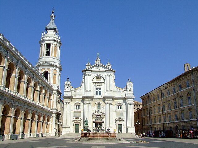

Loreto
- hill town and comune of the Italian province of Ancona, in the Marche
Hiking in Loreto
Loreto, located in the Marche region of Italy, is a great destination for hiking enthusiasts. The area boasts stunning landscapes, rich history, and an array of trails suitable for different experience levels. Here are some key highlights about hiking in Loreto:...
- Country:
- Postal Code: 60025
- Local Dialing Code: 071
- Licence Plate Code: AN
- Coordinates: 43° 26' 25" N, 13° 36' 27" E
- GPS tracks (wikiloc): [Link]
- AboveSeaLevel: 127 м m
- Area: 17.9 sq km
- Population: 12810
- Web site: [Link]


Numana
- Italian comune
Hiking in Numana
Numana, located on the Adriatic coast in the Marche region of Italy, offers a unique combination of scenic coastal trails and lush inland hikes. Here are some highlights and tips for hiking in and around Numana:...
- Country:
- Postal Code: 60026
- Local Dialing Code: 071
- Licence Plate Code: AN
- Coordinates: 43° 30' 49" N, 13° 37' 18" E
- GPS tracks (wikiloc): [Link]
- AboveSeaLevel: 96 м m
- Area: 10.94 sq km
- Population: 3763
- Web site: [Link]

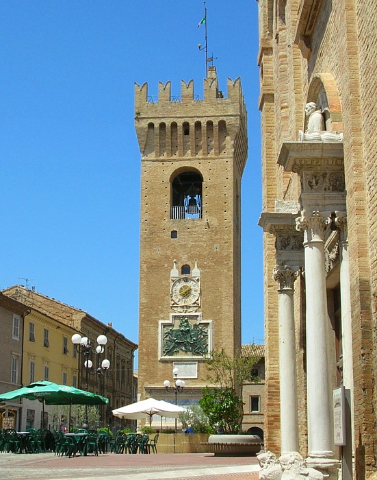
Osimo
- Italian comune
Hiking in Osimo
Osimo is a charming town in the Marche region of Italy, known for its rich history, beautiful architecture, and stunning landscapes. While it may not be as famous as some other hiking destinations, the surrounding areas offer a variety of hiking opportunities that can cater to different skill levels....
- Country:
- Postal Code: 60027
- Local Dialing Code: 071
- Licence Plate Code: AN
- Coordinates: 43° 29' 10" N, 13° 28' 56" E
- GPS tracks (wikiloc): [Link]
- AboveSeaLevel: 265 м m
- Area: 106.74 sq km
- Population: 35071
- Web site: [Link]


Sirolo
- Italian comune
Hiking in Sirolo
Sirolo, a picturesque village on the Adriatic Coast in Italy, is part of the Monte Conero Regional Park. This area is renowned for its stunning landscapes, diverse flora and fauna, and breathtaking views of the sea. Here’s an overview of hiking in Sirolo:...
- Country:
- Postal Code: 60020
- Local Dialing Code: 071
- Licence Plate Code: AN
- Coordinates: 43° 31' 34" N, 13° 36' 58" E
- GPS tracks (wikiloc): [Link]
- AboveSeaLevel: 125 м m
- Area: 16.68 sq km
- Population: 4078
- Web site: [Link]


Porto Recanati
- Italian comune
Hiking in Porto Recanati
Porto Recanati, located on the Adriatic coast in the Marche region of Italy, is a beautiful destination for hiking enthusiasts. Nestled between the sea and the Sibillini Mountains, this area offers diverse landscapes, stunning coastal views, and a rich cultural heritage....
- Country:
- Postal Code: 62017
- Local Dialing Code: 071
- Licence Plate Code: MC
- Coordinates: 43° 25' 48" N, 13° 39' 54" E
- GPS tracks (wikiloc): [Link]
- AboveSeaLevel: 5 м m
- Area: 17.25 sq km
- Population: 12609
- Web site: [Link]

Recanati
- Italian comune
Hiking in Recanati
Recanati, located in the Marche region of Italy, is not only known for its rich history and beautiful architecture but also for its stunning natural landscapes that lend themselves well to hiking. The area is characterized by rolling hills, lush countryside, and picturesque views that make for an enjoyable outdoor experience. Here are some highlights for hiking in Recanati:...
- Country:
- Postal Code: 62019
- Local Dialing Code: 0733; 071
- Licence Plate Code: MC
- Coordinates: 43° 23' 55" N, 13° 33' 9" E
- GPS tracks (wikiloc): [Link]
- AboveSeaLevel: 296 м m
- Area: 103.46 sq km
- Population: 21186
- Web site: [Link]