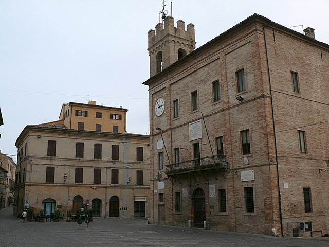
Numana (Numana)
.svg)
- Italian comune
 Hiking in Numana
Numana, located on the Adriatic coast in the Marche region of Italy, offers a unique combination of scenic coastal trails and lush inland hikes. Here are some highlights and tips for hiking in and around Numana:
Scenic Trails
-
Conero Regional Park: Just a short distance from Numana, this park is the star attraction for hikers. The park features a variety of trails that range from easy walks to more challenging hikes, often with stunning views of the Adriatic Sea, cliffs, and lush Mediterranean vegetation.
-
Path of the Ridges: This trail provides breathtaking panoramic views of the coastline and the surrounding landscape. It’s suited for those looking for moderate challenges, and it’s well-marked.
-
Via delle Due Sorelle: A more adventurous hike that leads to beautiful beaches and hidden coves. This trail takes you along the cliff tops and descends down towards the water, making it a popular choice for those looking for a mix of hiking and beach time.
-
Monte Conero: The highest peak of the Conero Massif offers several trail options. Hiking to the summit rewards you with a stunning view of the Adriatic Sea and the surrounding areas.
Tips for Hiking in Numana
- Best Time to Hike: The ideal months for hiking are typically from late spring to early autumn (May to October), when the weather is pleasant and the trails are accessible.
- Gear: Wear appropriate hiking shoes, bring a refillable water bottle, snacks, and sun protection. Since some trails can be rocky and uneven, sturdy footwear is crucial.
- Trail Markings: Most trails in the Conero Regional Park are well marked with signs. However, a map or GPS device, along with a local hiking app, can enhance your experience and ensure you stay on track.
- Wildlife and Flora: Keep an eye out for local wildlife and unique plants. The region is rich in biodiversity, making it a delightful spot for nature lovers and birdwatchers.
- Local Amenities: Numana offers various accommodations, restaurants, and shops. After a long hike, you can enjoy some local cuisine, including fresh seafood and regional wines.
Whether you’re an experienced hiker or just looking for a leisurely walk with breathtaking views, Numana and its surrounding areas provide a beautiful backdrop for outdoor adventures. Happy hiking!
- Country:

- Postal Code: 60026
- Local Dialing Code: 071
- Licence Plate Code: AN
- Coordinates: 43° 30' 49" N, 13° 37' 18" E


- GPS tracks (wikiloc): [Link]
- AboveSeaLevel: 96 м m
- Area: 10.94 sq km
- Population: 3763
- Web site: http://www.comune.numana.an.it
- Wikipedia en: wiki(en)
- Wikipedia: wiki(it)
- Wikidata storage: Wikidata: Q124456
- Wikipedia Commons Gallery: [Link]
- Wikipedia Commons Category: [Link]
- Freebase ID: [/m/0fctry]
- GeoNames ID: Alt: [6538514]
- BnF ID: [119689386]
- VIAF ID: Alt: [143099225]
- OSM relation ID: [42466]
- GND ID: Alt: [4295081-8]
- UN/LOCODE: [ITNUM]
- Digital Atlas of the Roman Empire ID: [15970]
- ISTAT ID: 042032
- Italian cadastre code: F978
Shares border with regions:

Castelfidardo
- Italian comune
Hiking in Castelfidardo
Castelfidardo is a charming town located in the Marche region of Italy, known for its scenic landscapes and rich cultural heritage. Hiking in Castelfidardo offers a wonderful experience as it combines the beauty of nature with historical sites and stunning views of the surrounding countryside, including the nearby Adriatic Sea....
- Country:
- Postal Code: 60022
- Local Dialing Code: 071
- Licence Plate Code: AN
- Coordinates: 43° 27' 51" N, 13° 32' 46" E
- GPS tracks (wikiloc): [Link]
- AboveSeaLevel: 215 м m
- Area: 33.39 sq km
- Population: 18601
- Web site: [Link]
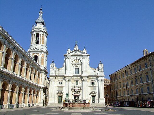

Loreto
- hill town and comune of the Italian province of Ancona, in the Marche
Hiking in Loreto
Loreto, located in the Marche region of Italy, is a great destination for hiking enthusiasts. The area boasts stunning landscapes, rich history, and an array of trails suitable for different experience levels. Here are some key highlights about hiking in Loreto:...
- Country:
- Postal Code: 60025
- Local Dialing Code: 071
- Licence Plate Code: AN
- Coordinates: 43° 26' 25" N, 13° 36' 27" E
- GPS tracks (wikiloc): [Link]
- AboveSeaLevel: 127 м m
- Area: 17.9 sq km
- Population: 12810
- Web site: [Link]


Sirolo
- Italian comune
Hiking in Sirolo
Sirolo, a picturesque village on the Adriatic Coast in Italy, is part of the Monte Conero Regional Park. This area is renowned for its stunning landscapes, diverse flora and fauna, and breathtaking views of the sea. Here’s an overview of hiking in Sirolo:...
- Country:
- Postal Code: 60020
- Local Dialing Code: 071
- Licence Plate Code: AN
- Coordinates: 43° 31' 34" N, 13° 36' 58" E
- GPS tracks (wikiloc): [Link]
- AboveSeaLevel: 125 м m
- Area: 16.68 sq km
- Population: 4078
- Web site: [Link]


Porto Recanati
- Italian comune
Hiking in Porto Recanati
Porto Recanati, located on the Adriatic coast in the Marche region of Italy, is a beautiful destination for hiking enthusiasts. Nestled between the sea and the Sibillini Mountains, this area offers diverse landscapes, stunning coastal views, and a rich cultural heritage....
- Country:
- Postal Code: 62017
- Local Dialing Code: 071
- Licence Plate Code: MC
- Coordinates: 43° 25' 48" N, 13° 39' 54" E
- GPS tracks (wikiloc): [Link]
- AboveSeaLevel: 5 м m
- Area: 17.25 sq km
- Population: 12609
- Web site: [Link]